Mount Washington
(Elevation 6,288 Feet)
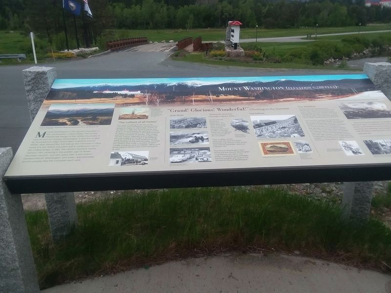
Mount Washington is the highest mountain in the northeastern United States. Part of the Presidential Range of the White Mountains, it was named for George Washington. It was first scaled by Europeans in 1642. Ethan Allen Crawford and his father, Abel, blazed the first trail up the mountain in 1819: today it is the oldest mountain trail in continuous use in the United States. In 1851, the railroad reached nearby Gorham, NH, ushering in the golden age of White Mountain tourism. Just two years later 3.400 visitors climbed Mount Washington, and today, approximately 50,000 people hike the mountain each year.
"The Loftiest of all Hotels" The work of getting to the top of the mountain was rewarded as entrepreneurs sought to make it a destination worthy of the effort. In 1852 the Summit House was built to accommodate the growing number of visitors--at its largest it was able to house and feed hundreds of guests. The smaller Tip-Top House, originally built in 1853. was the only building to escape a devastating 1908 fire and it is the only evidence of this era remaining on the summit today. Through the century and a half, a number of other, smaller buildings such as stables, offices and observational towers have come and gone as well.
"Grand! Glorious! Wonderful!"Climbing to the Summit
As
the summit became a destination for sightseers of all sorts, improving their journey became the focus. In 1861 a carriage road was completed on the east side of the mountain.Then in 1869, on the west side, the first mountain- climbing cog railway in the world was built by Sylvester Marsh of Littleton, NH.
The Mount Washington Auto Road and the Mount Washington Cog Railway are still in use today, conveying approximately 230,000 people per year to the summit of Mount Washington.
The Weather The top of Mount Washington is renowned for its extreme weather. On a clear day, visitors can see five states and Canada, but bad weather and poor visibility are far more common. In 1934. the observatory recorded 231 mile-per- hour winds, a world record at the time.
The summit's average temperature is 26 F. Hurricane-force winds are typically recorded 110 days per year, and snOw, which can occur in any month, averages 21.2 feet annually. For comparison, the average annual snowfall in nearby Conway, NH is 6.6 feet. Observatories to measure these extremes of weather were built on the summit beginning in the mid-19th century. Today the Mount Washington Observatory continues the tradition in the Sherman Adams Summit Building constructed in 1979.
....If ten hurricanes had been in deadly strife
with each other, it could have been no worse. The
winds, as if locked in mortal embrace, tore along,
twisting and whirling, and mingling their roaring
with the flinty rattling of the snow-grains in one
confused din.
Topics. This historical marker is listed in this topic list: Natural Features. A significant historical year for this entry is 1642.
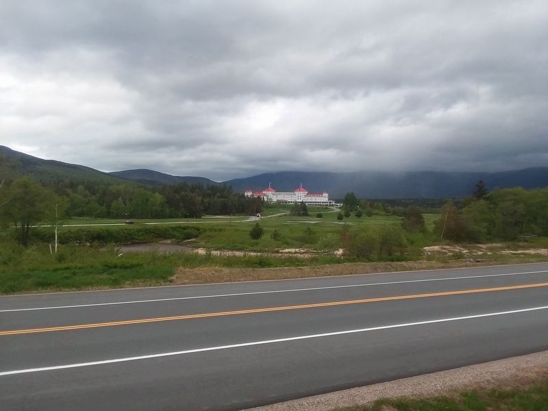
Location. 44° 15.243′ N, 71° 26.987′ W. Marker is in Bretton Woods, New Hampshire, in Coos County. Marker is at the intersection of U.S. 302 and Mt. Washington Hotel Road, on the left when traveling north on U.S. 302. Touch for map. Marker is in this post office area: Bretton Woods NH 03575, United States of America. Touch for directions.
Other nearby markers. At least 8 other markers are within 4 miles of this marker, measured as the crow flies. The Mount Washington Hotel (here, next to this marker); Crawford Notch (here, next to this marker); Executive Councilor Raymond S. Burton (here, next to this marker); Mount Washington Hotel / Bretton Woods Monetary Conference (about 300 feet away, measured in a direct line); The Crawford Family (approx. ¾ mile away); Zealand and James Everell Henry (approx. 2.6 miles away); Crawford House (approx. 3.1 miles away); Crawford Depot (approx. 3.1 miles away). Touch for a list and map of all markers in Bretton Woods.
Also see . . .
1. Mt. Washington State Park. (Submitted on December 18, 2020, by Michael Herrick of Southbury, Connecticut.)
2. Mount Washington Observatory. (Submitted on December 18, 2020, by Michael Herrick of Southbury, Connecticut.)
3. Mount Washington (Wikipedia). (Submitted on December 18, 2020, by Michael Herrick of Southbury, Connecticut.)
Credits. This page was last revised on February 16, 2023. It was originally submitted on December 15, 2020, by Craig Doda of Napoleon, Ohio. This page has been viewed 233 times since then and 22 times this year. Photos: 1, 2. submitted on December 15, 2020, by Craig Doda of Napoleon, Ohio. • Michael Herrick was the editor who published this page.

