Radford, Virginia — The American South (Mid-Atlantic)
Ingles Ferry Road
Photographed by Bernard Fisher, April 2, 2011
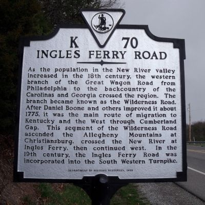
1. Ingles Ferry Road Marker
As the population in the New River valley increased in the 18th century, the western branch of the Great Wagon Road from Philadelphia to the backcountry of the Carolinas and Georgia crossed the region. The branch became known as the Wilderness Road. After Daniel Boone and others improved it about 1775, it was the main route of migration to Kentucky and the West through Cumberland Gap. This segment of the Wilderness Road ascended the Allegheny Mountains at Christiansburg, crossed the New River at Ingles Ferry, then continued west. In the 19th century, the Ingles Ferry Road was incorporated into the South Western Turnpike.
Erected 1998 by Department of Historic Resources. (Marker Number K-70.)
Topics and series. This historical marker is listed in these topic lists: Roads & Vehicles • Settlements & Settlers. In addition, it is included in the Virginia Department of Historic Resources (DHR) series list. A significant historical year for this entry is 1775.
Location. 37° 7.129′ N, 80° 31.996′ W. Marker is in Radford, Virginia. It is at the intersection of Rock Road East and Tyler Avenue (Virginia Route 177), on the
this page online

Regionally, this marker is in Southwest Virginia and in the Blue Ridge Highlands. It is also in the American South, specifically in the Upper South, in Appalachia, and specifically in Southern Appalachia. Globally, it is in North America, the Western Hemisphere, the Western World, and the Anglosphere. Historically, it finds itself in what was once the territory of the Mississippian Culture, one of the original Thirteen Colonies, one of the Confederate States of America, and the Antebellum South.
Other nearby markers. At least 8 other markers are within 3 miles of this marker, measured as the crow flies: Lovely Mount Tavern (approx. 1.1 miles away); Lovely Mount Baptist Church (approx. 1½ miles away); Former Site of Fred Wygal Elementary School (approx. 1.8 miles away); Radford (approx. 1.8 miles away); Connelly's Run (approx. 2.1 miles away); Wildwood Pool (approx. 2.1 miles away); Starnes (approx. 2.4 miles away); Green Ash Tree (approx.
Photographed by Bernard Fisher, April 2, 2011
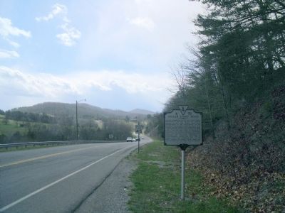
2. Rock Rd E (facing west)
Also see . . .
1. Wilderness Road - Radford. Radford website entry:
Virginia's Heritage Migration Route (Submitted on April 4, 2011, by Bernard Fisher of Richmond, Virginia.)
2. Ingles Farm. Visit Radford website entry (Submitted on March 1, 2022, by Larry Gertner of New York, New York.)
3. Mary Draper Ingles' Return To Virginia's New River Valley. Blue Ridge Country website entry (Submitted on April 4, 2011, by Bernard Fisher of Richmond, Virginia.)
4. Ingles Ferry. Virginia Department of Historic Resources website entry:
link to National Register of Historic Places Nomination Form (Submitted on April 8, 2011, by Bernard Fisher of Richmond, Virginia.)
National Register of Historic Places, circa 2003
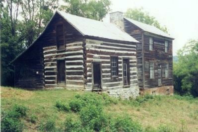
3. Ingles Ferry Tavern
Credits. This page was last revised on June 30, 2026. It was originally submitted on April 4, 2011, by Bernard Fisher of Richmond, Virginia. This page has been viewed 1,983 times since then and 75 times this year. Last updated on December 17, 2020, by Craig Doda of Napoleon, Ohio. Photos: 1, 2. submitted on April 4, 2011, by Bernard Fisher of Richmond, Virginia. 3. submitted on April 8, 2011, by Bernard Fisher of Richmond, Virginia. • J. Makali Bruton was the editor who published this page.
