Georgetown in Georgetown County, South Carolina — The American South (South Atlantic)
Hobcaw Barony
Photographed by Mike Stroud, 2009
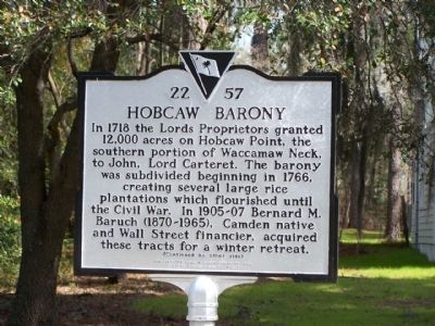
1. Hobcaw Barony Marker
In 1718 the Lords Proprietors granted 12,000 acres on Hobcaw Point, the southern portion of Waccamaw Neck, to John, Lord Carteret. The barony was subdivided beginning in 1766, creating several large rice plantations which flourished until the Civil War. In 1905- 07 Bernard M. Baruch (1870-1965), Camden native and Wall Street financier, aquired these tracts for a winter retreat.
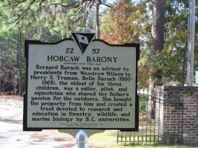
Bernard Baruch was an advisor to presidents from Woodrow Wilson to Harry S. Truman. Belle Baruch (1900- 1965), the oldest of his three children, was a sailor, pilot, and equestrian who shared her father's passion for the outdoors. She bought the property from him and created a trust devoted to research and education in forestry, wildlife, and marine biology by S.C. universities.
Erected 2008 by the Belle W. Baruch Foundation, replacing a marker erected in 1995. (Marker Number 22-57.)
Topics and series. This historical marker is listed in these topic lists: Agriculture • Education • Notable Places. In addition, it is included in the Former U.S. Presidents: #28 Woodrow Wilson, and the Former U.S. Presidents: #33 Harry S. Truman
this page online
Location. 33° 21.851′ N, 79° 13.622′ W. Marker is in Georgetown, South Carolina, in Georgetown County. It is at the intersection of Hobcaw Road and Ocean Highway (U.S. 17) on Hobcaw Road. Touch for map. Marker is at or near this postal address: 22 Hobcaw Road, Georgetown SC 29440, United States of America. Touch for directions.

Regionally, this marker is in the Pee Dee and on Waccamaw Neck. It is also in the American South, specifically in the Deep South, and on the Eastern Seaboard. Globally, it is in the North Atlantic Region, North America, the Western Hemisphere, the Western World, and the Anglosphere. Historically, it finds itself in what was once the territory of the Mississippian Culture, one of the original Thirteen Colonies, one of the Confederate States of America, and the Antebellum South.
Other nearby markers. At least 8 other markers are within 3 miles of this marker, measured as the crow flies: Belle W. Baruch (a few steps from this marker); a different marker also named Hobcaw Barony (within shouting distance of this marker); Prospect Hill (approx.
Photographed by Mike Stroud, February 15, 2009
2. Hobcaw Barony Marker rear
Another marker is no longer nearby. Attacks Upon Georgetown (was approx. 1.9 miles away but has been confirmed missing).
Also see . . .
1. Hobcaw Barony. Wikipedia entry (Submitted on July 18, 2023, by Larry Gertner of New York, New York.)
2. Hobcaw Barony. Website homepage (Submitted on July 18, 2023, by Larry Gertner of New York, New York.)
Courtesy of National Register Properties in South Carolina
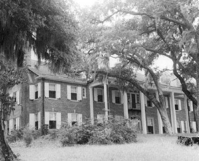
3. Hobcaw Barony Bellefield Plantation
National Register of Historic Places Nomination Form:
at NPGallery Digital Asset Management System
Click for more information.
Click for more information.
Photographed by Mike Stroud, February 2009
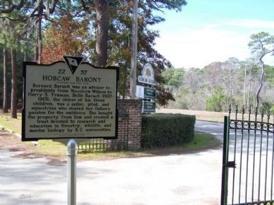
4. Hobcaw Barony Marker at Hobcaw Road, along US 17
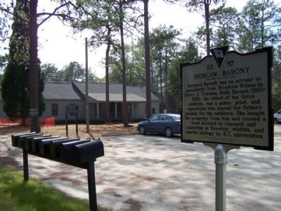
Photographed by Mike Stroud, February 15, 2009
5. Hobcaw Barony Marker
Background a New nature center being built
Credits. This page was last revised on July 18, 2023. It was originally submitted on February 20, 2009, by Mike Stroud of Bluffton, South Carolina. This page has been viewed 1,727 times since then and 60 times this year. Photos: 1, 2. submitted on February 20, 2009, by Mike Stroud of Bluffton, South Carolina. 3. submitted on February 23, 2009, by Mike Stroud of Bluffton, South Carolina. 4, 5. submitted on February 20, 2009, by Mike Stroud of Bluffton, South Carolina. • Kevin W. was the editor who published this page.
