Tall Grasses and Open Skies
— Herbert Hoover National Historic Site —
Captions:
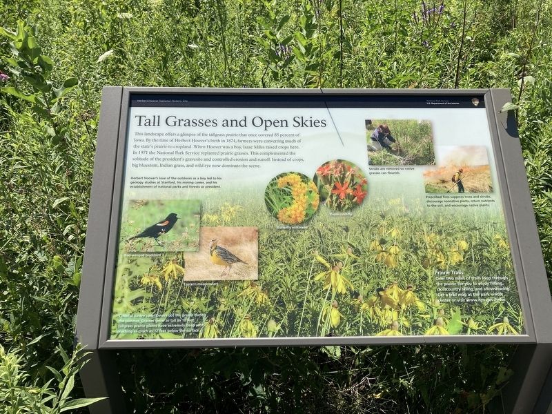
Herbert Hoover's love of the outdoors as a boy lead to his geology studies at Stanford, his mining career, and his establishment of national parks and forests as president.
Shrubs are removed so native grasses can flourish.
Prescribed fire suppressed trees and shrubs, discourage non-native plants, return nutrients to the soil, and encourage native plants.
Red-winged blackbird
Eastern meadowlark
Butterfly milkweed
Royal catchfly
Colorful native coneflowers Dr. prairie during the summer. Grasses grow as tall as 10 feet. Tallgrass prairie plants have extremely deep roots, reaching as much as 12 feet below the surface.
Prarie Trails Two miles of trails loop through the prairie for you to enjoy hiking, cross country skiing, and snowshoeing. Get a trail map at the park visitor center
or visit www.nps.gov/heho
Erected by National Park Service, US Department of the Interior.
Topics. This historical marker is listed in these topic lists: Agriculture • Parks & Recreational Areas. A significant historical year for this entry is 1874.
Location. 41° 40.058′ N, 91° 21.073′ W. Marker is in West Branch, Iowa, in Cedar County. Marker can be reached from Parkside Drive, on the right when traveling south. Located at the Prairie Trail trailhead. Touch for map. Marker is at or near this postal address: 210 Parkside Dr, West Branch IA 52358, United States of America. Touch for directions.
Other nearby markers. At least 8 other markers are within walking distance of this marker. Surrounded by Farms (here, next to this marker); Hoover Gravesite (within shouting distance of this marker); A World of Opportunity (approx. 0.2 miles away); Hoover Home (approx. ¼ mile away); To Herbert Hoover (approx. ¼ mile away); Helping War Victims (approx. ¼ mile away); Friends Meetinghouse (approx. ¼ mile away); Learning their A, B, Cs (approx. 0.3 miles away). Touch for a list and map of all markers in West Branch.
Credits. This page was last revised on December 23, 2020. It was originally submitted on December 22, 2020, by Connor Olson of Kewaskum, Wisconsin. This page has been viewed 119 times since then and 10 times this year. Photos: 1, 2. submitted on December 22, 2020, by Connor Olson of Kewaskum, Wisconsin. • Mark Hilton was the editor who published this page.
Editor’s want-list for this marker. A wide shot of the marker and its surroundings. • Can you help?

