Pittsburg in Carroll County, Indiana — The American Midwest (Great Lakes)
Pittsburg
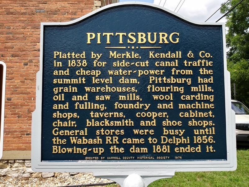
Photographed by Craig Doda, July 18, 2020
1. Pittsburg Marker
Platted by Merkle, Kendall & Co. in 1838 for side-cut canal traffic and cheap water-power from the summit level dam, Pittsburg had grain warehouses, flouring mills, oil and saw mills, wool carding and fulling, foundry and machine shops, taverns, cooper, cabinet, chair, blacksmith and shoe shops. General stores were busy until the Wabash RR came to Delphi 1856. Blowing-up the dam 1881 ended it.
The side cut from the West end of the great canal dam admitted canal boats and the cheap water power was used to capacity. It bisected a row of Blocks between this street and the river. The mill and warehouse sites and the riverbank street and wharfs have all been washed out. “The Brick Store” was Garrett A. “Doc” Depew's. Other merchants were Bolles & Colton, Spears & Bros., Timothy Donovan, Davis and Mudge. Later - Vandervolgen and Smith. From 1847 until 1856 Pittsburg probably did more in business than Delphi, separated by a ferry and plank-road. There was a Post Office from 1838 until 1915. Many flat boats were built in this area. Steamboats sometimes unloaded here when the water was high enough. When
this page online
Erected 1976 by Carroll County Historical Society.
Topics. This historical marker is listed in these topic lists: Railroads & Streetcars • Waterways & Vessels. A significant historical year for this entry is 1838.
Location. 40° 35.661′ N, 86° 42.013′ W. Marker is in Pittsburg, Indiana, in Carroll County. It is on Howard Street, on the right when traveling south. Touch for map. Marker is in this post office area: Delphi IN 46923, United States of America. Touch for directions.

Regionally, this marker is in Northern Indiana. It is also in the American Midwest and in the Corn Belt. Globally, it is in North America, the Western Hemisphere, the Western World, and the Anglosphere. Historically, it finds itself in what was once the territory of the Mississippian Culture and also the Northwest Territory.
Other nearby markers. At least 8 other markers are within walking distance of this marker: New Purchase Boundary (approx. 0.3 miles away); The Delphi Limestone Quarry (approx. 0.6 miles away); The Post Office At Sleeth

Photographed by Duane and Tracy Marsteller, November 2, 2025
2. Pittsburg Marker Reverse

Photographed by Craig Doda, July 18, 2020
3. Wabash & Erie Canal Marker
Wabash River Feeder Dam No. 4
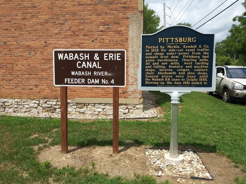
Photographed by Craig Doda, July 18, 2020
4. Pittsburg Marker
Credits. This page was last revised on November 26, 2025. It was originally submitted on December 23, 2020, by Craig Doda of Napoleon, Ohio. This page has been viewed 376 times since then and 25 times this year. Photos: 1. submitted on December 23, 2020, by Craig Doda of Napoleon, Ohio. 2. submitted on November 24, 2025, by Duane and Tracy Marsteller of Murfreesboro, Tennessee. 3, 4. submitted on December 23, 2020, by Craig Doda of Napoleon, Ohio. • J. Makali Bruton was the editor who published this page.
