
Mineral del Monte, Hidalgo, Mexico — The Central Highlands (North America)
Monument to Mexican Independence
Photographed by J. Makali Bruton, December 10, 2020
1. Monument to Mexican Independence Marker

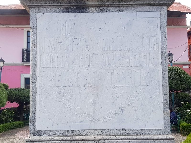
Jose Ma. Morelos. · Mariano Matamoros. · Ignacio de Allende. · Vicente Guerrero. · Agustin de Iturbide.
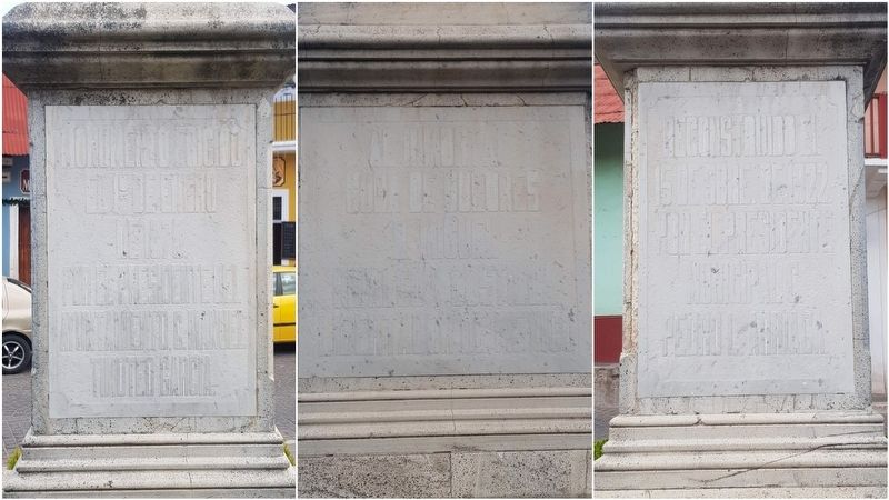
Monumento erigido el 1º de enero de 1870. Por el Presidente del Ayuntamiento, C. Manuel Timoteo Garcia.
Al inmortal Cuna de Dolores, D. Miguel Hidalgo Costilla
Libertador de Mexico
Reconstruido el 15 de Sbre. de 1922 por el Presidente Municipal C. Pedro L. Arriaga.
Se trasladó este monumento a este sitio el 16 de Sep. de 1935
1810. – 1821.
José María Morelos. · Mariano Matamoros. · Ignacio de Allende. · Vicente Guerrero. · Agustín de Iturbide.
Monument erected on January 1, 1870, by the President of the City Council, Manuel Timoteo Garcia.
To the Immortal Cradle of Dolores, Miguel Hidalgo Costilla
Liberator of Mexico
Rebuilt on September 15, 1922 by Municipal President Pedro L. Arriaga.
This monument was moved to this site on September 16, 1935
Erected 1870.
Topics. This memorial is listed in these topic lists: Patriots & Patriotism • Wars, Non-US. A significant historical date for this entry is January 1, 1870.
Location. 20° 8.358′ N, 98° 40.368′ W. Memorial is in Mineral del Monte,
this page online

Regionally, this memorial is in Central Mexico, specifically in the Sierra Madre, and in Mexico City Metropolitan Area. Globally, it is in North America, Mesoamerica, and the Western Hemisphere. Historically, it finds itself in what was once New Spain, a Spanish colony, and the Aztec Empire.
Other nearby markers. At least 8 other markers are within walking distance of this marker: Sanctuary of Our Lord of Zelontla (within shouting distance of this marker); Holy Cross Church (within shouting distance of this marker); Formation of the National Miner's Union in 1934 (about 120 meters away, measured in a direct line); Museum of Labor Medicine "Nicolás Zavala" (about 120 meters away); Church of Our Lady of the Rosary (about 150 meters away); House of the Count (about 150 meters away); Emmanuel Methodist Temple (about 180 meters away); First Worker Strike (approx. 0.4 kilometers away). Touch for a
Photographed by J. Makali Bruton
2. Monument to Mexican Independence Marker
This image shows the additional three sides of the monument.
Photographed by J. Makali Bruton, December 10, 2020
3. Monument to Mexican Independence Marker
Credits. This page was last revised on December 23, 2020. It was originally submitted on December 23, 2020, by J. Makali Bruton of Washington, District of Columbia. This page has been viewed 150 times since then and 7 times this year. Photos: 1, 2, 3. submitted on December 23, 2020, by J. Makali Bruton of Washington, District of Columbia.
