River Travel
Travel Before the Building of Canals
| — | Wabash & Erie Canal Park Village | — |
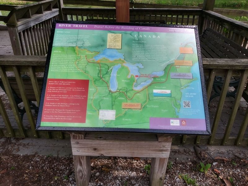
Before Canals
The Wabash River illustrates how wilderness streams served as highways beginning with the early French explorers. Before the canal, rivers brought settlers to new adventures and opportunities cutting through unknown country. River waters offered settlers power for their mills and factories, water for drinking, growing crops and draining the landscape. Where they flowed settlements developed.
An Ice Age …
The unique feature of a continental divide-formed
in northeastern Indiana at the end of the last Ice Age
12,000 years ago was revealed as the retreating glacier
left massive end moraines, or ridges. They deflected the
courses of the St. Joseph and the St. Mary's rivers to
the west. A slackwater glacial Lake Maumee filling to
the brim overtopping the divide, broke through a low
portion of the Fort Wayne Moraine. At the time a vast
volume of water flowed over the divide into the Little
Wabash River and ultimately to the Gulf of Mexico.
Five Great Portage Routes Dominate This Region:
1. Maumee of Lake Erie, a portage to the Wabash on to the Ohio and Mississippi rivers - the eventualroute of the Wabash & Erie Canal.
Click or scan to see
this page online
2. St. Joseph of Lake Michigan - to the Wabash via what appears to involve the Elkhart and Eel or possibly the Tippecanoe rivers.
3. St. Joseph of Lake Michigan, a portage to the Kankakee and to the Illinois River.
4. Upper Lake Michigan the Chicago River and a portage to the Des Plaines and Illinois rivers.
5. Green Bay, Lake Winnebago and Fox River to the Wisconsin River and to the Mississippi.
The Carrying Places
With New France's Quebec City established by the mid-1600s, the fur traders, explorers such as La Salle and Marquette came down the St. Lawrence River into the Great Lakes. Using wilderness routes known to the Indian people, they learned of "portages” over land barriers along a chain of navigable waterways for transferring boats and goods. Across North America, of the Six continental divides, the St. Lawrence Divide separates the Great Lakes water shed from the Ohio, Mississippi and upper Eastern Seaboard.
Canoe: A traditional birch-bark craft known to the Indian people.A light, serviceable craft, it was used for countless years before Europeans arrived.
Pirogue:
Keelboats: Developed from bateaus, up to 12 feet wide and over 50 feet long, were built with a broad keel and heavy flat bottom timbers to absorb the energy during collisions with obstacles. Keelboats were moved up or down river using long "sweep" oars. Some may have used the aid of a sail, or pole-men pushing against the river bed with pike poles walking on a plank the length of the boat's gunwales.
Flatboats: Made from tall straight poplar trees, a flatboat could be 15-feet wide and stoutly made with the use-of a great deal of timber. Moved downstream to New Orleans and unloaded its cargo, the boat was sold for its timber.
Barter: A French word for "boar"
used by military, traders and settlers. A flat bottomed
craft, it was pointed on both bow and stern, and often
prop led by oars although some used a sail.
Erected by Tippecanoe Arts Federation.
Topics and series. This historical marker is listed in these topic lists: Exploration • Waterways & Vessels. In addition, it is included in the Wabash & Erie Canal series
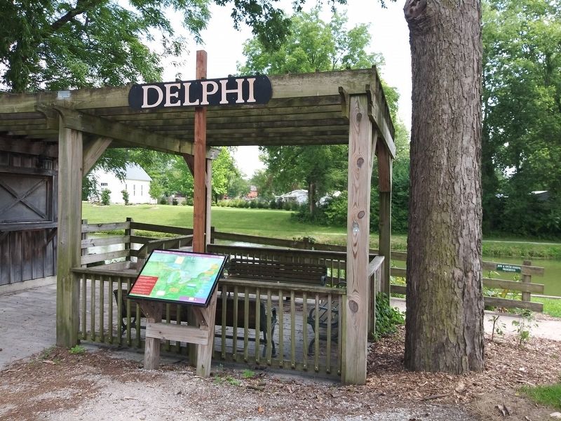
Location. 40° 35.483′ N, 86° 40.833′ W. Marker is in Delphi, Indiana, in Carroll County. It can be reached from West North Washington Street just east of North Charles Street, on the right when traveling east. The marker is on the Grounds of the Wabash & Erie Canal Conference & Interpretive Center. Touch for map. Marker is at or near this postal address: 12252 West North Washington Street, Delphi IN 46923, United States of America. Touch for directions.

Regionally, this marker is in Northern Indiana. It is also in the American Midwest and in the Corn Belt. Globally, it is in North America, the Western Hemisphere, the Western World, and the Anglosphere. Historically, it finds itself in what was once the territory of the Mississippian Culture and also the Northwest Territory.
Other nearby markers. At least 8 other markers are within walking distance of this marker: Welcome To Canal Park (here, next to this marker); Wabash & Erie Canal (here, next to this marker); Welcome To Delphi (here, next to this marker); Lewis Thomas Jones (a few steps from this marker); Constructing the Wabash & Erie Canal (a few steps from this marker); An Herb Garden (within shouting distance of this marker); Blacksmithing (within shouting distance of this marker); Native Plants of the Canal (within shouting distance of this marker). Touch for a list and map of all markers in Delphi.
Credits. This page was last revised on December 25, 2020. It was originally submitted on December 25, 2020, by Craig Doda of Napoleon, Ohio. This page has been viewed 283 times since then and 14 times this year. Photos: 1, 2. submitted on December 25, 2020, by Craig Doda of Napoleon, Ohio. • Devry Becker Jones was the editor who published this page.
