Constructing the Wabash & Erie Canal
468 Miles of Hard Labor
— Wabash & Erie Canal Park Village —
Surveying: A Canal could not proceed along the upper Wabash until title to Miami and Potawatomi lands were transferred to the State. At the 1826 Treaty of Paradise Springs the title was conveyed.
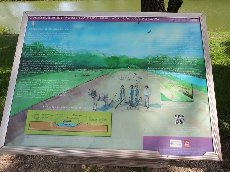
A corps of U. S. engineers was sent to Fort Wayne in 1826 to survey the portage that connected the Maumee and Wabash river systems. From the Rapids of the Maumee to the mouth of the Tippecanoe, the party continued the Canal line down the rivers in both directions from Fort Wayne. Running lines and levels was well understood, however, the science of mechanical engineering was in its infancy.
To begin construction of the Canal in 1832, a source of water found on the summit of the surveyed route was located in Allen County, Indiana. From this summit, water impounded by a dam across the St. Joseph River was directed through a feeder to the mainline in Fort Wayne. A row of surveyor's stakes marked the way for construction to begin.
Construction: The Federal government granted Indiana land amounting to five miles of alternating (checkerboard-style) sections on each side of the survey line. Various ideas were suggested such as cutting a channel from the Maumee Rapids to the mouth of the Tippecanoe on the Wabash River. When completed in 1853, the Canal extended from Lake Erie at Toledo, Ohio to Evansville, Indiana
on the Ohio River, the second longest canal in the world.An adequate supply of water was the basic concern for the Canal's design It was usually accomplished by taking advantage of a drop in altitude from a higher summit level and aided by reservoirs along the line as needed. The bed of the Canal was pitched with a slight fall to create a slow flow of water, yet not strong enough to retard the speed of boats going upstream. Lock gate doors came together in a "V” shape which pointed in the direction of the current. This added pressure against the lock gates helped create a more water tight seal.
Maintenance of the Canal meant ensuring that a channel would hold water. Light, gravelly soil or porous limestone caused leaks and required a thick layer or stiff clay called “puddle" which even at times did not always hold porous substrata.
Indiana canals suffered great damage done to the banks and bottoms by "crawdads” or crawfish, muskrats and other critters. State boats patrolled the line checking for damage and making repairs in towpath breaks. Grass grew in the channel which had to be cut out.
A Construction Camp resembled a shanty town with bunkhouses for dozens of working men who slept on bunks tiered, one above the other along the wall A family shanty provided domestic quarters for married worker with a wife and children.
Erected by Tippecanoe Arts Federation.
Topics and series. This historical marker is listed in these topic lists: Animals • Industry & Commerce • Native Americans • Waterways & Vessels. In addition, it is included in the Wabash & Erie Canal series list. A significant historical year for this entry is 1826.
Location. 40° 35.483′ N, 86° 40.817′ W. Marker is in Delphi, Indiana, in Carroll County. Marker can be reached from the intersection of West North Washington Street and North Charles Street, on the right when traveling east. On the Grounds of the Wabash & Erie Canal Conference & Interpretive Center. Touch for map. Marker is at or near this postal address: 12252 West North Washington Street, Delphi IN 46923, United States of America. Touch for directions.
Other nearby markers. At least 8 other markers are within walking distance of this marker. River Travel (a few steps from this marker); Welcome To Canal Park (a few steps from this marker); Wabash & Erie Canal (a few steps from this marker); Welcome To Delphi (a few steps from this marker); An Herb Garden (within shouting distance of this marker); Canal Bridges (within shouting distance of this marker); Blacksmithing (within shouting distance of this marker); Lewis Thomas Jones (within shouting distance of this marker). Touch for a list and map of all markers in Delphi.
Credits. This page was last revised on December 25, 2020. It was originally submitted on December 25, 2020, by Craig Doda of Napoleon, Ohio. This page has been viewed 150 times since then and 11 times this year. Photos: 1, 2. submitted on December 25, 2020, by Craig Doda of Napoleon, Ohio. • Devry Becker Jones was the editor who published this page.

