Near Southport in Brunswick County, North Carolina — The American South (South Atlantic)
Fort Caswell
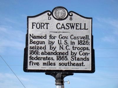
Photographed by J. J. Prats, February 17, 2009
1. Fort Caswell Marker
Named for Gov. Caswell. Begun by U.S. in 1826; seized by N.C. troops, 1861; abandoned by Confederates, 1865. Stands five miles southeast.
Erected 1950 by Archives, Conservation and Highway Departments. (Marker Number D-8.)
Topics and series. This historical marker is listed in these topic lists: Forts and Castles • War, US Civil. In addition, it is included in the North Carolina Division of Archives and History series list. A significant historical year for this entry is 1826.
Location. Marker has been reported missing. It was located near 33° 57.138′ N, 78° 2.868′ W. Marker was near Southport, North Carolina, in Brunswick County. It was at the intersection of Southport-Supply Road (State Highway 211) and Long Beach Road (State Highway 133), on the left when traveling east on Southport-Supply Road. Touch for map. Marker was in this post office area: Southport NC 28461, United States of America. Touch for directions.

Regionally, this marker was in the Coastal Plain and on the Cape Fear Coast. It was also in the American South, specifically in the Upper South, in the Tidewater, and on the Eastern Seaboard.
this page online
Other nearby markers. At least 8 other markers are within 3 miles of this location, measured as the crow flies: Robert Howe (approx. 2.6 miles away); Franklin Square (approx. 2.8 miles away); Robert C. Ruark (approx. 2.8 miles away); Robert Ruark (approx. 2.8 miles away); Southport’s First Fire Alarm (approx. 2.8 miles away); Railroad & Religion on Rhett Street (approx. 2.8 miles away); Old Jail (approx. 2.9 miles away); Indian Trail Tree (approx. 2.9 miles away). Touch for a list and map of all markers in Southport.
Related marker. Click here for another marker that is related to this marker. This other Fort Caswell marker is closer to the fort, and has photos of the fort itself.
Also see . . . Fort Caswell. NCpedia website entry (Submitted on May 7, 2024, by Larry Gertner of New York, New York.)
Additional commentary.
1.
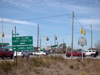
Photographed by J. J. Prats, February 17, 2009
2. Fort Caswell Marker
This marker was was reportedly knocked over sometime after Hurricane Florence, in September 2018, and recently has gone missing. The N.C. Department of Transportation reported they moved it out of the way to conduct recovery work, while another source reported seeing it pulled down with chains by contractors.
— Submitted June 22, 2019, by Mark Hilton of Montgomery, Alabama.
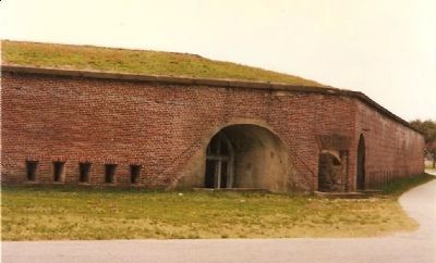
Photographed by Craig Swain, circa 1997
3. Fort Caswell Sally Port
The fort was heavily modified in the 1890s and early 1900's with updated defense systems. Today it serves as a youth facility.
Credits. This page was last revised on May 7, 2024. It was originally submitted on February 21, 2009, by J. J. Prats of Powell, Ohio. This page has been viewed 2,699 times since then and 31 times this year. Photos: 1, 2. submitted on February 21, 2009, by J. J. Prats of Powell, Ohio. 3. submitted on February 24, 2009, by Craig Swain of Leesburg, Virginia.
