Near Chester in Chesterfield County, Virginia — The American South (Mid-Atlantic)
Henricus Historical Park
Captain John Smith’s Adventures on the James
— www.johnsmithtrail.org —
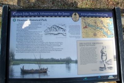
In 1611, Sir Thomas Dale founded the Citie of Henricus on a bluff above a bend in the river. The location was deemed both more defensible and more healthful than Jamestown, where settlers were often forced to drink brackish water that left them ill or lethargic. At Henricus, the English chartered Virginia’s first university and built their first hospital.
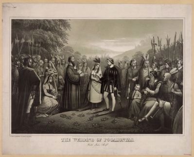
According to one tradition, Pocahontas, the daughter of the Algonquin ruler Powhatan, was kidnapped at Jamestown and met and married John Rolfe at Henricus in 1614. Their union prompted an eight-year truce between the Powhatan chiefdom and the English. Rolfe was the first Englishman to successfully cultivate tobacco in 1612.
The profitable export crop would give rise to vast plantations that siphoned settlers from Henricus and angered displaced Natives. As a result, the truce between the Algonquians and the English unraveled in 1622, shortly after Powhatan’s death.
Capt. John Smith’s Trail
John Smith knew the James River by its Algonquian name: Powhatan, the same as the region’s paramount chief. Smith traveled the river many times between 1607 and 1609, trading with Virginia Indians to ensure survival at Jamestown. What he saw of Virginia’s verdant woodlands and pristine waters inspired him to explore the greater Chesapeake Bay, chronicling its natural wonders.
(sidebar)
Did native Virginians have tattoos?
The English colonists at Jamestown were curious about -and sometimes astonished by-the Natives surrounding them. John Smith’s contemporary, George Percy, recorded his observations of the ornate tattoos worn by Algonquian women: “ The women kinde in this Countrey doth pounce and race their bodies, legges, thighes, armes and faces with a sharpe Iron, which makes a stampe in curious knots, and drawes the proportion of Fowles, Fish, or Beasts, then with paintings of sundry lively colours, they rub it into the stampe which will never be taken away, because it is dried into the flesh where it is sered.” It is unknown whether Pocahontas wore similar tattoos, though it is likely when she was a child the sides of her head were shaved. This was the custom for Indian girls, who wore their remaining hair in long braids.
Erected by Captain John Smith’s Trail, James River Association, Virginia Department of Conservation and Recreation, Chesapeake Bay Gateways Network. (Marker Number
9.)
Topics. This historical marker is listed in these topic lists: Colonial Era • Exploration • Settlements & Settlers. A significant historical year for this entry is 1607.
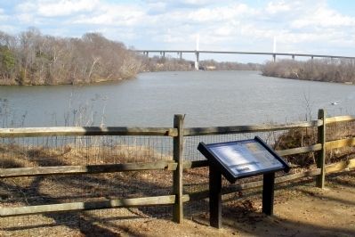
Location. 37° 22.585′ N, 77° 21.582′ W. Marker is near Chester, Virginia, in Chesterfield County. Marker can be reached from Henricus Park Road, 1.3 miles east of Coxendale Road. The marker is located in Henricus Historical Park 300 yards north of the parking lot. Touch for map. Marker is at or near this postal address: 251 Henricus Park Road, Chester VA 23836, United States of America. Touch for directions.
Other nearby markers. At least 8 other markers are within walking distance of this marker. John Smith Explores the Chesapeake (a few steps from this marker); The Church of Henricopolis (a few steps from this marker); Changes Over Time (within shouting distance of this marker); The Lightkeeper’s House (within shouting distance of this marker); Henricopolis (within shouting distance of this marker); The Bermuda Hundred Campaign (within shouting distance of this marker); USCTs At Dutch Gap (within shouting distance of this marker); Dutch Gap Canal (within shouting distance of this marker). Touch for a list and map of all markers in Chester.
More about this marker. On the lower left is a depiction of the exploration of the James River by English colonist. The photo carries
the caption "“The New World” © MMV, New Line Productions, Inc. All rights reserved. Photo by Merie Wallace. Photo appears courtesy of New Line Productions, Inc."
On the upper center is a sketch of an early settlement "Images Courtesy of the Library of Virginia."
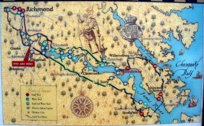
On the upper right is a map Captain John Smith's Trail. The map carries the caption, "Capt. John Smith’s Trail on the James is a 40-site water trail and auto tour for modern explorers."
On the right of the sidebar is a sketch of an Indian girl with braided hair. "Image Courtesy of the Library of Virginia."
Also see . . .
1. Captain John Smith’s Trail. (Submitted on February 15, 2009, by Bernard Fisher of Richmond, Virginia.)
2. Henricus Historical Park. (Submitted on February 15, 2009, by Bernard Fisher of Richmond, Virginia.)
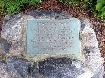
Photographed By Bernard Fisher, June 27, 2013
5. Henricus Park
who have contributed to
the preservation of this site.
Henricus Foundation
John N. Pastore, D.D.S., President
Pauline A. Mitchell, Secretary
Hardy B. Traylor, Treasurer
Placed by Henrico Doctor's Hospital
September 1986
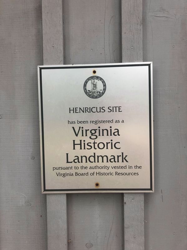
Photographed By Devry Becker Jones (CC0), May 8, 2020
6. Virginia Historic Landmark Plaque on the visitor center building
Credits. This page was last revised on May 9, 2020. It was originally submitted on February 15, 2009, by Bernard Fisher of Richmond, Virginia. This page has been viewed 1,845 times since then and 32 times this year. Last updated on February 21, 2009, by Bernard Fisher of Richmond, Virginia. Photos: 1, 2, 3. submitted on February 15, 2009, by Bernard Fisher of Richmond, Virginia. 4. submitted on January 18, 2010, by Bernard Fisher of Richmond, Virginia. 5. submitted on June 27, 2013, by Bernard Fisher of Richmond, Virginia. 6. submitted on May 9, 2020, by Devry Becker Jones of Washington, District of Columbia.
