Closing a railroad - Creating a trail
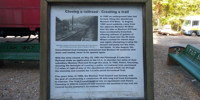
In 1980 an underground lake had formed, filling the abandoned Montour #10 Mine. In August, 1980 word suddenly came from the adjacent Montour #4 Mine that the lake in Montour #10 had been accidentally breached, allowing millions of gallons of water to flood into the #4 mine. Miners worked for eleven days and nights attempting to plug the breach and pump out the mine, but failed. In late August, the Consolidated Coal Company announced that Montour #4 would be shut down and sealed, never to be opened again.
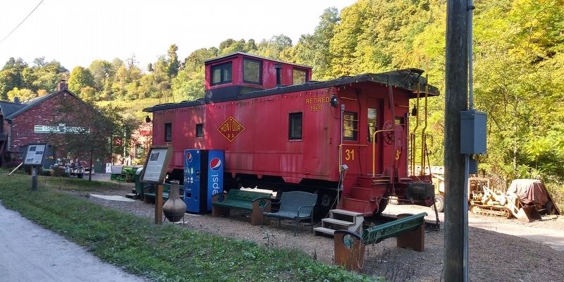
With the mine closed, on May 30, 1982 the Pittsburgh & Lake Erie Railroad made an application to the I.C.C. to abandon ten miles of their subsidiary Montour Railroad through this area. In 1984, Peters Township, showing the foresight of creating a public recreational trail, purchased 7.5 miles of right-of-way of the abandoned railroad which ran through the township and created the 3.5-mile paved Arrowhead Trail.
Five years later, in 1989, the Montour Trail Council was formed, with the goal of constructing a continuous 46 mile long trail from Coraopolis to Clairton. The Trail Council entered into
this page online
This photo, looking west from near this location, shows the track west
of Rt. 19 being removed after closure of Montour Mine #4.
Erected by Montour RR Historical Society.
Topics. This historical marker is listed in these topic lists: Parks & Recreational Areas • Railroads & Streetcars. A significant historical date for this entry is May 30, 1982.
Location. 40° 17.848′ N, 80° 6.542′ W. Marker is near Canonsburg, Pennsylvania, in Washington County. It is in Peters Township. It is on T.A.R. Avenue, on the right when traveling north. Touch for map. Marker is at or near this postal address: 107 Valley Brook Rd, Canonsburg PA 15317, United States of America. Touch for directions.
Regionally, this marker is in Greater Pittsburgh. It is also in the American Northeast, in the Mid-Atlantic, in Appalachia, and specifically in Northern Appalachia. Globally, it is in North America, the Western Hemisphere, the Western World, and the Anglosphere. Historically, it finds itself in what was once

Other nearby markers. At least 8 other markers are within 3 miles of this marker, measured as the crow flies: Montour Mine No. 4 (here, next to this marker); Milepost 32 - Signal Board (a few steps from this marker); X1 Railroad Crane (a few steps from this marker); Lotus Bridge (a few steps from this marker); Lawrence, Pa. Honor Roll (approx. 0.8 miles away); Revolutionary War Soldiers (approx. 1.1 miles away); McMurray VFW Memorial (approx. 1.8 miles away); Montour Trail (approx. 2.3 miles away). Touch for a list and map of all markers in Canonsburg.

Credits. This page was last revised on February 7, 2023. It was originally submitted on December 30, 2020, by Craig Doda of Napoleon, Ohio. This page has been viewed 665 times since then and 63 times this year. Photos: 1, 2, 3, 4. submitted on December 30, 2020, by Craig Doda of Napoleon, Ohio. • Bill Pfingsten was the editor who published this page.
