Mississippi River
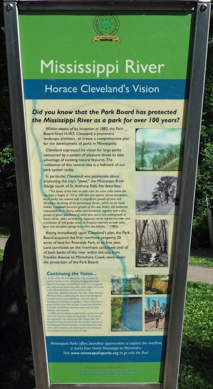
Horace Cleveland's Vision
— The 125th Historical Marker Project —
Within weeks of its inception in 1883, the Park Board hired H.W.S. Cleveland, a prominent landscape architect, to create a comprehensive plan for the development of parks in Minneapolis.
Cleveland expressed his vision for large parks connected by a system of pleasure drives to take advantage of existing natural features. The realization of this central idea is a hallmark of our park system today.
In particular, Cleveland was passionate about protecting the city's "jewel," the Mississippi River Gorge south of St. Anthony Falls. He describes:
"The banks of the river on both sides for some miles below the city have a height of 150 or 200 feet and appear almost precipitous... these banks are covered with a magnificent growth of trees and shrubbery, assuming all the picturesque forms... which no art could imitate. I observed luxuriant growth of elm, oak, linden, ash, butternut, cottonwood, birch, cherry, willow and hornbeam, together with a few groups of grand specimens of white pine and a rich undergrowth of hazel, sumac, alder, serviceberry, dogwood, cornel, red-berried elder and a profusion of wild grape vines. At frequent intervals on both sides, pure and abundant springs burst from the hillsides..." (1883).
Acting immediately upon Cleveland's plan, the Park Board acquired the first riverfront property, 20 acres of land for Riverside Park, in its first year. Land purchases on the riverfront continued until all of both banks of the river within the city, from Franklin Avenue to Minnehaha Creek, were under the protection of the Park Board.
Continuing the Vision...
In the 1970s, the Park Board and City looked at its central riverfront with rail yards and aging and vacant industrial buildings, and developed a plan to re-invigorate the riverfront by expanding public green space and access to the Mississippi River and St. Anthony Falls.
Since then, significant progress has been made. Opening Mill Ruins Park, re-dedicating the Stone Arch Bridge for recreational use and establishing a new Park Board headquarters building are highlights. Public investment in green infrastructure has resulted in more than $1 billion in private investments, including restaurants, housing, theatres and museums.
In 2005, the Park Board looked farther up the river and saw more intensive industrial businesses. A new vision was captured in the Above the Falls Master Plan. This document charts the future for the northern portion of the Mississippi River, focusing on connecting to the river with a series of parks and restoring the natural features that Cleveland
would have found so dear.Erected 2008 by Minneapolis Park and Recreation Board.
Topics. This historical marker is listed in these topic lists: Environment • Parks & Recreational Areas. A significant historical year for this entry is 1883.
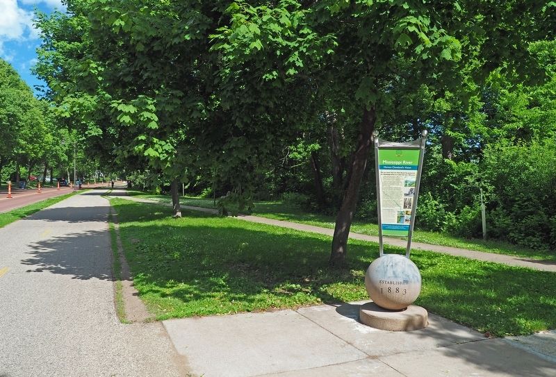
Location. 44° 57.083′ N, 93° 12.51′ W. Marker is in Minneapolis, Minnesota, in Hennepin County. It is in Cooper. Marker is on West River Parkway north of East 29th Street, on the right when traveling north. Marker is between the walking and biking paths at the northwest end of a wider grassy area along the river bluff. Touch for map. Marker is at or near this postal address: 2858 W River Pkwy, Minneapolis MN 55406, United States of America. Touch for directions.
Other nearby markers. At least 8 other markers are within walking distance of this marker. Roar of Waterfall, Rush of Rapids (about 700 feet away, measured in a direct line); Meeker Island Lock and Dam (approx. 0.2 miles away); Meeker Island Lock and Dam Historic Site (approx. 0.2 miles away); Sri Chinmoy Peace Bridge (approx. ¼ mile away); Sesquicentennial Trees (approx. 0.4 miles away); Bridging the Mississippi (approx. 0.4 miles away); The Red River Ox Cart Trail (approx. 0.7 miles away); Saint Paul and Ramsey County WWI Memorial (approx. 0.8 miles away). Touch for a list and map of all markers in Minneapolis.
Credits. This page was last revised on February 12, 2023. It was originally submitted on January 1, 2021, by McGhiever of Minneapolis, Minnesota. This page has been viewed 160 times since then and 25 times this year. Photos: 1, 2. submitted on January 1, 2021, by McGhiever of Minneapolis, Minnesota. • Mark Hilton was the editor who published this page.

