Near Mechanicsville in Hanover County, Virginia — The American South (Mid-Atlantic)
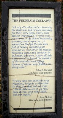
The Federal Collapse
John E. Stewart
44th New York Infantry
“If any man can mention any regiment, brigade or division in that line that did not run, I should like to see it. In fact, they all ran, and came back, and ran again.”
Lew McKoy
44th New York Infantry
Erected by National Park Service.
Topics. This historical marker is listed in this topic list: War, US Civil.
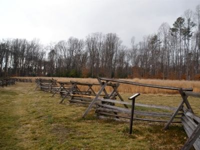
Location. 37° 34.409′ N, 77° 17.552′ W. Marker is near Mechanicsville, Virginia, in Hanover County. Marker can be reached from Watt House Road, 0.7 miles south of Cold Harbor Road (Virginia Route 156), on the right when traveling south. This marker is located on the walking trail along Boatswain Creek in the Gaines' Mill Battlefield unit of the Richmond National Battlefield Park. Touch for map. Marker is in this post office area: Mechanicsville VA 23111, United States of America. Touch for directions.
Other nearby markers. At least 8 other markers are within walking distance of this marker. Final Stand (a few steps from this marker); Union Artillery (within shouting distance of this marker); Whiting's Advance (about 300 feet away, measured in a direct line); Hood's Attack (about 300 feet away); Confederate Pursuit (about 400 feet away); Lee’s First Victory: At a Huge Cost (about 400 feet away); The Union Left Flank (about 500 feet away); Confederate Grand Assault (about 500 feet away). Touch for a list and map of all markers in Mechanicsville.
Also see . . .
1. CWSAC Battle Summary. Gaines’ Mill. (Submitted on February 23, 2009, by Bernard Fisher of Richmond, Virginia.)
2. Gaines' Mill Battlefield Loop Trail. This marker is one along the loop trail in the Gaines' Mill Battlefield unit of the Richmond National Battlefield Park. (Submitted on February 26, 2009, by Bernard Fisher of Richmond, Virginia.)
Credits. This page was last revised on June 16, 2016. It was originally submitted on February 23, 2009, by Bernard Fisher of Richmond, Virginia. This page has been viewed 1,089 times since then and 7 times this year. Photos: 1, 2. submitted on February 23, 2009, by Bernard Fisher of Richmond, Virginia.

