Northrop in Minneapolis in Hennepin County, Minnesota — The American Midwest (Upper Plains)
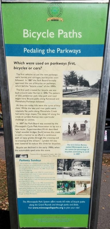
Bicycle Paths
Pedaling the Parkways
The first vehicles to use the new parkways were horses and carriages, but bicycles soon followed. In 1887 the Park Board formally approved the use of bicycles on parkways, which fed the "bicycle craze" of the 1890s.
The first path created for bicycle use was built around Lake Harriet in 1896. The pattern of lake, pedestrian path, bike path and road began here. Bicycle paths along Kenwood and Minnehaha Parkways followed.
As they are today, hills were the curse of bicyclists. While the lake and river paths were relatively flat, paths along Minnehaha Creek had some large slopes. The steep hill along the creek at Lyndale Avenue was a particular challenge to cyclists.
In 1897 the Park Board was assisted by the Minneapolis Cycle Path Association to lay out a new route. Superindendent Wirth described "small wooden bridges [built] across the creek in such a manner as to afford a continuous path on easy grades through the crossing and re-crossing of the stream." Lyndale hill was even lowered to reduce the climb for bicyclists.
Bicycle use declined in the early 1900s, when the automobiel sped onto the scene.
Parkway Sundays
Bicycle paths have continued to evolve since 1896 and are still an important recreational amenity on parkways. Certain eras have seen large peaks in bicycle use and parkway design has changed to meed the demand. The 1890s "bicycle craze" was just the beginning.
Parkway Sundays began in the 1950s. For certain hours on Sunday, parkways were closed to motor vehicles and open to anyone and every one on a bicycle.
In the 1970s, the groovy 10-speed bicycle spurred more bike touring. Usage became so heavy that bike and pedestrian paths were separated for safety.
Growing numbers of riders in the 1990s necessitated that some bicycle paths around the lakes become one way.
Trends in bicycle commuting and off-road cycling have been supported by building new trails with specialized designs.
The Grand Rounds parkway "missing link" plan was finally approved in 2008, and will complete the parkway bicycle path through northeast Minneapolis.
The U.S. Census Bureau ranked Minneapolis 2nd in the nation for percentage of bicyclists commuting to work in 2007.
Erected 2008 by Minneapolis Park and Recreation Board.
Topics. This historical marker is listed in these topic lists: Parks & Recreational Areas • Roads & Vehicles. A significant historical year for this entry is 1887.
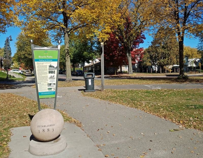
Location. 44° 54.802′ N, 93° 15.303′ W. Marker is in Minneapolis, Minnesota, in Hennepin County. It is in Northrop. Marker is at the intersection of Minnehaha Parkway East and 14th Avenue South, on the right when traveling east on Minnehaha Parkway East. Marker is in Minnehaha Creek Park, beside the paved walking path leading south from the road intersection. Touch for map. Marker is in this post office area: Minneapolis MN 55417, United States of America. Touch for directions.
Other nearby markers. At least 8 other markers are within 2 miles of this marker, measured as the crow flies. South Minneapolis History: The Arthur and Edith Lee Family (approx. 0.6 miles away); Playgrounds (approx. one mile away); Original Millstone from the Washburn-Crosby Flour Mill (approx. 1.7 miles away); The Crash of Flight 307 (approx. 1.9 miles away); World War Memorial (approx. 2 miles away); The First Flag Raised Over Iwo Jima (approx. 2 miles away); The Honoring All Veterans Memorial (approx. 2 miles away); PFC. Jimmy Berray (approx. 2 miles away). Touch for a list and map of all markers in Minneapolis.
Credits. This page was last revised on February 12, 2023. It was originally submitted on January 5, 2021, by McGhiever of Minneapolis, Minnesota. This page has been viewed 175 times since then and 23 times this year. Photos: 1, 2. submitted on January 5, 2021, by McGhiever of Minneapolis, Minnesota. • Mark Hilton was the editor who published this page.

