Fort Mitchell in Russell County, Alabama — The American South (East South Central)
Bartram's Trail
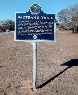
Photographed by James L.Whitman, January 5, 2021
1. Bartram's Trail Marker
After being refurbished.
Erected by Erected by Russell County Commission and Alabama Bicentennial Commission.
Topics and series. This historical marker is listed in these topic lists: Arts, Letters, Music • Colonial Era • Environment • Horticulture & Forestry. In addition, it is included in the The Spirit of ’76, America’s Bicentennial Celebration, and the William Bartram Trails series lists.
Location. 32° 16.668′ N, 85° 0.196′ W. Marker is in Fort Mitchell, Alabama, in Russell County. It is on Alabama Route 165 north of Creek Trail, on the right when traveling north. Marker is located next to Oswichee Baptist Church. Touch for map. Marker is at or near
this page online

Regionally, this marker is in Greater Columbus. It is also in the American South, specifically in the Deep South, and in the Black Belt. Globally, it is in North America, a Gulf of Mexico state, the Western Hemisphere, the Western World, and the Anglosphere. Historically, it finds itself in what was once the territory of the Mississippian Culture, one of the Confederate States of America, and the Antebellum South.
Other nearby markers. At least 8 other markers are within 5 miles of this marker, measured as the crow flies: Fryar Field (approx. 3.1 miles away); Macedonia Missionary Baptist Church / Macedonia School (approx. 3.2 miles away); Spanish Fort, 1689-1691 (approx. 4 miles away); Archaeology and Daily Life Among the Creeks (approx. 4.7 miles away); Pokkecheta, or the Ball Play (approx. 4.7 miles away); J.W. and Ethel I. Woodruff Foundation Interpretive Trail (approx. 4.7 miles away); Indian Ball Ground (approx. 4.7 miles away); Archaeology And Our Understanding of the Creek People (approx. 4.7 miles away).
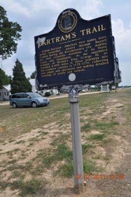
Photographed by Sandra Hughes, July 12, 2011
2. Bartram's Trail Marker before refurbishing.
Another marker is no longer nearby. Old Federal Road (was approx. 4.7 miles away in Georgia but has been permanently removed).
Also see . . . Google Earth. Driving directions to Oswichee Baptist Church (Submitted on October 17, 2011, by Sandra Hughes Tidwell of Killen, Alabama, USA.)
Additional commentary.
1. Regarding the Royal Appointment
William Bartram was not the king's botanist as this marker claims. John Bartram, William's father, was appointed the King's Botanist for North America in 1765 and held that post until his death in 1777. John Bartram routinely corresponded with a community of persons interested in botany. One such individual was John Fothergill, an English physician and owner of a large botanical garden. Fothergill supported William's expedition through the southern colonies from 1773 until 1777 with payments of £50 per year plus an additional allowance for expenses. During his journey William made shipments to Fothergill that included dried plant specimens, zoological and botanical drawings, and a report on his travels. Note To Editor only visible by Contributor and editor
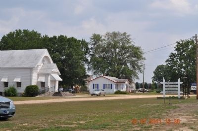
Photographed by Sandra Hughes, July 12, 2011
3. Oswichee Baptist Church
— Submitted February 22, 2012, by Harry Gatzke of Huntsville, Alabama.
Credits. This page was last revised on January 6, 2021. It was originally submitted on October 17, 2011, by Sandra Hughes Tidwell of Killen, Alabama, USA. This page has been viewed 1,944 times since then and 46 times this year. Last updated on January 6, 2021, by James L.Whitman of Eufaula, Alabama. Photos: 1. submitted on January 6, 2021, by James L.Whitman of Eufaula, Alabama. 2, 3. submitted on October 17, 2011, by Sandra Hughes Tidwell of Killen, Alabama, USA. • Mark Hilton was the editor who published this page.
