Near Petersburg in Dinwiddie County, Virginia — The American South (Mid-Atlantic)
The Battle of Reams Station
The Exposed Position of the Federal Artillery
Photographed by Craig Swain, November 22, 2008
1. The Battle of Reams Station - Exposed Position Marker
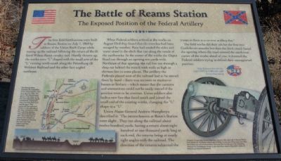
The first field fortifications were built at Reams Station on July 1, 1864 by soldiers of the Union Sixth Corps while tearing up the railroad following the return of the ill-fated Wilson-Kautz cavalry raid. Hastily thrown up, the works were "L" shaped with the small arm of the "L" running north-south along the Petersburg (& Weldon) Railroad and the other face angled northwest.
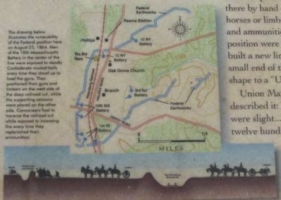
When Federal soldiers arrived at the works on August 23rd they found that the trenches had been ravaged by weather. Rain had eroded the sides and water stood in the ditch that ran along the inside of the earthworks. In the center of the works the Depot Road ran through an opening ten yards wide. Northeast of that opening, the rail line ran through a deep cut behind the trench with walls as high as thirteen feet in some places. The artillery the Federals placed west of the railroad had to be moved there by hand - there was no room to maneuver horses or limbers - which meant that the cannons and ammunition could not be easily moved if the position were to be overrun. Union soldiers also built a new line that faced south and joined the small end of the
this page online
Union Major General Andrew Humphreys described it: "The intrenchments at Ream's Station were slight... They ran along the railroad about twelve hundred yards, having a return about eight hundred or one thousand yards long at each end, the returns being at nearly right angles with the railroad. The direction of the returns subjected the troops in them to a reverse artillery fire."
The field works did their job for the first two Confederate assaults but then the third attack found the opening where the road entered the northwest corner of the works ahead of you; it doomed the Federal soldiers trying to defend their unsupported position.
Erected by Civil War Preservation Trust.
Topics and series. This historical marker is listed in this topic list: War, US Civil. In addition, it is included in the Battlefield Trails - Civil War series list. A significant historical date for this entry is July 1, 1864.
Location. Marker has been permanently removed. It was located near 37° 5.839′ N, 77° 25.282′ W. Marker was near Petersburg, Virginia, in Dinwiddie County. It was on Reams Drive (County Route 606)

We have been informed that this marker is no longer there and will not be replaced. This page is an archival view of what was.
Regionally, this marker was in the Piedmont, in Southside Virginia, and specifically in Central Virginia. It was also in the American South and specifically in the Upper South. Globally, it was in North America, the Western Hemisphere, the Western World, and the Anglosphere. Historically, it found itself in what was once the territory of the Mississippian Culture, one of the original Thirteen Colonies, one of the Confederate States of America, and the Antebellum South.

Other nearby markers. At least 8 other markers are within 5 miles of this location, measured as the crow flies: Second Battle of Reams Station (within shouting distance of this marker); a different marker also named Ream's Station (about 500
Photographed by Craig Swain, November 22, 2008
3. Close Up of the Map and Profile
Click on the photo to zoom in.
Other markers no longer nearby. The Battle of Reams Station (was about 500 feet away, measured in a direct line but has been permanently removed); Ream's Station (was about 500 feet away but has been confirmed missing); a different marker also named The Battle of Reams Station (was approx. 0.2 miles away but has been permanently removed); a different marker also named The Battle of Reams Station (was approx. ¼ mile away but has been permanently removed).
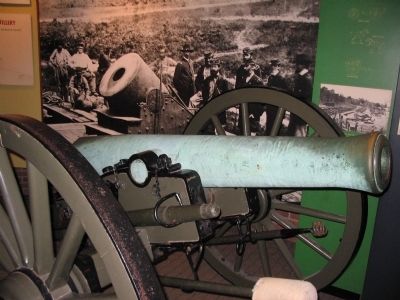
More about this marker. In the lower right is a photo of an Original 12-pounder bronze Napoleon cannon tube captured at Reams Station from Battery B, 1st Rhode Island Light Artillery. It was one of four guns lost after the battery ran out of ammunition and was then turned upon the retreating Federals by Confederate forces. It can be seen in the visitor center at Petersburg National Battlefield.
In
Photographed by Craig Swain, November 22, 2008
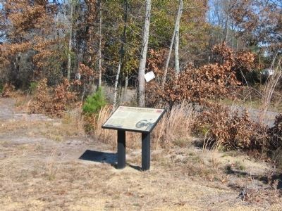
4. Exposed Position of the Artillery Wayside
Related markers. Click here for a list of markers that are related to this marker. The Second Battle of Reams Station Virtual Tour by Markers.
Also see . . .
1. Reams Station. National Park Service site detailing the phases of the battle. (Submitted on November 23, 2008, by Craig Swain of Leesburg, Virginia.)
2. Core Work: Preserving the Center at the Ream’s Station Battlefield. National Park Service website entry (Submitted on April 7, 2024, by Larry Gertner of New York, New York.)
Photographed by Craig Swain, November 22, 2008
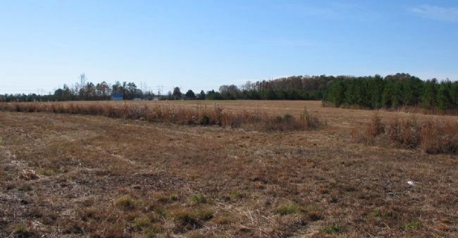
5. Traces of Federal Earthworks
Looking southwest from the marker location. The tall grass indicates the traces of Federal earthworks.
Photographed by Craig Swain, November 22, 2008
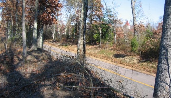
6. The Railraod Cut
View from the west side of Halifax Road looking over the old railroad bed. The cut here is today about 10 feet deep, but illustrates the point mentioned on the marker.
Photographed by Craig Swain, November 22, 2008
7. The 12-pounder Napoleon Captured at Reams Station
As mentioned on the marker, this 12-pounder Napoleon displayed at the Petersburg Visitor Center was captured from Battery B, 1st Rhode Island Artillery at Reams Station. It was later recaptured when Petersburg fell. The piece carries the registry number 253, and was made at Revere Copper Company, of Boston, Massachusetts. The gun weighed 1,238 pounds when cast in 1863.
Credits. This page was last revised on April 7, 2024. It was originally submitted on November 23, 2008, by Craig Swain of Leesburg, Virginia. This page has been viewed 3,374 times since then and 62 times this year. Last updated on January 8, 2021, by Bradley Owen of Morgantown, West Virginia. Photos: 1. submitted on November 23, 2008, by Craig Swain of Leesburg, Virginia. 2. submitted on March 11, 2009, by Craig Swain of Leesburg, Virginia. 3, 4, 5, 6, 7. submitted on November 23, 2008, by Craig Swain of Leesburg, Virginia. • Bernard Fisher was the editor who published this page.
