Bullboats
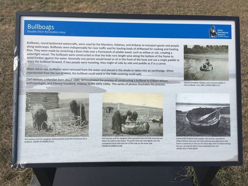
When not in use, bullboats were removed from the water and placed in the shade or taken into an earthlodge. When unprotected from the sun or wind, the bullboat could warp or the hide covering could split.
Owl-woman, a Mandan born about 1840, demonstrated the process of constructing a bullboat to Gilbert Wilson, anthropologist, and Edward Goodbird, Hidatsa, in the early 1900s. This series of photos illustrates
this page online
Captions:
Edward Goodbird, Hidatsa, and a woman paddle in
their bullboat, circa 1909.
Owl-woman and her daughter Many-growths build the framework for a
bullboat.
Owl-woman and her daughter Many-growths trim the hide covering and
attach the hide to the frame. The green hide was tied tightly over the
completed frame with the hair of the hide on the outer side.
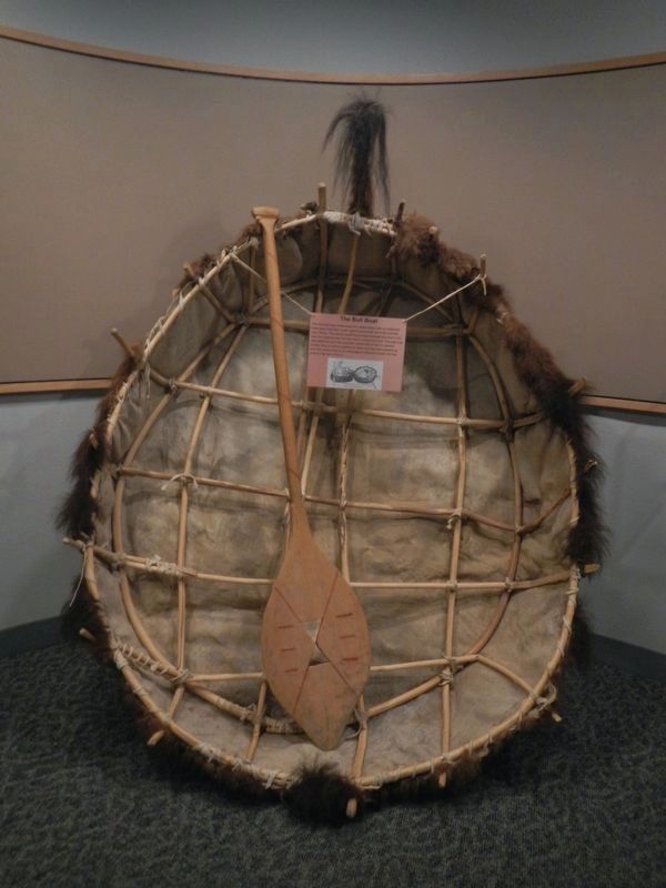
Constructed bullboat with paddle. Owl-woman reported to
Gilbert Wilson that once the hide covering was attached to the
frame it would dry in the sun for three days with its interior facing
the sun. During this time it was protected from rain.
Erected by State Historical Society of North Dakota.
Topics. This historical marker is listed in these topic lists: Indigenous Peoples and Communities • Waterways & Vessels. A significant historical year for this entry is 1840.
Location. 46° 56.354′ N, 100° 54.139′ W. Marker is in Bismarck, North Dakota, in Burleigh County. It can be reached from Double Ditch Loop. Touch for map. Marker is in this post office area: Bismarck ND 58503, United States of America. Touch for directions.
Regionally, this marker
Other nearby markers. At least 8 other markers are within walking distance of this marker: Hunting and Gathering (within shouting distance of this marker); Potande and the Mandan Fishery (within shouting distance of this marker); Glaciation and Forming the Missouri River Trench (about 400 feet away, measured in a direct line); Mandan Origin Stories (about 400 feet away); Mandans and the Practice of Farming (about 500 feet away); Square Buttes (approx. 0.2 miles away); Double Ditch State Historic Site (approx. 0.2 miles away); Stone Shelter (approx. 0.2 miles away). Touch for a list and map of all markers in Bismarck.

Credits. This page was last revised on September 15, 2025. It was originally submitted on January 10, 2021, by Connor Olson of Menomonee Falls, Wisconsin. This page has been viewed 490 times since then and 37 times this year. Photos: 1. submitted on January 10, 2021, by Connor Olson of Menomonee Falls, Wisconsin. 2, 3. submitted on September 15, 2025, by Barry Swackhamer of Brentwood, California. • Bill Pfingsten was the editor who published this page.
