Alamo Plaza in San Antonio in Bexar County, Texas — The American South (West South Central)
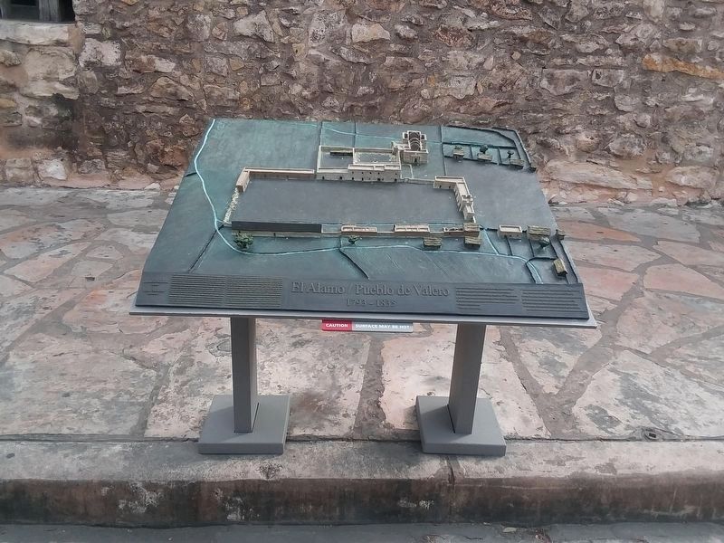
Mission San Antonio de Valero 1793-1835
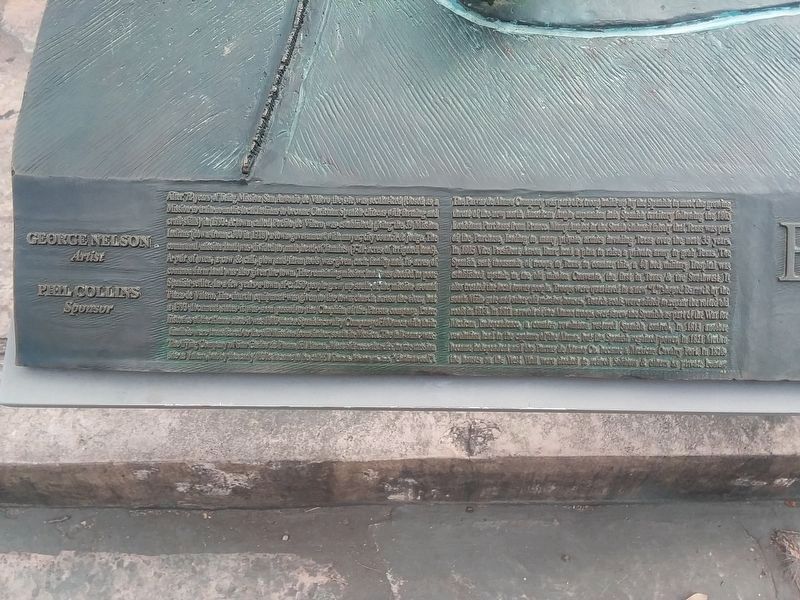
After 72 years of being Mission San Antonio de Valero the site was secularized (closed as a Mission to train nomadic local Indians to become Christian Spanish citizens with farming and craft skills) in 1793. A town called Pueblo de Valero was established giving the 39 Mission Indians (down from c 300 in 1718) a town government with mayor, city council & judge. The communal mission land was divided to male head of families (7-21 acres of irrigated land). A pair of oxen, a cow & calf, plow and farm tools was given each family and 16 acres of common farm land was also given the town. The remaining mission land was deeded to poor Spanish settler. In a few years a town of c. 250 people grew up south of the mission around Plaza de Valero. The church equipment was given to the town church across the river, but a 1793 document states it was soon passed to the Chaplain of the Parras Company. Later histories of the Alamo state it was 1803 that a Spanish cavalry Company of 100 men with their families were transferred to the old Mission from father south in Mexico. The full name was The Flying Company of San Carlos de Parra del Alamo. Most old records refer to the mission site as Valero, but by the early 1830s it came to be called El Alamo. Alamo means "Cottonwood."
The Parras de Alamo Company was part of a troop build up by the Spanish
to meet the growing threat of the new north American Anglo expansion into Spanish territory following the 1803 Louisiana Purchase from France. Many Anglos in the South claimed falsely that Texas was part of the Purchase, leading to many private armies invading Texas over the next 35 years. In 1805 Vice President Aaron Burr led a plan to raise a private army to grab Texas. The Spanish sent thousands of troops to Texas to counter this. A 40 bed military Hospital was upstairs in the old mission Convento, the first in Texas & Southwest. It also treated the local townspeople. Troops were guarded in a new "I" shaped Barrack by the south Main gate and other old mission houses, Church roofs were added to repair the old roofs in 1813. In 1811 a revolt of the Alamo troops overturn the Spanish as part of the War for Mexican Independence, a counter revolution lead to the capture of the Alamo, but the Spanish regained power in 1821. Mexico became independent and the Parras de Alamo Co. became a Mexican Cavalry Fort. In 1820s the houses on the West Wall were deeded to retired soldiers & others as private homes.George Nelson
Artist
Phil Collins
Sponsor
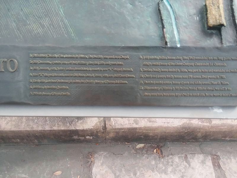
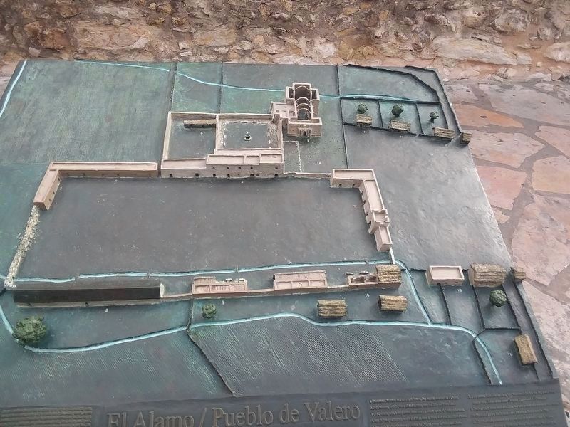
1. Unfinished Church of San Antonio de Valero, The Sacristry was used as a Chapel
2. Old Convento, upstairs was a 40 bed Military Hospital 1806 and years later
3. Old Convent, yard, 2 story arches
demolished & reused in new “L” shaped Barrack
4. New “L” shaped Barrack, next to Old Main Gate & Tower with new Jail Guard house
5. Yard with Latrine & Outhouse pit toilets for Cavalry troops of Parras del Alamo
6. Soldiers & families Quarters
7. Private house of Reyes Family
8. 2 old mission Indian houses along West Wall remodeled into one long gabled wood shingle roofed house of the Alamo Company Commander Lt. Castaneda
9. Trevino Family house divided in 1800s, was part in ruins and remodeled and roofed
10. Church and Lasoya family houses near SW corner, first granted in 1785
11. Thatched roofed soldiers homes of posts and adobe around Plaza de Valero
12. Old cemetery of Mission (c 900 Indians buried Mission …) was still in use … must have been some type of wall on south side, but no records exist of location
Topics. This historical marker is listed in these topic lists: Colonial Era • Forts and Castles • Native Americans. A significant historical year for this entry is 1793.
Location. 29° 25.572′ N, 98° 29.189′ W. Marker is in San Antonio, Texas, in Bexar County. It is in Alamo Plaza. Marker is on Alamo Plaza south of East Houston Street, on the right when traveling north. Touch for map. Marker is in this post office area: Alamo TX 78516, United States of America. Touch for directions.
Other nearby markers. At least 8 other markers are within walking distance of this marker. Mission San Antonio de Valero 1785 (here, next to this marker); The Alamo 1836 (a few steps from this marker); Mission Mill (and Millstone) (a few steps from this marker); Mission San Antonio de Valero 1744 (a few steps from this marker); Spanish Mission and Military Post (a few steps from this marker); The Alamo (a few steps from this marker); The Alamo 1836-1846 (a few steps from this marker); The Alamo Cenotaph (a few steps from this marker). Touch for a list and map of all markers in San Antonio.
Credits. This page was last revised on February 2, 2023. It was originally submitted on January 11, 2021, by Craig Doda of Napoleon, Ohio. This page has been viewed 354 times since then and 43 times this year. Photos: 1, 2. submitted on January 12, 2021, by Craig Doda of Napoleon, Ohio. 3, 4. submitted on January 11, 2021, by Craig Doda of Napoleon, Ohio. • J. Makali Bruton was the editor who published this page.


