Casper in Natrona County, Wyoming — The American West (Mountains)
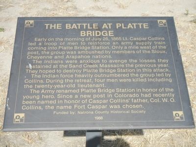
The Battle at Platte Bridge
The Indians were anxious to avenge the losses they sustained at the Sand Creek Massacre the previous year. They hoped to destroy Platte Bridge Station in this attack.
The Indian force heavily outnumbered the group led by Collins. During the retreat, four men were killed including the twenty-year-old lieutenant.
The Army renamed Platte Bridge Station in honor of the young hero. Since a new post in Colorado had recently been named in honor of Caspar Collins’ father, Col. W.O. Collins, the name Fort Caspar was chosen.
Erected 1988 by Natrona County Historical Society.
Topics. This historical marker is listed in this topic list: Wars, US Indian. A significant historical date for this entry is July 26, 1865.
Location. 42° 50.207′ N, 106° 22.266′ W. Marker is in Casper, Wyoming, in Natrona County. Marker can be reached from Fort Caspar Road, 0.1 miles west of South West Wyoming Boulevard (Wyoming Highway 258), on the left when traveling west. Touch for map. Marker is at or near this postal address: 4001 Fort Caspar Road, Casper WY 82604, United States of America. Touch for directions.
Other nearby markers. At least 8 other markers are within walking distance of this marker. The Battle of Red Buttes (a few steps from this marker); Reconstructed Fort Caspar (within shouting distance of this marker); Old Fort Caspar (within shouting distance of this marker); Platte Bridge Cemetery (about 300 feet away, measured in a direct line); Robert Stuart Cabin Site (about 300 feet away); Indians Of Wyoming (about 300 feet away); Military Explorers (about 300 feet away); Oregon/California/Mormon Trails (about 300 feet away). Touch for a list and map of all markers in Casper.
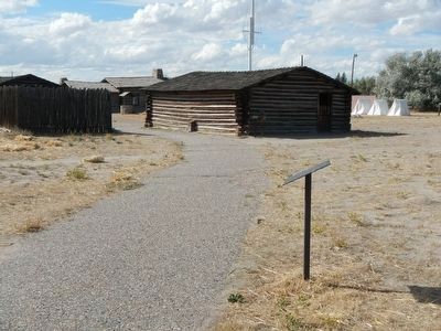
More about this marker. This marker is on the pathway leading from the museum to the reconstructed fort.
Also see . . . Battle of Platte Bridge -- Wikipedia. The bridge, across the North Platte River near present day Casper, Wyoming, was guarded by 120 soldiers. In an engagement near the bridge, and another against a wagon train guarded by 28 soldiers a few miles away, the Indians killed 29 soldiers while suffering at least eight dead. (Submitted on December 18, 2015, by Barry Swackhamer of Brentwood, California.)
Credits. This page was last revised on January 12, 2021. It was originally submitted on December 18, 2015, by Barry Swackhamer of Brentwood, California. This page has been viewed 951 times since then and 105 times this year. Last updated on January 12, 2021, by Craig Baker of Sylmar, California. Photos: 1, 2, 3. submitted on December 18, 2015, by Barry Swackhamer of Brentwood, California.


