Sylmar in Los Angeles in Los Angeles County, California — The American West (Pacific Coastal)
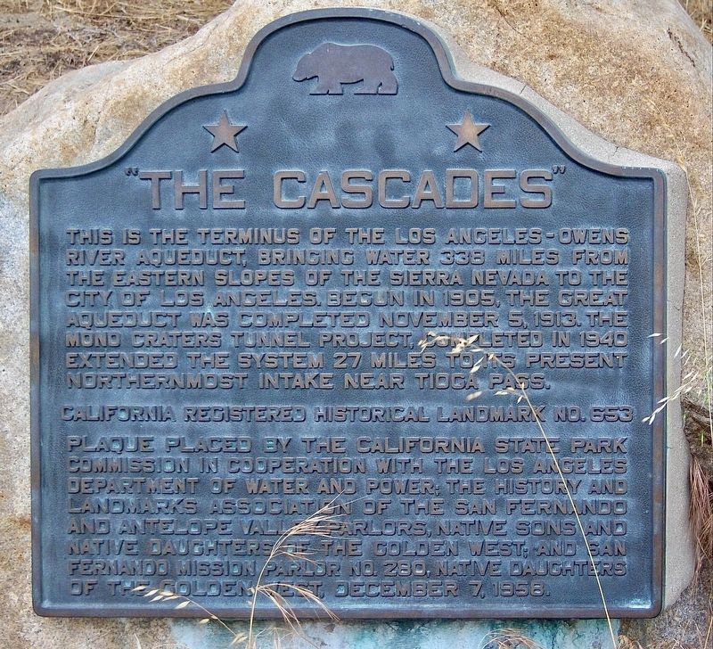
"The Cascades"
Photographed by Craig Baker
1. "The Cascades" Marker
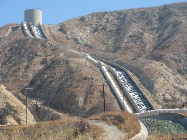
This is the terminus of the Los Angeles-Owens River Aqueduct, which brings water 338 miles from the eastern slopes of the Sierra Nevada to the City of Los Angeles. Begun in 1905, the great aqueduct was completed November 5, 1913. The Mono Craters Tunnel project, completed in 1940, extended the system 27 miles to its present northernmost intake near Tioga Pass.
California Registered Historical Landmark No.653.
Erected 1958 by Calif. State Parks; L.A. Dept. of Water and Power; and Native Sons & Daughters of the Golden West. (Marker Number 653.)
Topics and series. This historical marker is listed in these topic lists: Industry & Commerce • Natural Resources • Waterways & Vessels. In addition, it is included in the ASCE Civil Engineering Landmarks, the California Historical Landmarks, and the Native Sons/Daughters of the Golden West series lists. A significant historical date for this entry is November 5, 1991.
Location. 34° 19.366′ N, 118° 29.848′ W. Marker is in Los Angeles, California, in Los Angeles County. It is in Sylmar. It is on Foothill Boulevard 0.1 miles north of Balboa Boulevard, on the right when traveling north.
this page online

Regionally, this marker is in The Valley (the San Fernando Valley) and in the Transverse Ranges. It is also on the American Pacific Coast. Globally, it is in North America, on the Ring of Fire, on the Pacific Rim, in the Western Hemisphere, in the Western World, and in the Anglosphere. Historically, it finds itself in what was once New Spain and also Mexico’s Alta California.
Other nearby markers. At least 8 other markers are within 3 miles of this marker, measured as the crow flies: The Cascades (a few steps from this marker); Rim of the Valley Trail (approx. 1.2 miles away); O’Melveny Park (approx. 1.3 miles away); Los Angeles Aqueduct Filtration Plant (approx. 1.3 miles away); Edminster House (approx. 1.4 miles away); Kramer House (approx. 1½ miles away); Sayre Fire (approx. 1.8 miles away); La Puerta (approx. 2.3 miles away). Touch for a list and map of all markers in Los Angeles.
Another marker is no longer nearby. Beale's Cut (was approx. 1½ miles away but has been confirmed missing).
Regarding "The Cascades". This
Photographed by Syd Whittle, June 19, 2009
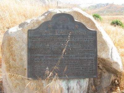
2. “The Cascades” Marker
A new marker was installed next to this one in 2013.

Photographed by Thomas Chris English
3. The California Marker is Missing
The marker was stolen in 2010.
Photographed by Syd Whittle, June 19, 2009
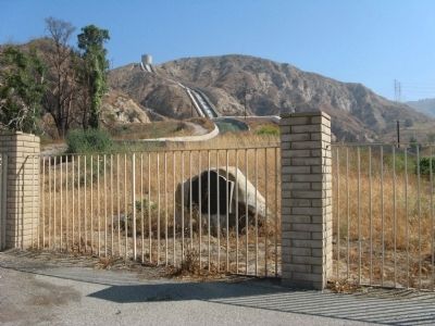
4. “The Cascades” Marker
Photographed by Craig Baker, February 13, 2018
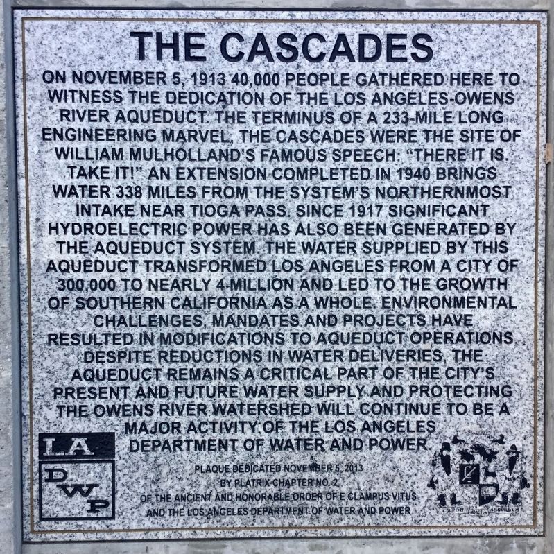
5. 2013 Marker
100th anniversary marker, located next to the others.

Photographed by Syd Whittle, June 19, 2009
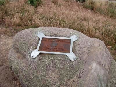
6. National Historic Civil Engineering Landmark
This site has been designated as a National Historic Civil Engineering Landmark by the American Society of Civil Engineers.
Photographed by Denise Boose, March 3, 2010
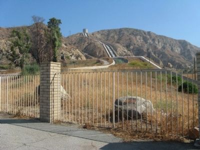
7. National Historic Civil Engineering Landmark Plaque
It appears that they wanted to reinforce the security of this plaque, since the other one went missing.
Photographed by Syd Whittle, June 19, 2009
8. National Historic Civil Engineering Landmark Marker

Photographed by Craig Baker, February 13, 2018
9. Markers and Cascades - 2018
Photographed by Syd Whittle, June 19, 2009
10. The Cascades
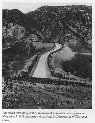
November 5, 1913
11. Crowds Celebrating at the Owensmouth Cascades
Crowds Celebrating at the Owensmouth Cascades Near Sylmar on November 5, 1913
(Photo courtesy of Los Angeles Department of Water and Power)
Library of Congress
(Photo courtesy of Los Angeles Department of Water and Power)
Library of Congress
Credits. This page was last revised on March 8, 2026. It was originally submitted on June 19, 2009, by Syd Whittle of Mesa, Arizona. This page has been viewed 3,071 times since then and 57 times this year. Last updated on January 16, 2021, by Craig Baker of Sylmar, California. Photos: 1. submitted on March 8, 2026, by Craig Baker of Sylmar, California. 2. submitted on June 19, 2009, by Syd Whittle of Mesa, Arizona. 3. submitted on June 20, 2010, by Chris English of Phoenix, Arizona. 4. submitted on June 19, 2009, by Syd Whittle of Mesa, Arizona. 5. submitted on February 14, 2018, by Craig Baker of Sylmar, California. 6. submitted on June 19, 2009, by Syd Whittle of Mesa, Arizona. 7. submitted on January 31, 2012, by Denise Boose of Tehachapi, California. 8. submitted on June 19, 2009, by Syd Whittle of Mesa, Arizona. 9. submitted on February 14, 2018, by Craig Baker of Sylmar, California. 10. submitted on June 19, 2009, by Syd Whittle of Mesa, Arizona. 11. submitted on June 30, 2009, by Syd Whittle of Mesa, Arizona. • J. Makali Bruton was the editor who published this page.
