Williamsburg, Virginia — The American South (Mid-Atlantic)
Battle of Williamsburg
The Bloody Ravine
— 1862 Peninsula Campaign —
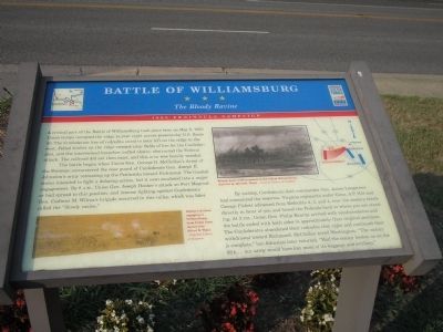
The battle began when Union Gen. George B. McClellan’s Army of the Potomac encountered the rear guard of Confederate Gen. Joseph E. Johnston’s army retreating up the Peninsula toward Richmond. The Confederates intended to fight a delaying action, but it soon escalated into a major engagement. By 8 A.M., Union Gen. Joseph Hooker’s attack on Fort Magruder had spread to this position, and intense fighting against Confederate Gen. Cadmus M. Wilcox’s brigade occurred in this valley, which was later called the “bloody ravine.”
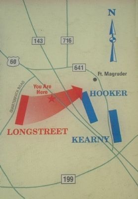
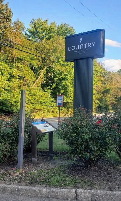
By midday, Confederate field commander Gen. James Longstreet had committed the reserves. Virginia regiments under Gens. A.P. Hill and George Pickett advanced from Redoubts 2, 3, and 4, near the modern hotels directly in front of you and forced the Federals back to where you are standing. At 3 P.M., Union Gen. Philip Kearny arrived with reinforcements and the battle ended with both sides in approximately their original positions. The Confederates abandoned their redoubts that night and continued their withdrawal toward Richmond. McClellan wired Washington, “The victory is complete,” but Johnston later retorted, “Had the enemy beaten us on the fifth … our army would have lost most of its baggage and artillery.”
Erected by Virginia Civil War Trails.
Topics and series. This historical marker is listed in this topic list: War, US Civil. In addition, it is included in the Virginia Civil War Trails series list. A significant historical month for this entry is May 1929.
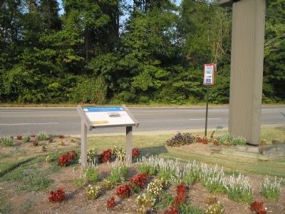
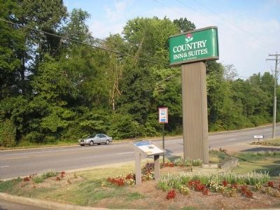
Location. 37° 15.594′ N, 76° 40.409′ W. Marker is in Williamsburg, Virginia. Marker is on Pocahontas Trail (U.S. 60), on the right when traveling east. Touch for map. Marker is in this post office area: Williamsburg VA 23185, United States of America. Touch for directions.
Other nearby markers. At least 8 other markers are within walking distance of this marker. Magruder’s Defenses (about 400 feet away, measured in a direct line); Quarterpath Road (approx. 0.4 miles away); Peninsula Campaign (approx. 0.4 miles away); a different marker also named The Battle of Williamsburg (approx. 0.4 miles away); History of Fort Magruder (approx. 0.4 miles away); Fort Magruder (approx. half a mile away); Confederate Soldiers and Sailors Monument (approx. half a mile away); a different marker also named Fort Magruder (approx. half a mile away). Touch for a list and map of all markers in Williamsburg.
More about this marker. The marker contains two pictures depicted by Alfred R. Waud. – Courtesy Library of Congress. The bottom left of the marker contains a picture of “Hooker’s division engaging at Williamsburg, from Union lines” and in a picture at the top of the marker, “Kearny leads reinforcements in the rain at Williamsburg.”
The top right of the marker features a battle map showing troop movements during the May 5, 1862 Battle of Williamsburg.
Also see . . .
1. Battle of Williamsburg, 5 May 1862. Williamsburg was the first large battlefield encounter between Union and Confederate forces during the Peninsula Campaign of 1862. (Submitted on August 17, 2008, by Bill Coughlin of Woodland Park, New Jersey.)
2. The Peninsula Campaign of 1862. (Submitted on August 17, 2008, by Bill Coughlin of Woodland Park, New Jersey.)
3. Tidewater Virginia, The 1862 Peninsula Campaign. Civil War Traveler. (Submitted on August 17, 2008, by Bill Coughlin of Woodland Park, New Jersey.)
Credits. This page was last revised on October 21, 2021. It was originally submitted on August 17, 2008, by Bill Coughlin of Woodland Park, New Jersey. This page has been viewed 3,724 times since then and 73 times this year. Last updated on January 17, 2021, by Bradley Owen of Morgantown, West Virginia. Photos: 1, 2, 3, 4. submitted on August 17, 2008, by Bill Coughlin of Woodland Park, New Jersey. 5. submitted on October 17, 2021, by Bradley Owen of Morgantown, West Virginia. • J. Makali Bruton was the editor who published this page.
