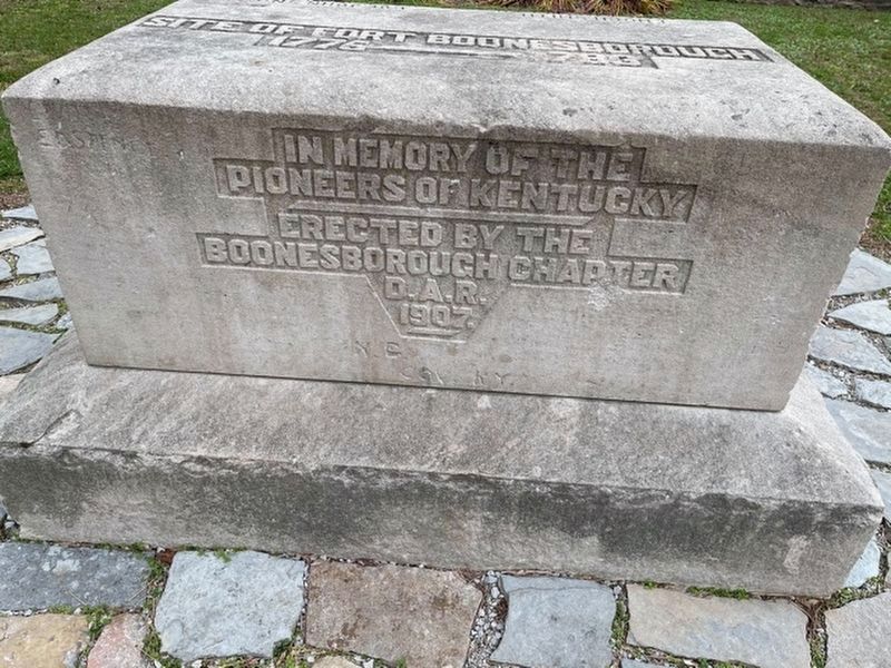
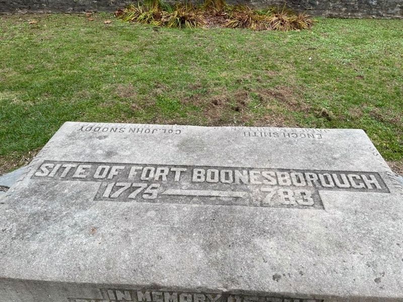
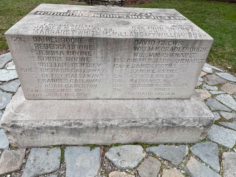
Site of Fort Boonesborough 1775-1783
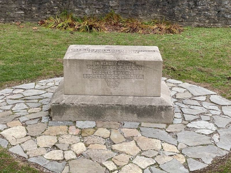
In memory of the Pioneers of Kentucky
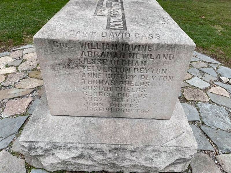
Capt David Cass, Col. William Irvine, Abraham Newland, Jesse Oldham, Yelverton Peyton, Anne Guffey Peyton, Thomas Phelps, Josiah Phelps, George Phelps, Lucy Phelps, John Phelps, Joseph Proctor
Enoch Smith, James McMillian SR, Maragret White McMillian, Col. Daniel Boone, Rebecca Boone, Jemima Boone, Squire Boone, William Bentley, Col. Richard Callaway, Betsy Callaway, Frances Callaway, Adam Caperton, Gen. Green Clay, Capt. John Holder, Col. John Snoopy, Capt. John Kennedy, Capt. William Bush, David Crews, William Crandlebough, William Chenault, Elizabeth Mullins Chenault, Capt. James Estill, Samuel Estill, Col. Ezekiel Field, Col. Nathaniel Hart, Col. Richard Henderson, Dr. Hines, Richard Hogan
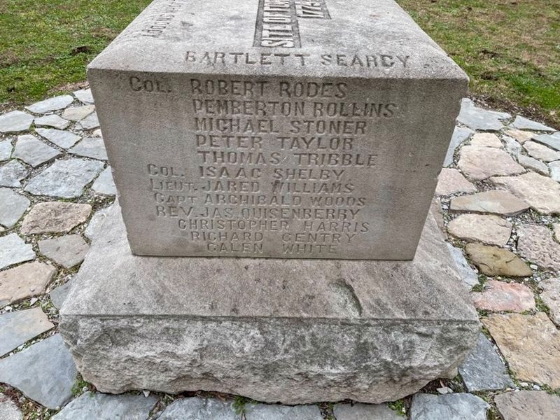
Barlett Searcy, Robert Rodes, Pemberton Rollins, Michael Stoner, Peter Taylor, Thomas Tribble, Col. Isaac Shelby, Loet. Jared Williams, Capt. Archibald Woods, Rev. Jas. Quisenberry, Christopher Harris, Richard Gentry, Galen White
Erected 1907 by The Boonesborough Chapter, Daughters of the American Revolution.
Topics and series. This historical marker is listed in these
this page online
Location. 37° 53.99′ N, 84° 15.942′ W. Marker is near Richmond, Kentucky, in Madison County. It can be reached from Ford Hampton Road. The marker is located in the old fort at Fort Boonesborough State Park. Touch for map. Marker is at or near this postal address: 835 Ford Hampton Rd, Richmond KY 40475, United States of America. Touch for directions.

Regionally, this marker is in the American South, specifically in the Upper South, in Appalachia, and specifically in Southern Appalachia. Globally, it is in North America, the Western Hemisphere, the Western World, and the Anglosphere. Historically, it finds itself in what was once the territory of the Mississippian Culture and also the Antebellum South.
Other nearby markers. At least 8 other markers are within walking distance of this marker: Daniel Boone's Trail (a few steps from this marker); Fort Boonsborough Site (a few steps from this marker); "Sycamore Hollow"
Credits. This page was last revised on January 23, 2021. It was originally submitted on December 23, 2020, by Frank Profitt of Georgetown, Kentucky. This page has been viewed 1,399 times since then and 84 times this year. Last updated on January 23, 2021, by Frank Profitt of Georgetown, Kentucky. Photos: 1, 2, 3, 4, 5, 6. submitted on December 23, 2020, by Frank Profitt of Georgetown, Kentucky. • J. Makali Bruton was the editor who published this page.
