Woodsboro in Refugio County, Texas — The American South (West South Central)
Woodsboro Square
Photographed by James Hulse, January 20, 2021
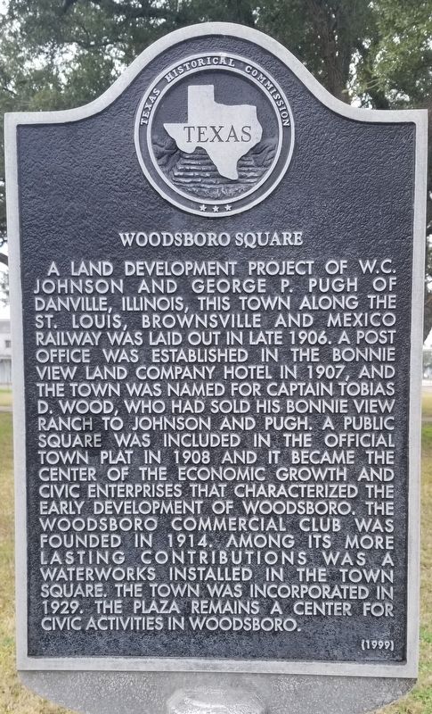
1. Woodsboro Square Marker
A land development project of W.C. Johnson and George P. Pugh of Danville, Illinois, this town along the St. Louis, Brownsville and Mexico Railway was laid out in late 1906. A post office was established in the Bonnie View Land Company Hotel in 1907, and the town was named for Captain Tobias D. Wood, who had sole his Bonnie View Ranch to Johnson and Pugh. A public square was included in the official town plat in 1908 and it became the center of the economic growth and civic enterprises that characterized the early development of Woodsboro. The Woodsboro Commercial Club was founded in 1914. Among its more lasting contributions was a waterworks installed in the town square. The town was incorporated in 1929. The plaza remains a center for civic activities in Woodsboro.
Erected 1999 by Texas Historical Commission. (Marker Number 12169.)
Topics. This historical marker is listed in these topic lists: Industry & Commerce • Parks & Recreational Areas • Railroads & Streetcars. A significant historical year for this entry is 1906.
Location. 28° 14.378′ N, 97° 19.72′ W. Marker is in Woodsboro, Texas, in Refugio County. It is at the intersection of Wood Avenue and 2nd Street, on the left when traveling east on Wood Avenue. The marker is located in the southeast corner of Woodsboro Square. Touch for map. Marker is in this post office area: Woodsboro TX 78393, United States of America. Touch for directions.

Regionally, this marker is in the American South and on the Gulf Coast. Globally, it is in North America, a Gulf of Mexico state, the Western Hemisphere, the Western World, and the Anglosphere. Historically, it finds itself in what was once New Spain, the Republic of Texas, and one of the Confederate States of America.
Other nearby markers. At least 8 other markers are within 5 miles of this
this page online
Also see . . . Woodsboro, Texas. The town was originally called Church because it was located just north of the Church siding on the St. Louis, Brownsville and Mexico Railway, which built through the area in 1906. The townsite was laid out in November and December 1906, and by February 1907 Johnson and Pugh had completed the town's first structure, a wooden hotel built to house prospective land buyers. ("This is the Real Garden of the Lord," a large sign painted on the side of the hotel advised visitors.) A post office was established in the hotel later that year, and the town's name was changed to Woodsboro after Captain Tobias D. Wood, who had sold the Bonnie View Ranch to the
Photographed by James Hulse, January 20, 2021
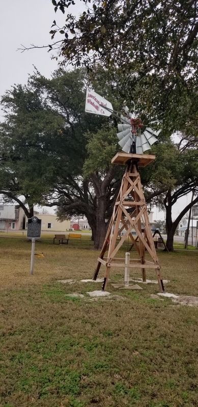
2. Windmill next to the Woodsboro Square Marker

Photographed by James Hulse, January 20, 2021
3. Woodsboro Square Gazebo and Marker
Credits. This page was last revised on January 25, 2021. It was originally submitted on January 25, 2021, by James Hulse of Medina, Texas. This page has been viewed 1,965 times since then and 312 times this year. Photos: 1, 2, 3. submitted on January 25, 2021, by James Hulse of Medina, Texas. • J. Makali Bruton was the editor who published this page.
