Twentynine Palms in San Bernardino County, California — The American West (Pacific Coastal)
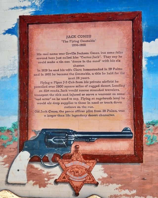
Jack Cones
"The Flying Constable"
— 1896-1960 —
In 1929 he and his wife Clara homesteaded in 29 Palms and in 1932 he became the Constable, a title he held for the next 28 years.
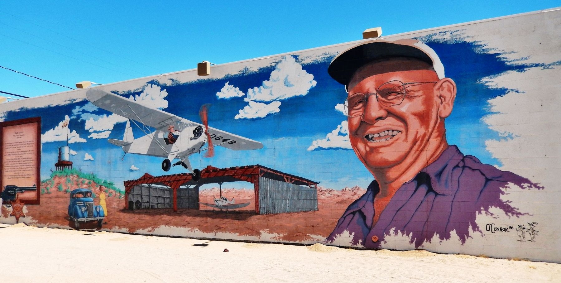
Flying a Piper J-3 Cub from his private airfield he patrolled over 2800 square miles of rugged desert. Landing on dirt roads, Jack would rescue stranded travelers, transport the sick and injured or serve a warrant on some "bad actor" as he used to say. Flying at sagebrush level he would air drop supplies to those in need or track down outlaws on the run.
Old Jack Cones, the peace officer pilot from 29 Palms, was a larger than life legendary desert character.
Erected 1996 by Action 29 Palms. (Marker Number 6.)
Topics. This historical marker is listed in these topic lists: Law Enforcement • Settlements & Settlers. A significant historical year for this entry is 1896.
Location. 34° 8.343′ N, 116° 3.286′ W. Marker is in Twentynine Palms, California, in San Bernardino County. Marker is on Adobe Road just south of Gorgonio Drive, on the left when traveling north. Marker and mural cover the south side of the church as this address. Touch for map. Marker is at or near this postal address: 6308 Adobe Road, Twentynine Palms CA 92277, United States of America. Touch for directions.
Other nearby markers. At least 8 other markers are within 2 miles of this marker, measured as the crow flies. Cattle Days in Hidden Valley (a few steps from this marker); Good Times at Smith's Ranch (within shouting distance of this marker); Keys' Desert Queen Ranch (within shouting distance of this marker); The Desert Trail (about 500 feet away, measured in a direct line); Flash Flood (about 500 feet away); Oasis of Mara (approx. 0.3 miles away); Minerva Hamilton Hoyt (approx. 1.2 miles away); Champion of the Desert (approx. 1.2 miles away). Touch for a list and map of all markers in Twentynine Palms.
More about this marker. Mural artist: Tim O'Connor of Twentynine Palms, CA
Related markers. Click here for a list of markers that are related to this marker. Oasis of Murals • 29 Palms
Also see . . . Jack Cones Adobe and Landing Field. Jack was the law here until his death in 1960. In July of 1946, Jack and a friend purchased a Piper Cub J-3 airplane. Jack learned to fly in San Bernardino. Thereafter, almost daily, Jack patrolled the desert by airplane, searching for lost people or wanted criminals. Sadly, Jack Cones was killed in a plane crash in Yucca Valley in 1960. (Submitted on January 28, 2021, by Cosmos Mariner of Cape Canaveral, Florida.)
Credits. This page was last revised on January 29, 2021. It was originally submitted on January 28, 2021, by Cosmos Mariner of Cape Canaveral, Florida. This page has been viewed 324 times since then and 38 times this year. Photos: 1, 2. submitted on January 28, 2021, by Cosmos Mariner of Cape Canaveral, Florida.

