
Piqua in Miami County, Ohio — The American Midwest (Great Lakes)
The 1913 Flood
Sign of the Past
Photographed by William Fischer, Jr., March 6, 2009
1. The 1913 Flood Marker
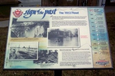
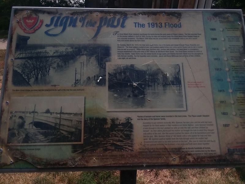
The Great Miami River regularly overflowed its banks during the early years of Piqua's history. The first recorded flood hit the pioneer settlers in April of 1805. During the next one hundred years the Great Miami River flooded Piqua on nine separate occasions. The March 1898 flood was the worst flood in the nineteenth century and hit a record forty-one inches above the flood level.
On Tuesday, March 25, 1913, the river once again broke free of its banks and swept through Piqua, Rossville and Shawnee. The flood waters crested at over one hundred eighty inches and unlike earlier floods took its toll in human lives as well as property. Within three days, fourteen men, women and children had been taken to a temporary morgue established in the print shop of W. F. Steiner at 424 North Main Street. The Great Flood resulted in a total of forty-four deaths. Isaac Kerns was the oldest fatality at age eighty and Charles Kenneth Croner was the youngest at only thirteen months. Family tragedies were common. Jacob and Grace Millhouse lost all three of their children, ages eight, six and three.
Stories of heroism and horror were recorded
this page online
According to eye-witness accounts, Mrs. Spencer, her son Leon, and his wife had been trapped by the flood waters in their residence on Home Avenue. Leon Spencer knocked a hole through to the roof, pushed his wife up onto the roof, and then climbed up himself. He then attempted to pull his mother up through the hole to what they thought was safety of the roof. But the current pushed the house off of its foundations and Leon lost his grip. Mrs. Spencer threw up her hands with a wild appeal for help and then sank. Mr. Spencer walked rapidly from the hole through which his mother had disappeared and went to his wife huddled on the roof. She rose to meet him and laying off her raincoat enfolded her husband in her arms and both went down together.
The flood resulted in the destruction or serious damages to literally hundreds of homes, businesses and industries. Flood protection levees and dams were constructed by the Miami Conservancy District beginning in 1917. The Piqua levees were completed in 1922 using dirt dredged from the Great Miami River channel.
Erected 2008
Photographed by Craig Doda, September 14, 2019
2. The 1913 Flood Marker
The marker has weathered but remains generally legible.
Topics. This historical marker is listed in these topic lists: Disasters • Waterways & Vessels. A significant historical month for this entry is March 1898.
Location. Marker has been permanently removed. It was located near 40° 8.81′ N, 84° 14.308′ W. Marker was in Piqua, Ohio, in Miami County. It could be reached from Water Street (U.S. 36), on the right when traveling east. Marker is in Lock Nine Riverfront Park, near the remains of Lock Nine, north of the former railroad trestle (now a pedestrian walkway) over the Great Miami River, and about 150 feet east of Main Street. Touch for map. Marker was in this post office area: Piqua OH 45356, United States of America.
We have been informed that this marker is no longer there and will not be replaced. This page is an archival view of what was.
Regionally, this marker was in Ohio’s Dayton Metro, in the Miami Valley, and in the Till Plains. It was also in the American Midwest and in the Corn Belt. Globally, it was in North America, the Western Hemisphere, the Western World, and the Anglosphere. Historically,

Photographed by William Fischer, Jr., March 6, 2009
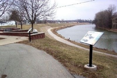
3. The 1913 Flood Marker in Lock Nine Riverfront Park
Looking east.
Other nearby markers. At least 8 other markers are within walking distance of this location: Shawnee Bridge (within shouting distance of this marker); Lock Nine Riverfront Park (within shouting distance of this marker); Main Street (within shouting distance of this marker); Public Square (about 400 feet away, measured in a direct line); a different marker also named Shawnee Bridge (about 500 feet away); a different marker also named Shawnee Bridge (about 500 feet away); Vice Admiral Stephen Clegg Rowan (about 700 feet away); The Village of Huntersville (about 700 feet away). Touch for a list and map of all markers in Piqua.
Another marker is no longer nearby. Lock Nine (was within shouting distance of this marker but has been confirmed missing).
More about this marker. Photos of the flooding appear on the left side of the marker. On the right is a time line showing some of the other major flood events.
Related markers. Click here for a list of markers that are related
Photographed by Dale K. Benington, July 11, 2010
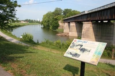
4. The 1913 Flood Marker
Another view of the historical marker looking east along the Great Miami River, with a view of a local bridge spanning the river.
Additional keywords. Miami and Erie Canal.
Credits. This page was last revised on June 27, 2025. It was originally submitted on March 23, 2009, by William Fischer, Jr. of Reynoldsburg, Ohio. This page has been viewed 3,396 times since then and 95 times this year. Last updated on June 17, 2025, by Craig Doda of Napoleon, Ohio. Photos: 1. submitted on March 23, 2009, by William Fischer, Jr. of Reynoldsburg, Ohio. 2. submitted on May 22, 2024, by Craig Doda of Napoleon, Ohio. 3. submitted on March 23, 2009, by William Fischer, Jr. of Reynoldsburg, Ohio. 4. submitted on January 23, 2011, by Dale K. Benington of Toledo, Ohio. • Devry Becker Jones was the editor who published this page.
