Near McDowell in Highland County, Virginia — The American South (Mid-Atlantic)
Battle Of McDowell
The Heart of the Battlefield
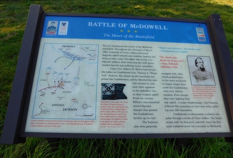
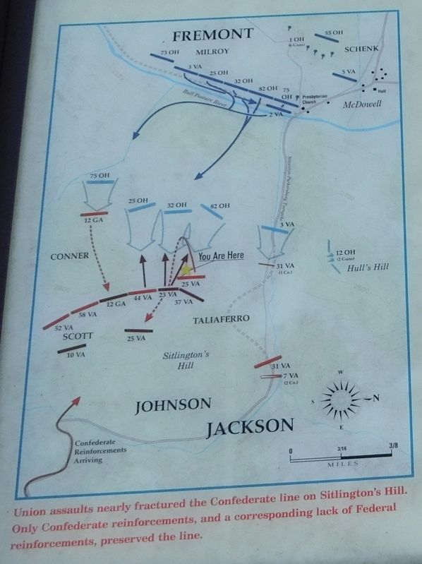
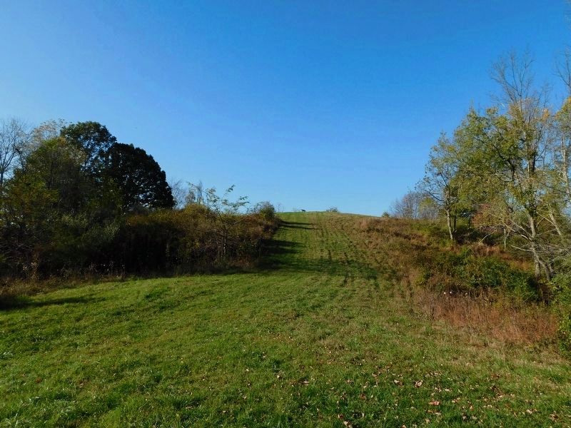
Union Gen. Robert H. Milroy had turned the tables on Gen. Thomas J. "Stonewall" Jackson. His attack up the mountain surprised the Confederates, and he directed his men into ravines to minimize their exposure to the defenders' fire as they trudged uphill. From the ravines, Milroy's men launched several bayonet charges that pushed the Confederates farther up the hill.
The Federals also were generally equipped with rifles, which enabled them to fire more accurately at longer ranges than could the Confederates with their inferior muskets. Even though they were fighting their way uphill—a major disadvantage—the Federals inflicted 532 casualties on their foes while suffering only 259 themselves.
Confederate reinforcements rushed to this point through a storm of Union bullets. The Southerners held the line until nightfall, when the Federals withdrew down the mountain to McDowell.
"There's old Johnson—let's flank him!"
—Unnamed Union soldier
"Yes, damn you, flank me if you can!"
—Gen. Edward Johnson, CSA
(captions)
Union assaults nearly fractured the Confederate line on Sitlington's Hill. Only Confederate reinforcements, and a corresponding lack of Federal reinforcements, preserved the line.
Downhill to your right, the Union 3rd [West] Virginia Infantry clashed with the Confederate 31st Virginia Infantry (whose flag is shown here). Many of the men on one side had known men on the other before the war. When the firing began, the soldiers "called (each other) by name, and proceeded with the slaughter." Courtesy West Virginia University
Confederate Gen. Edward "Allegheny" Johnson held this sector of the field. Leading from the front, he was wounded and almost captured in a Federal charge. Courtesy Library of Congress
Erected by Virginia Civil War Trails.
Topics and series. This historical marker is listed in this topic list: War, US Civil. In addition, it is included in the Virginia Civil War Trails series list. A significant historical date for this entry is May 8, 1862.
Location. Marker has been reported permanently removed. It was located near 38° 19.452′ N, 79° 28.507′ W. Marker was near McDowell, Virginia, in Highland County. Marker could be reached from Highland Turnpike (U.S. 250) 1½ miles east of Virginia Route 656, on the right when traveling east. The marker can be reached from U.S. 250 by way of the Civil War Trust one mile hiking trail that leads to the top of Sitlington's Hill. Touch for map. Marker was in this post office area: Mc Dowell VA 24458, United States of America.
We have been informed that this sign or monument is no longer there and will not be replaced. This page is an archival view of what was.
Other nearby markers. At least 8 other markers are within walking distance of this location. The 12th Georgia (here, next to this marker); The Battle Rages (about 400 feet away, measured in a direct line); The Confederate Right (about 700 feet away); A Spectacular Show (approx. 0.2 miles away); Sitlington's Hill (approx. 0.2 miles away); The Ravines (approx. 0.2 miles away); An Attack Repulsed (approx. 0.3 miles away); A Reconnaissance In Force (approx. 0.4 miles away). Touch for a list and map of all markers in McDowell.
Credits. This page was last revised on January 12, 2024. It was originally submitted on January 28, 2021, by Bradley Owen of Morgantown, West Virginia. This page has been viewed 273 times since then and 28 times this year. Photos: 1, 2. submitted on January 28, 2021, by Bradley Owen of Morgantown, West Virginia. 3. submitted on January 30, 2021, by Bradley Owen of Morgantown, West Virginia. • Bernard Fisher was the editor who published this page.
Editor’s want-list for this marker. Wide shot of marker and its surroundings. • Can you help?


