Plantsville in Southington in Capitol Region, Connecticut — The American Northeast (New England)
Washington – Rochambeau Revolutionary Route
Photographed by Michael Herrick, July 28, 2010
1. Washington – Rochambeau Revolutionary Route Marker
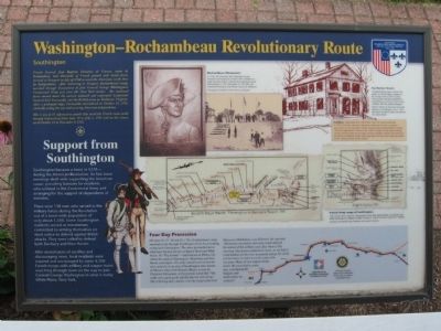
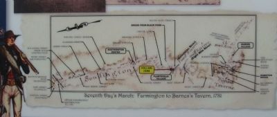
French General Jean Baptiste Donatien de Vimeur, comte de Rochambeau, and thousands of French ground and naval forces arrived in Newport in July of 1780 to assist the Americans in the War for Independence. After wintering in Newport, Rochambeau's troops marched through Connecticut to join General George Washington's Continental Army just over the New York border. The combined forces moved down the eastern seaboard and confronted Lieutenant General Earl Cornwallis and the British army in Yorktown, Virginia. After a prolonged seige, Cornwallis surrendered on October 19, 1781, virtually ending the war and ensuring American independence.
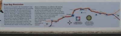
This is one of 12 informative panels that mark the French route south through Connecticut from June 19 to July 2, 1781 and on the return north October 23 to November 9, 1782.
Support from Southington
Southington became a town in 1779 – during the American Revolution. Its first town meetings dealt with supporting the American cause: providing bonuses for residents who enlisted in the Continental Army and arranging for the support of dependents of enlistees.
There
this page online
After several years of sacrifice and discouraging news, local residents were inspired and encouraged by some 4,700 French troops with artillery and wagon trains marching through town on the way to join General George Washington in what is today White Plains, New York.
Erected 2006 by Southington Rotary Club, Connecticut Commission On Culture & Tourism.
Topics and series. This historical marker is listed in this topic list: War, US Revolutionary. In addition, it is included in the Former U.S. Presidents: #01 George Washington, the Rotary International, and the The Washington-Rochambeau Route series lists. A significant historical month for this entry is June 1848.
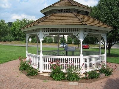
Location. 41° 35.268′ N, 72° 53.344′ W. Marker is in Southington in Capitol Region, Connecticut. It is in Plantsville. It is at the intersection of Main Street (Connecticut Route
Photographed by Michael Herrick, July 28, 2010
2. Washington – Rochambeau Revolutionary Route Marker

Regionally, this marker is in the Connecticut River Valley, in Greater Hartford, and in the Knowledge Corridor. It is also in the American Northeast and in New England. Globally, it is in North America, the Western Hemisphere, the Western World, and the Anglosphere. Historically, it finds itself in what was once Hartford County and also one of the original Thirteen Colonies.
Other nearby markers. At least 8 other markers are within 2 miles of this marker, measured as the crow flies: Gang Scarpa Shoda (approx. one mile away); Southington World War II (approx. 1.1 miles away); Southington Soldiers Memorial (approx. 1.1 miles away); Southington (approx. 1.1 miles away); Southington Veterans Memorial (approx. 1.1 miles away); Constitution Oak (approx. 1.1 miles away); Forever Honored Forever Mourned (approx. 1.2 miles away); Reverend Zygmunt Woroniecki (approx. 1.2 miles away). Touch for a list and map
Photographed by Michael Herrick, July 28, 2010
3. Detail from the Marker
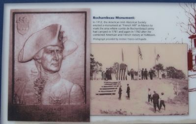
Photograph provided by Andrea Triano-LaChapelle
(See the related marker for details of the monument. It is now surrounded by houses)
Related marker. Click here for another marker that is related to this marker.
Photographed by Michael Herrick, July 28, 2010
4. Detail from the Marker
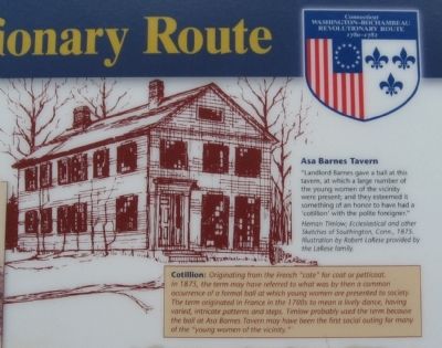
Herman Timlow; Ecclesiastical and other Sketches of Southington, Conn., 1875. Illustration by Robert LaRese provided by the LaRese family.
Cotillion: Originating from the French "cote" for coat or petticoat. In 1875, the term may have referred to what was by then a common ocurrence of a formal ball at which young women are presented to society. The term originated in France in the 1700s to mean a lively dance, having varied, intricate patterns and steps. Timlow probably used the term because the ball at Asa Barnes Tavern may have been the first social outing for many of the " young women of the vicinity."
Photographed by Michael Herrick, July 28, 2010
5. Detail from the Marker
Photographed by Michael Herrick, July 28, 2010
6. Detail from the Marker
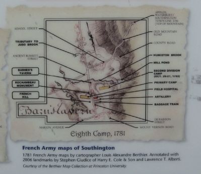
Courtesy of the Berthier Map Collection at Princeton University.
Photographed by Michael Herrick, July 28, 2010
7. Detail from the Marker
Credits. This page was last revised on May 19, 2026. It was originally submitted on July 30, 2010, by Michael Herrick of Southbury, Connecticut. This page has been viewed 1,947 times since then and 71 times this year. Last updated on January 29, 2021, by Carl Gordon Moore Jr. of North East, Maryland. Photos: 1, 2, 3, 4, 5, 6, 7. submitted on July 30, 2010, by Michael Herrick of Southbury, Connecticut. • J. Makali Bruton was the editor who published this page.
