Near Zanesville in Muskingum County, Ohio — The American Midwest (Great Lakes)
Eisenhower Interstate System
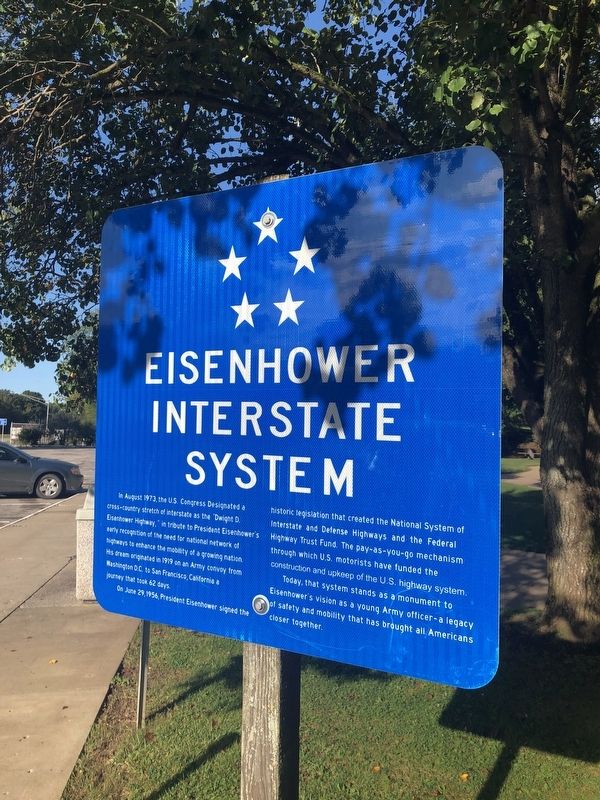
In August 1973, the U.S. Congress Designated a cross-country stretch of interstate as the "Dwight D. Eisenhower Highway," in tribute to President Eisenhower's early recognition of the need for national network of highways to enhance the mobility of a growing nation. His dream originated in 1919 on an Army convoy from Washington, D.C. to San Francisco, California a journey that took 62 days.
On June 29, 1956, President Eisenhower signed the historic legislation that created the National System of Interstate and Defense Highways and the Federal Highway Trust Fund. The pay-as-you-go mechanism through which U.S. motorists have funded the construction and upkeep of the U.S. highway system.
Today, that system stands as a monument to Eisenhower's vision as a young Army officer — a legacy of safety and mobility that has brought all Americans closer together.
Topics and series. This historical marker is listed in these topic lists: Government & Politics • Military • Roads & Vehicles. In addition, it is included in the Former U.S. Presidents: #34 Dwight D. Eisenhower series list. A significant historical date for this entry is June 29, 1956.
Location. 39° 58.415′ N,
this page online

Regionally, this marker is in the American Midwest, in Appalachia, and specifically in Northern Appalachia. Globally, it is in North America, the Western Hemisphere, the Western World, and the Anglosphere. Historically, it finds itself in what was once the Haudenosaunee (Iroquois) Confederacy, the territory of the Mississippian Culture, and the Northwest Territory.
Other nearby markers. At least 8 other markers are within 2 miles of this marker, measured as the crow flies: Tomb Of The Unknown Soldier (approx. 1.9 miles away); Zane’s Trace Bridge (approx. 1.9 miles away); Warren Pony Truss Bridge (approx. 1.9 miles away); Motels (approx. 1.9 miles away); Mile Markers (approx. 2 miles away); The Historic National Road in Ohio
Credits. This page was last revised on February 7, 2021. It was originally submitted on September 16, 2019, by Devry Becker Jones of Washington, District of Columbia. This page has been viewed 771 times since then and 86 times this year. Last updated on February 7, 2021, by Bradley Owen of Morgantown, West Virginia. Photos: 1, 2. submitted on September 16, 2019, by Devry Becker Jones of Washington, District of Columbia.
