Baptistown in Hunterdon County, New Jersey — The American Northeast (Mid-Atlantic)
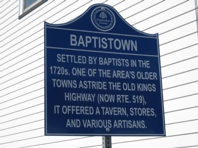
Baptistown
Erected by Hunterdon County Cultural And Heritage Commission.
Topics and series. This historical marker is listed in these topic lists: Colonial Era • Settlements & Settlers. In addition, it is included in the New Jersey, Hunterdon County Cultural and Heritage Commission series list.
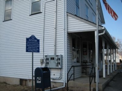
Location. 40° 31.316′ N, 75° 0.375′ W. Marker is in Baptistown, New Jersey, in Hunterdon County. Marker is on County Route 519, on the right when traveling south. Touch for map. Marker is in this post office area: Baptistown NJ 08803, United States of America. Touch for directions.
Other nearby markers. At least 8 other markers are within 3 miles of this marker, measured as the crow flies. Kingwood Township Veterans Monument (approx. 1.2 miles away); Oak Summit (approx. 1.4 miles away); Oak Summit Cemetery (approx. 1.4 miles away); Old Stone Church (approx. 1.4 miles away); Oak Summit School (approx. 1˝ miles away); Frenchtown (approx. 2˝ miles away); Barbertown (approx. 2.8 miles away); St. Thomas Episcopal of Alexandria (approx. 2.8 miles away). Touch for a list and map of all markers in Baptistown.
Credits. This page was last revised on June 16, 2016. It was originally submitted on March 4, 2009, by Alan Edelson of Union Twsp., New Jersey. This page has been viewed 1,206 times since then and 19 times this year. Photos: 1, 2. submitted on March 4, 2009, by Alan Edelson of Union Twsp., New Jersey. • Bill Pfingsten was the editor who published this page.

