Digging Up The Past
Fort Monroe
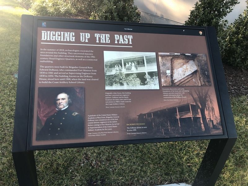
In the summer of 2018, archaeologists excavated the area around this building. They uncovered masonry foundations and other structural elements of the 19th-century Head Engineer Quarters as well as a connected outbuilding.
The quarters were built for Brigadier General Rene Edward DeRussy, who commanded Fort Monroe from 1838 to 1841 and served as Supervising Engineer from 1838 to 1854. The building, known as the DeRussy House, stood here until 1908, when the land was cleared to build the Coast Artillery School Library.
[Captions:]
Originally a lime house, this building was later converted into engineers' quarters. DeRussy and his family lived here for many years until it was torn down in 1908 to make room for the Coast Artillery Library.
Excavation discoveries, such as the foundations of the house and outbuilding chimney, provide researchers with valuable information about the construction of the DeRussy House.
A graduate of the United States Military Academy at West Point, Brigadier General DeRussy was considered one of the best coastal defense engineers in the nation. Before coming to Fort Monroe, he served as Superintendent of the United States Military Academy for five years.
Erected by Fort Monroe Authority; National Park Service,
Topics. This historical marker is listed in these topic lists: Anthropology & Archaeology • Forts and Castles. A significant historical year for this entry is 2018.
Location. 37° 0.116′ N, 76° 18.637′ W. Marker is in Hampton, Virginia. It is in Fort Monroe. Marker is on Ingalls Road just north of Fenwick Road, on the right when traveling north. Touch for map. Marker is at or near this postal address: 30 Ingalls Rd, Fort Monroe VA 23651, United States of America. Touch for directions.
Other nearby markers. At least 8 other markers are within walking distance of this marker. Who Built Fort Monroe? (within shouting distance of this marker); Hurricane Isabel (within shouting distance of this marker); Flood of August 23, 1933 (within shouting distance of this marker); How Big Is Fort Monroe? (within shouting distance of this marker); Fort Monroe's Arc Of Freedom (within shouting distance of this marker); Why A Moat? (within shouting distance of this marker); A Bay Worth Preserving (within shouting distance of this marker); Enormous Undertaking: The Fort's Construction (within shouting distance of this marker). Touch for a list and map of all markers in Hampton.
Credits. This page was last revised on February 1, 2023. It was originally submitted on February 9, 2021, by Devry Becker Jones of Washington, District of Columbia. This page has been viewed 132 times since then and 11 times this year. Photos: 1, 2. submitted on February 9, 2021, by Devry Becker Jones of Washington, District of Columbia.

