Southampton Township near Shippensburg in Cumberland County, Pennsylvania — The American Northeast (Mid-Atlantic)
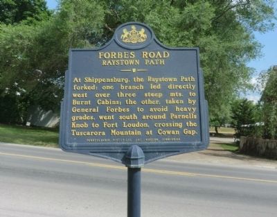
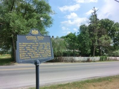
Forbes Road - Raystown Path
Erected 1952 by Pennsylvania Historical & Museum Commission.
Topics and series. This historical marker is listed in this topic list: War, French and Indian. In addition, it is included in the Pennsylvania Historical and Museum Commission series list.
Location. 40° 4.263′ N, 77° 29.408′ W. Marker is near Shippensburg, Pennsylvania, in Cumberland County. It is in Southampton Township. Marker is on Ritner Highway (US 11) just west of Newville Road. Touch for map. Marker is in this post office area: Shippensburg PA 17257, United States of America. Touch for directions.
Other nearby markers. At least 8 other markers are within 2 miles of this marker, measured as the crow flies. Shippensburg (approx. 1.2 miles away); Hagerstown Silt Loam (approx. 1.4 miles away); High-Speed Ammunition Run on the Cumberland Valley Railroad (approx. 1.4 miles away); Locust Grove Cemetery (approx. 1.7 miles away); The First Court House of Cumberland County (approx. 1.7 miles away); The Original Site of the German Reformed and Lutheran Congregations (approx. 1.7 miles away); Old Court House (approx. 1.7 miles away); Fort Morris (approx. 1.7 miles away). Touch for a list and map of all markers in Shippensburg.
Credits. This page was last revised on February 7, 2023. It was originally submitted on June 2, 2015, by Don Morfe of Baltimore, Maryland. This page has been viewed 443 times since then and 13 times this year. Last updated on February 12, 2021, by Carl Gordon Moore Jr. of North East, Maryland. Photos: 1, 2. submitted on June 2, 2015, by Don Morfe of Baltimore, Maryland. • J. Makali Bruton was the editor who published this page.

