Independence in Washington County, Texas — The American South (West South Central)
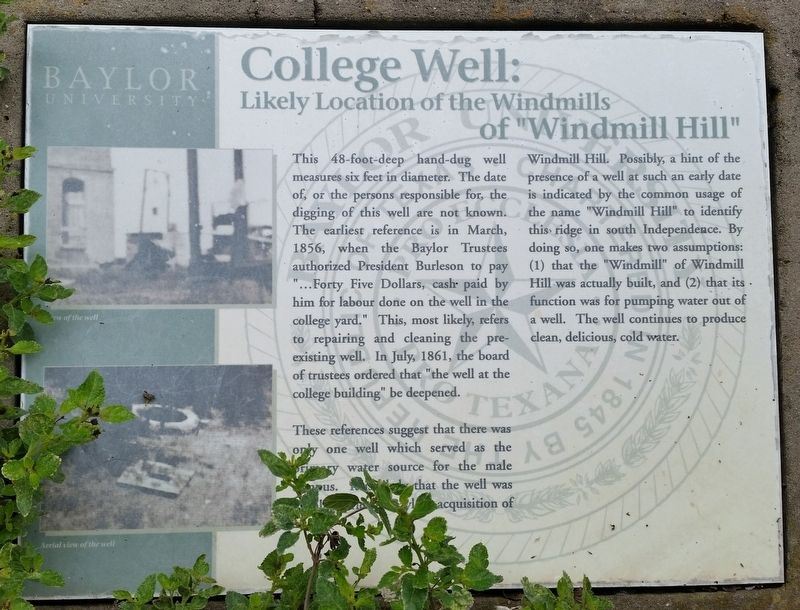
College Well: of Windmill Hill
Likely Location of the Windmills
— Baylor University —
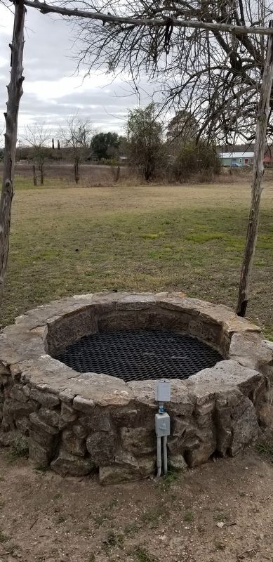
This 48-foot-deep hand-dug well measures six feet in diameter. The date of, or the persons responsible for the digging of this well are not known. The earliest reference is in March, 1856, when the Baylor Trustees authorized President Burleson to pay "...Forty Five Dollars, cash paid by him for labour done on the well in the college yard." This, most likely, refers to repairing and cleaning the pre-existing well. In July, 1861, the board of trustees ordered that "the well at the college building" be deepened.
These references suggest that there was only one well which served as the primary water source for the male campus. ...that the well was .... acquisition of Windmill Hill. Possibly, a hint of the presence of a well at such an early date is indicated by the common usage of the name "Windmill Hill to identify this ridge in south Independence. By doing so, one makes two assumptions: (1) that the "Windmill" of Windmill Hill was actually built, and (2) that its function was for pumping water out of a well. The well continues to produce clean, delicious, cold water.
(Captions)
View of the well
Arial view of the well
Erected by Baylor University.
Topics. This historical marker is listed in this topic list: Education. A significant historical month for this entry is March 1856.
Location. 30° 18.947′ N, 96° 20.751′ W. Marker is in Independence, Texas, in Washington County. Marker can be reached from the intersection of Farm to Market Road 50 and Hood Hotel Road. The marker is located at the south side of Baylor Park on Windmill Hill. Touch for map. Marker is in this post office area: Brenham TX 77833, United States of America. Touch for directions.
Other nearby markers. At least 8 other markers are within walking distance of this marker. Tryon Hall (a few steps from this marker); Baylor University for Boys (within shouting distance of this marker); Robert Emmett Bledsoe Baylor (within shouting distance of this marker); Grave Site of R.E.B. Baylor (within shouting distance of this marker); Bell Tower (within shouting distance of this marker); Houston Hall (within shouting distance of this marker); Baylor University (within shouting distance of this marker); Baylor University on Windmill Hill (within shouting distance of this marker). Touch for a list and map of all markers in Independence.
Also see . . . Baylor University.
Baylor University owes its founding to Robert E. B. Baylor, James Huckins, and William Milton Tryon, who in 1841 organized an education society in the Texas Union Baptist Association with the purpose of establishing a Baptist university in Texas. Baylor was chartered by the Republic of Texas on February 1, 1845, and was opened in 1846 at Independence. Professor Henry F. Gillette directed the school until the arrival of its first president, Henry Lee Graves, who received notice of his election on January 12, 1846, arrived in Independence in December 1846, and entered upon his duties on February 4, 1847. Source: The Handbook of Texas(Submitted on February 10, 2021, by James Hulse of Medina, Texas.)
Credits. This page was last revised on February 13, 2021. It was originally submitted on February 10, 2021, by James Hulse of Medina, Texas. This page has been viewed 252 times since then and 46 times this year. Last updated on February 13, 2021, by James Hulse of Medina, Texas. Photos: 1, 2, 3. submitted on February 10, 2021, by James Hulse of Medina, Texas. • J. Makali Bruton was the editor who published this page.


