Near McDowell in Highland County, Virginia — The American South (Mid-Atlantic)
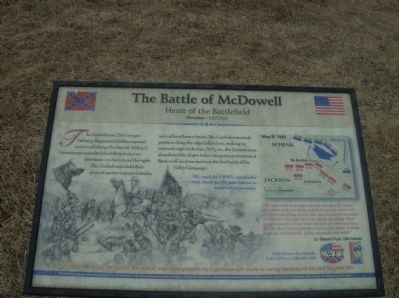
The Battle of McDowell
Heart of the Battlefield
— Elevation – 2,815 Feet —
This concludes CWPT’s interpretive trail, thank you for your interest in battlefield preservation.
“I felt quite small in that fight the other day when the musket and cannon balls were flying around me as thick as hail and my best friends falling on both sides, dead & mortally wounded. Oh Dear, it is impossible for me to express my feelings. When the fight was over & I saw what was done, the teras came then free. Oh, that I never could behold such a sight again. To think it among civilized people; killing one another like beasts.”
Lt. Shepard Pryor, 12th Georgia
Erected by Civil War Preservation Trust & Shenandoah Valley Battlefields Foundation.
Topics. This historical marker is listed in this topic list: War, US Civil.
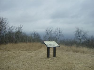
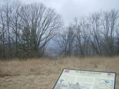
Location. Marker has been reported permanently removed. It was located near 38° 19.439′ N, 79° 28.501′ W. Marker was near McDowell, Virginia, in Highland County. Marker could be reached from U.S. 250, on the right when traveling east. Located in the Civil War Preservation's Trust McDowell Battlefield. Touch for map. Marker was in this post office area: Mc Dowell VA 24458, United States of America.
We have been informed that this sign or monument is no longer there and will not be replaced. This page is an archival view of what was.
Other nearby markers. At least 8 other markers are within walking distance of this location. The 12th Georgia (a few steps from this marker); The Battle Rages (about 300 feet away, measured in a direct line); The Confederate Right (about 600 feet away); A Spectacular Show (about 700 feet away); Sitlington's Hill (approx. 0.2 miles away); The Ravines (approx. 0.2 miles away); An Attack Repulsed (approx. ¼ mile away); A Reconnaissance In Force (approx. 0.3 miles away). Touch for a list and map of all markers in McDowell.
More about this marker. In the center of the marker is a sketch depicting a scene from the battle. To the right is a map of the battlefield showing unit positions as described in the text.
Related markers. Click here for a list of markers that are related to this marker. To better understand the relationship, study each marker in the order shown.
Also see . . . A View from the Top: Sitlington's Hill, McDowell Battlefield, Highland County, Virginia. (Submitted on March 4, 2009, by Robert H. Moore, II of Winchester, Virginia.)
Additional commentary.
1. 10th Virginia Infantry
None of the signs on this walking tour show the movements of the 10th Virginia Infantry. The 10th actually came up to this position (that of the 12th Georgia Infantry) and reinforced the line here. Col. Simeon B. Gibbons, commanding the 10th, was struck by two minie balls in the forehead when near this spot.
— Submitted March 4, 2009, by Robert H. Moore, II of Winchester, Virginia.
Credits. This page was last revised on October 18, 2023. It was originally submitted on March 4, 2009, by Robert H. Moore, II of Winchester, Virginia. This page has been viewed 1,829 times since then and 16 times this year. Photos: 1. submitted on March 4, 2009, by Robert H. Moore, II of Winchester, Virginia. 2. submitted on March 30, 2009. 3, 4. submitted on March 4, 2009, by Robert H. Moore, II of Winchester, Virginia. • Craig Swain was the editor who published this page.


