The Story of this Site
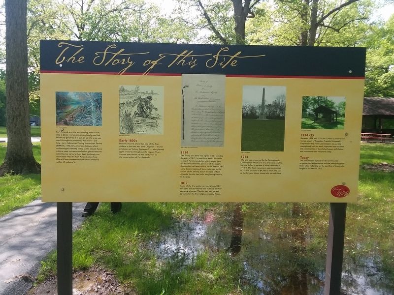
Fort Amanda and the surrounding area is built atop a glacial moraine (soil, sand and gravel left behind by glaciers). It is safe to say the area was used throughout prehistory for short- and long-term habitation. During the Archaic Period (8000 BC-500 AD), American Indians, which archaeologists identify today as the Glacial Kame culture, used moraines and other glacial features called kames to bury their dead. Although not associated with the Fort Amanda site, three Glacial Kame cemeteries have been identified within 15 miles of it.
Early 1800s
Historic records show that one of the first
civilians in the area was John Chapman-known
in folklore as "Johnny Appleseed"-who planted apple orchards throughout the region. There
is some speculation he was here prior to
the construction of Fort Amanda.
1814
The Treaty of Ghent was signed in 1814, ending
the War of 1812 It took four weeks for news
to reach Fort Amanda, but within seven days,
the fort was deserted. Soon, all of the supply
depots that had been critical to the War of 1812
were decommissioned. Some returned to the
nature of the swamp, but in the case of Fort
Amanda, the site has had a long lasting history
in the area.
1817
Some of the first settlers arrived around 1817
and used the abandoned fort buildings
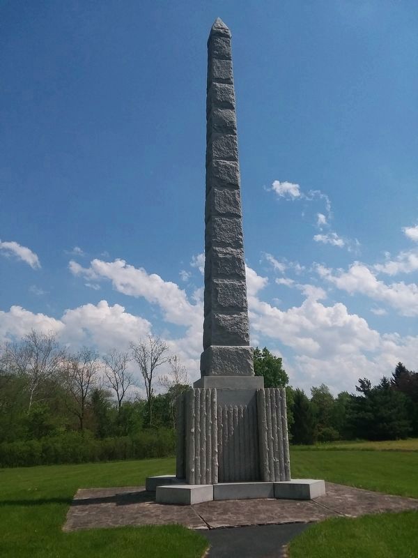
1913
The site was preserved by the Fort Amanda
Commission, which sold it to the Sate of Ohio
for one dollar It became a State Memorial in
1913. A fifty-foot monument was constructed
in 1915 at the cost of $4.500 to mark the site
of the fort and honor those who served there.
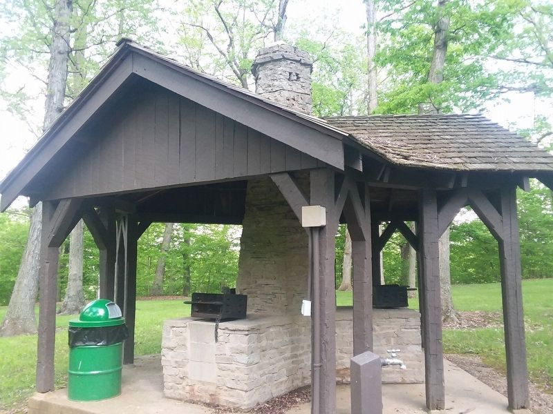
1934-35
Between 1934 and 1935, the Civilian Conservation
Corps, a part of President Franklin Roosevelt's
Depression-era New Deal initiative to put the
unemployed back to work, improved the site with
the construction of the shelterhouse, grill shelter
and restrooms that still stand today.
Today
The site remains a place for the community
to gather and enjoy nature and the nearby Auglaize
River while reflecting on the sacrifice of those who
fought in the War of 1812.
Erected by Ohio History Connection.
Topics and series. This historical marker is listed in these topic lists: Forts and Castles • Parks & Recreational Areas • War of 1812. In addition, it is included in the Civilian Conservation Corps (CCC), and the Former U.S. Presidents: #32 Franklin D. Roosevelt series lists. A significant historical year for this entry is 1814.
Location. 40° 40.964′ N, 84°
Other nearby markers. At least 8 other markers are within walking distance of this marker. Story of Fort Amanda (here, next to this marker); The Cemetery (within shouting distance of this marker); The 77 Unknown Soldiers (within shouting distance of this marker); Troops Stationed at Fort Amanda (about 400 feet away, measured in a direct line); a different marker also named Troops Stationed at Fort Amanda (about 400 feet away); a different marker also named Troops Stationed at Fort Amanda (about 400 feet away); Strategic Location (about 400 feet away); The Fort: Construction (about 700 feet away). Touch for a list and map of all markers in Kossuth.
Credits. This page was last revised on February 18, 2021. It was originally submitted on February 16, 2021, by Craig Doda of Napoleon, Ohio. This page has been viewed 228 times since then and 34 times this year. Photos: 1. submitted on February 16, 2021, by Craig Doda of Napoleon, Ohio. 2, 3. submitted on February 17, 2021, by Craig Doda of Napoleon, Ohio. • Devry Becker Jones was the editor who published this page.


