Capon Bridge in Hampshire County, West Virginia — The American South (Appalachia)
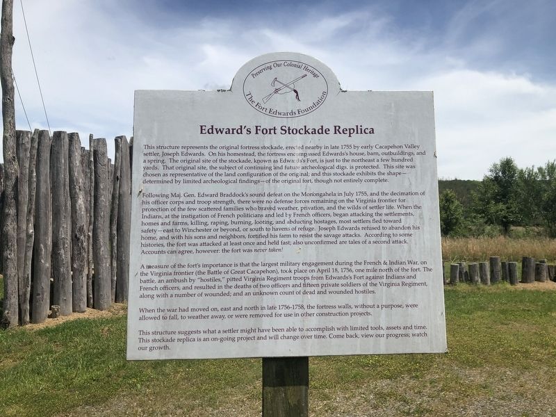
Edward's Fort Stockade Replica
Preserving Our Colonial Heritage
— The Fort Edwards Foundation —
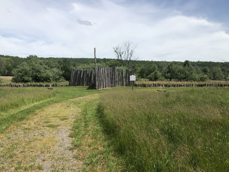
This structure replicates the original fortress stockade, erected nearby in late 1755 by early Cacapehon Valley settler, Joseph Edwards. On his homestead, the fortress encompassed Edwards's house, barn, outbuildings, and a spring. The original site of the stockade, known as Edwards's Fort, is just to the northeast a few hundred yards. The original site, the subject of continuing and future archaeological digs, is protected. This site was chosen as representative of the land configuration of the original; and this stockade exhibits the shape — determined by limited archeological findings — of the original fort, though not entirely complete.
Following Maj. Gen. Edward Braddock's sound defeat on the Monongahela in July 1755, and the decimation of his officer corps and troop strength, there were no defense forces remaining on the Virginia frontier for protection of the few scattered families who braved weather, privation, and the wilds of settler life. When the Indians, at the instigation of French politicians and led by French officers, began attacking the settlements, homes and farms, killing, raping, burning, looting, and abducting hostages, most settlers fled toward safety — east to Winchester or beyond, or south to havens of refuge. Joseph Edwards refused to abandon his home, and with his sons and neighbors, fortified his farm to resist the savage attacks. According to some histories, the fort was attacked at least once and held fast; also unconfirmed are tales of a second attack. Accounts can agree, however: the fort was never taken!
A measure of the fort's importance is that the largest military engagement during the French & Indian War, on the Virginia frontier (the Battle of Great Cacapehon), took place on April 18, 1756, one mile north of the fort. The battle, an ambush by "hostiles," pitted Virginia Regiment troops from Edwards's Fort against Indians and French officers, and resulted in the deaths of two officers and fifteen private soldiers of the Virginia Regiment, along with a number of wounded; an unknown count of dead and wounded hostiles.
When the war had moved on, east and north in late 1756-1758, the fortress walls, without a purpose, were allowed to fall, to weather away, or were removed for use in other construction projects.
This structure suggests what a settler might have been able to accomplish with limited tools, assets and time. This stockade replica is an on-going project and will change over time. Come back; view our progress; watch our growth.
Erected by The Fort Edwards Foundation.
Topics. This historical marker is listed in these topic lists: Colonial Era
Location. 39° 18.153′ N, 78° 25.976′ W. Marker is in Capon Bridge, West Virginia, in Hampshire County. Marker can be reached from Cold Stream Road (County Road 15) just north of Henderson Lane, on the right when traveling north. Touch for map. Marker is at or near this postal address: 350 Cold Stream Rd, Capon Bridge WV 26711, United States of America. Touch for directions.
Other nearby markers. At least 8 other markers are within walking distance of this marker. The Ken Edmonds Memorial Heritage Trail (about 300 feet away, measured in a direct line); Soldiers and Settlers (about 300 feet away); Forts in Col. George Washington's Chain of Forts Guarding the Eighteenth Century Virginia Froniter (about 400 feet away); The Fort Comes and Goes (about 400 feet away); Some French and Indian War Incidents in Hampshire County (about 400 feet away); Gen. Braddock is Defeated (about 400 feet away); In Memory (approx. 0.2 miles away); My Dream (approx. 0.2 miles away). Touch for a list and map of all markers in Capon Bridge.
Credits. This page was last revised on February 17, 2021. It was originally submitted on May 29, 2020, by Devry Becker Jones of Washington, District of Columbia. This page has been viewed 279 times since then and 28 times this year. Last updated on February 16, 2021, by Carl Gordon Moore Jr. of North East, Maryland. Photos: 1, 2. submitted on May 29, 2020, by Devry Becker Jones of Washington, District of Columbia.

