Near Fairfax in Fairfax County, Virginia — The American South (Mid-Atlantic)
Aftermath: The Invasion of Maryland
★ The Battle of Ox Hill ★
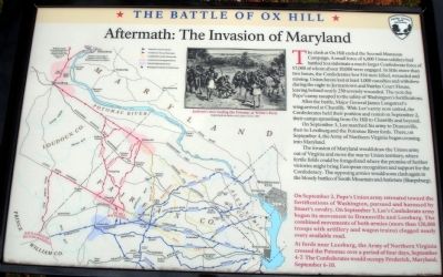
The clash at Ox Hill ended the Second Manassas Campaign. A small force of 6,000 Union soldiers had battled to a stalemate a much larger Confederate force of 17,000 of whom about 10,000 were engaged. In little more than two hours, the Confederates lost 516 men killed, wounded and missing. Union forces lost at least 1,000 casualties and withdrew during the night to Jermantown and Fairfax Court House, leaving behind nearly 250 severely wounded. The next day Pope’s army escaped to the safety of Washington’s fortifications.
After the battle, Major General James Longstreet’s wing arrived at Chantilly. With Lee’s army now united, the Confederates held their position and rested on September 2, their camps sprawling from Ox Hill to Chantilly and beyond.
On September 3, Lee marched his army to Dranesville, then to Leesburg and the Potomac River fords. There, on September 4, the Army of Northern Virginia began crossing into Maryland.
The invasion of Maryland would draw the Union army out of Virginia and move the war to Union territory, where fertile fields could be foraged and where promise of further victories might bring European recognition and support for the Confederacy. The opposing armies would soon clash again in the bloody battles of South Mountain and Antietam (Sharpsburg).
Erected 2008 by Fairfax County Park Authority.
Topics. This historical marker is listed in this topic list: War, US Civil. A significant day of the year for for this entry is September 2.
Location. 38° 51.864′ N, 77° 22.175′ W. Marker is near Fairfax, Virginia, in Fairfax County. Marker can be reached from West Ox Road (Virginia Route 608). Located at the ninth trail stop wayside at the Ox Hill Battlefield Park Interpretive Trail. Touch for map. Marker is at or near this postal address: 4134 West Ox Road, Fairfax VA 22033, United States of America. Touch for directions.
Other nearby markers. At least 8 other markers are within walking distance of this marker. The Wounded Left Behind (a few steps from this marker); La Batalla de Ox Hill (Chantilly) (a few steps from this marker); Who Fought Here: The Generals (a few steps from this marker); Where the Battle was Fought (within shouting distance of this marker); Wounds Suffered at Ox Hill (Chantilly) (within shouting distance of this marker); Sequel to Second Manassas (within shouting distance of this marker); Ox Hill Battlefield Park & Interpretive Trail (within shouting distance of this marker); General Reno's Probe East of Ox Road (within shouting distance of this marker). Touch for a list and map of all markers in Fairfax.
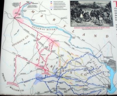
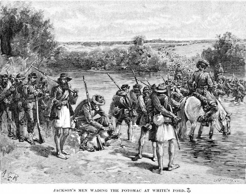
More about this marker. On the upper middle middle of the marker is a sketch captioned, “Jackson’s men wading the Potomac at White’s Ford.” Engraving from Battles and Leaders, Vol. II, 1887. The left side of the marker is a map depicting Confederate and Union troop movements. The map is captioned,
On September 2, Pope’s Union army retreated toward the fortifications of Washington, pursued and harassed by Stuart’s cavalry. On September 3, Lee’s Confederate army began its movement to Dranesville and Leesburg. The combined movements of both armies (more than 120,000 troops with artillery and wagon trains) clogged nearly every available road.
At fords near Leesburg, the Army of Northern Virginia crossed the Potomac over a period of four days, September 4-7. The Confederates would occupy Frederick, Maryland, September 6-10.
Also see . . .
1. The Battle of Chantilly. American Battlefield Trust (Submitted on January 10, 2009.)
2. The Battle of Ox Hill (Chantilly). “A Last Salute” (Submitted on January 10, 2009.)
Credits. This page was last revised on September 20, 2021. It was originally submitted on January 10, 2009. This page has been viewed 1,588 times since then and 26 times this year. Last updated on February 17, 2021. Photos: 1, 2, 3. submitted on January 10, 2009. 4. submitted on August 16, 2018, by Allen C. Browne of Silver Spring, Maryland. • Bernard Fisher was the editor who published this page.


