Union City in Fulton County, Georgia — The American South (South Atlantic)
Shadnor Baptist Church
Photographed by David Seibert, September 10, 2005
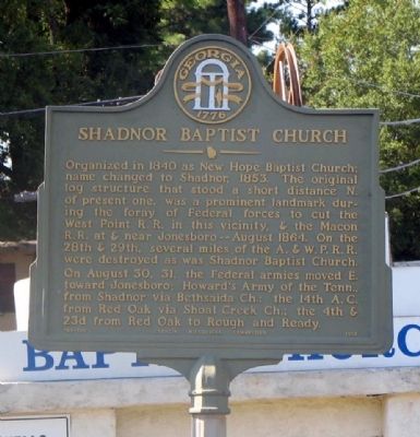
1. Shadnor Baptist Church Marker
On August 30, 31, the Federal armies moved E. towards Jonesboro; Howard’s Army of the Tenn. from Shadnor via Bethsaida Ch.; the 14th A.C. from Red Oak via Shoal Creek Ch.: the 4th & 23d from Red Oak to Rough and Ready
Erected 1958 by Georgia Historical Commission. (Marker Number 060-169.)
Topics and series. This historical marker is listed in these topic lists: Railroads & Streetcars • Religion & Religious Structures • War, US Civil. In addition, it is included in the Georgia Historical Society series list. A significant historical year for this entry is 1840.
Location. 33° 34.993′ N, 84° 32.959′ W. Marker is in Union City, Georgia, in Fulton County. It is on Flat Shoals Road 0 miles north of Flat
this page online

Regionally, this marker is in the Piedmont and in Metro Atlanta. It is also in the American South and specifically in the Deep South. Globally, it is in North America, the Western Hemisphere, the Western World, and the Anglosphere. Historically, it finds itself in what was once the territory of the Mississippian Culture, one of the original Thirteen Colonies, one of the Confederate States of America, and the Antebellum South.
Other nearby markers. At least 8 other markers are within 3 miles of this marker, measured as the crow flies: Unknown Soldiers Memorial (within shouting distance of this marker); Union City Centennial Time Capsule (approx. 0.4 miles away); Old Campbell County Courthouse (approx. 2.1 miles away); Old Campbell County (approx. 2.1 miles away); Here the First Confedereate Flag Was Unfurled in Georgia (approx. 2.1 miles away); Celebrating Fairburn's History (approx.
Photographed by David Seibert, June 19, 2010
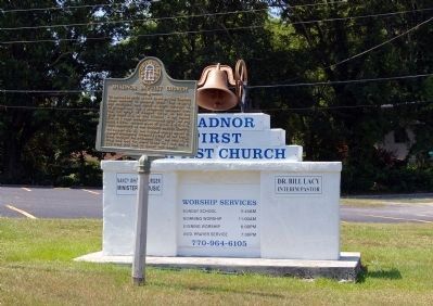
2. Shadnor Baptist Church Marker
Photographed by David Seibert, June 19, 2010
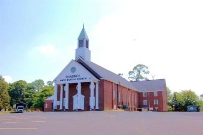
3. Shadnor First Baptist Church
The marker stands in front of the current Shadnor Baptist Church building.

Photographed by Mark Parker, September 18, 2025
4. Shadnor First Baptist Church cornerstone
Organized 1840 A.D.
Remodeled 1951 A.D.
Remodeled 1965 A.D.
S.W. Huckaby, Pastor
Remodeled 1951 A.D.
Remodeled 1965 A.D.
S.W. Huckaby, Pastor
Credits. This page was last revised on September 20, 2025. It was originally submitted on March 4, 2009, by David Seibert of Sandy Springs, Georgia. This page has been viewed 1,630 times since then and 38 times this year. Photos: 1. submitted on March 4, 2009, by David Seibert of Sandy Springs, Georgia. 2, 3. submitted on June 20, 2010, by David Seibert of Sandy Springs, Georgia. 4. submitted on September 18, 2025, by Mark Parker of Hickory, North Carolina. • Craig Swain was the editor who published this page.
