Franklin in Macon County, North Carolina — The American South (South Atlantic)
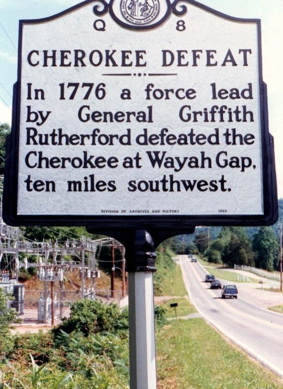
Cherokee Defeat
Erected 1986 by Division of Archives and History. (Marker Number Q-8.)
Topics and series. This historical marker is listed in these topic lists: Native Americans • War, US Revolutionary. In addition, it is included in the North Carolina Division of Archives and History series list. A significant historical year for this entry is 1776.
Location. Marker has been permanently removed. It was located near 35° 12.732′ N, 83° 23.996′ W. Marker was in Franklin, North Carolina, in Macon County. Marker was at the intersection of Bryson City Road (State Highway 28) and Airport Road, on the right when traveling north on Bryson City Road. Marker was permanently removed by the state and its number reassigned to another marker in Bryson City. Touch for map. Marker was in this post office area: Franklin NC 28734, United States of America.
We have been informed that this sign or monument is no longer there and will not be replaced. This page is an archival view of what was.
Other nearby markers. At least 8 other markers are within 3 miles of this location, measured as the crow flies. Dixie Hall (approx. 2.3 miles away); William Bartram Naturalist (approx. 2.3 miles away); Thomas's Legion (approx. 2.3 miles away); The North Carolina Bartram Trail (approx. 2.4 miles away); Macon County Confederate Memorial (approx. 2.4 miles away); Battle of Echoe (approx. 2.4 miles away); Gem Mining (approx. 2.4 miles away); Built in 1921 (approx. 2.4 miles away). Touch for a list and map of all markers in Franklin.
Additional commentary.
1. Language usage on the marker
The use of lead has been taken verbatim from the marker.
— Submitted June 30, 2021, by Devry Becker Jones of Washington, District of Columbia.
Credits. This page was last revised on June 30, 2021. It was originally submitted on February 20, 2021, by Tim Fillmon of Webster, Florida. This page has been viewed 346 times since then and 31 times this year. Photo 1. submitted on February 20, 2021, by Tim Fillmon of Webster, Florida.
