Marietta in Cobb County, Georgia — The American South (South Atlantic)
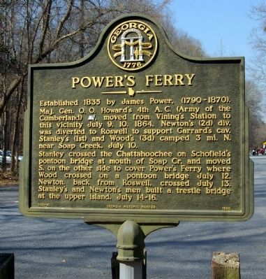
Power's Ferry
Stanley crossed the Chattahoochee on Schofield’s pontoon bridge at mouth of Soap Cr. and moved S. on the other side to cover Power’s Ferry where Wood crossed on a pontoon bridge July 12. Newton, back from Roswell, crossed July 13. Stanley’s and Newton’s men built a trestle bridge at the upper island, July 14-16.
Erected 1989 by Georgia Department of Natural Resources. (Marker Number 033-90.)
Topics and series. This historical marker is listed in these topic lists: Bridges & Viaducts • War, US Civil • Waterways & Vessels. In addition, it is included in the Georgia Historical Society, and the Historically Black Colleges and Universities series lists. A significant historical date for this entry is July 9, 1862.
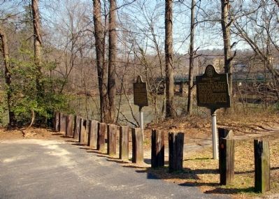
Location. 33° 54.133′ N, 84° 26.643′ W. Marker is in Marietta, Georgia, in Cobb County. Marker is on Entrance road to Cochran Shoals Unit Parking Lot, 0 miles north of Interstate North Parkway NE, on the right when traveling north. Marker is just inside the parking lot of the Chattahoochee River National Recreation Area, Cochran Shoals Unit. Interstate North Parkway parallels Interstate 285 West. Touch for map. Marker is in this post office area: Marietta GA 30067, United States of America. Touch for directions.
Other nearby markers. At least 8 other markers are within 3 miles of this marker, measured as the crow flies. The River Patrol & Cochran’s Ford (a few steps from this marker); Genuine Parts Company (approx. 0.9 miles away); Howard's 4th A.C. Line (approx. one mile away); 4th & 23d A.C. Advance (approx. 1.6 miles away); Confederate Battery Position (approx. 1.7 miles away); Isom's Ferry (approx. 1.8 miles away); The Hargrove House (approx. 2.1 miles away); The 4th Corps Posted Along the River (approx. 2.3 miles away). Touch for a list and map of all markers in Marietta.
Credits. This page was last revised on January 26, 2020. It was originally submitted on March 6, 2009, by David Seibert of Sandy Springs, Georgia. This page has been viewed 1,541 times since then and 64 times this year. Photos: 1, 2. submitted on March 6, 2009, by David Seibert of Sandy Springs, Georgia. • Craig Swain was the editor who published this page.

