
Washington Township near Waynesboro in Franklin County, Pennsylvania — The American Northeast (Mid-Atlantic)
Before The Battle Of Gettysburg
Refugees Flood The Road To Monterey Pass
Photographed by Larry Gertner, May 13, 2019
1. Before The Battle Of Gettysburg Marker
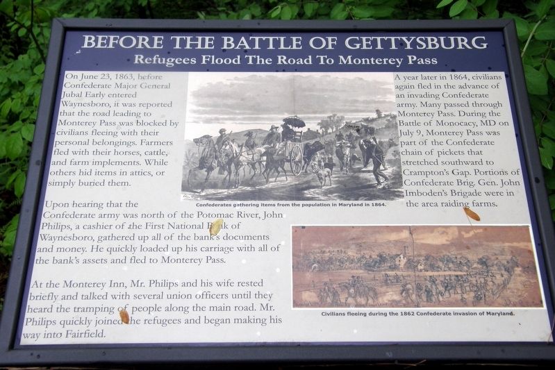
On June 23, 1863, before Confederate Major General Jubal Early entered Waynesboro, it was reported the road leading to Monterey Pass was blocked by civilians fleeing with their personal belongings. Farmers fled with their horses, cattle, and farm implements. While others hid items in attics, or simply buried them.
Upon hearing that the Confederate army was north of the Potomac River, John Philips, a cashier of the First National Bank of Waynesboro, gathered up all of the bank’s documents and money. He quickly loaded up his carriage with all of the bank’s assets and fled to Monterey Pass.
At the Monterey Inn, Mr. Philips and his wife rested briefly and talked with several union (sic) officers until they heard the tramping of people along the main road. Mr. Philips quickly joined the refugees and began making his way into Fairfield.
A year later in 1864, civilians again fled in the advance of an invading Confederate army. Many passed through Monterey Pass. During the Battle of Monocacy, MD on July 9, Monterey Pass was part of the Confederate chain of pickets that stretched south to Crampton’s Gap. Portions of Confederate
this page online
Topics. This historical marker is listed in this topic list: War, US Civil. A significant historical date for this entry is June 23, 1863.
Location. 39° 44.344′ N, 77° 28.748′ W. Marker is near Waynesboro, Pennsylvania, in Franklin County. It is in Washington Township. It is on Charmian Road east of Buchanan Trail East/Waynesboro Road, on the left when traveling east. Touch for map. Marker is at or near this postal address: 9 Charmian Rd, Waynesboro PA 17268, United States of America. Touch for directions.

Regionally, this marker is in South-Central Pennsylvania. It is also in the American Northeast, in the Mid-Atlantic, in Appalachia, and specifically in Northern Appalachia. Globally, it is in North America, the Western Hemisphere, the Western World, and the Anglosphere. Historically, it finds itself in what was once the Haudenosaunee (Iroquois) Confederacy and also one of the original Thirteen Colonies.
Other nearby markers. At least 8 other markers are within walking distance of this marker: The Underground Railroad (a few steps from this marker); The Raid On Harpers Ferry
Photographed by Devry Becker Jones (CC0), February 19, 2022
2. Before The Battle Of Gettysburg Marker
Credits. This page was last revised on February 7, 2023. It was originally submitted on July 5, 2019, by Larry Gertner of New York, New York. This page has been viewed 512 times since then and 36 times this year. Last updated on March 2, 2021, by Carl Gordon Moore Jr. of North East, Maryland. Photos: 1. submitted on July 5, 2019, by Larry Gertner of New York, New York. 2. submitted on February 21, 2022, by Devry Becker Jones of Washington, District of Columbia.
