Lemoyne in Cumberland County, Pennsylvania — The American Northeast (Mid-Atlantic)
Lemoyne - Bridgeport Heights
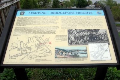
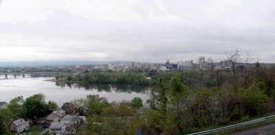
As Lt. Gen. Richard S. Ewell’s Confederate Second Corps advanced on Harrisburg in June 1863, Union Maj. Gen. Darius N. Couch, charged with the defense of the city, recognized the need for a series of defensive fortifications to be constructed on Bridgeport Heights. Shortly after Couch arrived in Harrisburg, local citizens were encouraged to volunteer to build the defenses. On June 15, the work began in earnest, with a reported 1,000 men patriotically assisting. By the following morning, however, only a fraction of the civilian volunteers remained. Their places were filled by workers from the Pennsylvania Railroad and Canal, who received a daily wage of $1.25.
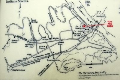
Constructed hastily by a workforce with little military experience, the fortifications were not overly impressive from a military standpoint and had numerous potentially deadly defects in battle. Christened Fort Washington, the earthworks measured about two hundred by six hundred yards. Unfortunately, Fort Washington was constructed on the lower militarily-unfavorable portion of Bridgeport Heights. To protect the misplaced fortress, a smaller earthwork called Fort Couch was erected a short distance farther west at what is now the intersection of 8th and Indiana Streets.
Camp Couch - separate from Fort Couch - was established between the two forts. Many New York National Guard and Pennsylvania Militia regiments were encamped there throughout the summer of 1863. The steepness of Bridgeport Heights, however, made the hill a treacherous location for a camp. By one account, eight horses and twenty men were required to haul just one cannon up to the encampment. Many complaints survive from the infantrymen in Camp Couch, who slid down the steep slope during their slumber. The difficult terrain complicated many ordinary tasks, such as drill, for the soldiers. “We can show no fancy appearance of [c]amp”, wrote one New York soldier in Camp Couch, “as it is on the summit of a very high hill… above the Susquehanna. There is not a level spot, and every parade drill or sentry walk has to be [done] with one foot much lower down than the other.”
Erected by Camp Curtin Historical Society.
Topics. This historical marker is listed in these topic lists: Forts and Castles • War, US Civil. A significant historical date for this entry is June 15, 1863.
Location. 40° 15.021′ N, 76° 53.788′ W. Marker is in Lemoyne, Pennsylvania, in Cumberland County. Marker is on Cumberland Road, 0.2 miles west of Washington Terrace, on the right when traveling west. Touch for map. Marker is in this post office area: Lemoyne PA 17043, United States of America. Touch for directions.
Other nearby markers. At least 8 other markers are within walking distance of this marker. Lemoyne Veterans Memorial (about 300 feet away, measured in a direct line); The Wormleysburg School (approx. 0.2 miles away); The Original Fire Bell (approx. 0.2 miles away); Harrisburg (approx. 0.2 miles away); John Wormley (approx. half a mile away); Fort Couch (approx. half a mile away); a different marker also named Fort Couch (approx. half a mile away); Fort Couch - General Couch - Fort Washington (approx. half a mile away). Touch for a list and map of all markers in Lemoyne.
Also see . . . Camp Curtin Historical Society and Civil War Roundtable. (Submitted on May 9, 2016.)
Credits. This page was last revised on March 3, 2021. It was originally submitted on May 8, 2016, by Larry Gertner of New York, New York. This page has been viewed 553 times since then and 50 times this year. Last updated on March 2, 2021, by Carl Gordon Moore Jr. of North East, Maryland. Photos: 1, 2, 3, 4, 5. submitted on May 8, 2016, by Larry Gertner of New York, New York.
