Murrells Inlet in Georgetown County, South Carolina — The American South (South Atlantic)
Washington’s Visit
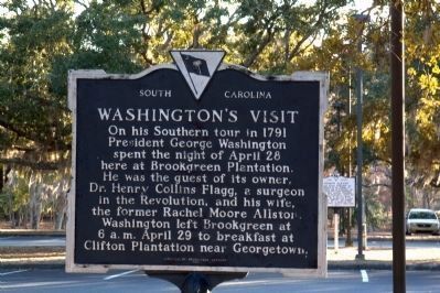
Photographed by J. J. Prats, February 14, 2011
1. Washington’s Visit Marker
The nearby Joseph Alston marker can be seen in the distance on the right.
Erected 1982 by Brookgreen Gardens. (Marker Number 22-13.)
Topics and series. This historical marker is listed in this topic list: Notable Events. In addition, it is included in the Former U.S. Presidents: #01 George Washington, and the George Washington Slept Here series lists. A significant historical date for this entry is April 28, 1908.
Location. 33° 31.073′ N, 79° 5.73′ W. Marker is in Murrells Inlet, South Carolina, in Georgetown County. It is on Henry Flagg Loop near William Alston Loop. Marker is in Brookgreen Gardens, Between Pawleys Island and Murrells Inlet on U.S. 17. It is in the main parking lot at the Welcome Center in one of the medians. There is a per person fee to enter the gardens. Once paid it grants the bearer access for seven consecutive days. Touch for map. Marker
this page online

Regionally, this marker is on the Grand Strand and in the Pee Dee. It is also in the American South, specifically in the Deep South, and on the Eastern Seaboard. Globally, it is in the North Atlantic Region, North America, the Western Hemisphere, the Western World, and the Anglosphere. Historically, it finds itself in what was once the territory of the Mississippian Culture, one of the original Thirteen Colonies, one of the Confederate States of America, and the Antebellum South.
Other nearby markers. At least 8 other markers are within 2 miles of this marker, measured as the crow flies: Washington Allston (within shouting distance of this marker); Theodosia Burr Alston (within shouting distance of this marker); Joseph Alston (within shouting distance of this marker); Brookgreen Plantation (within shouting distance of this marker); Brookgreen Gardens (approx. ¼ mile away); Joseph & Theodosia Burr Alston (approx. 1.1 miles away); An Ancient Tool for a Modern Task (approx. 1.8 miles
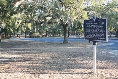
Photographed by J. J. Prats, February 14, 2011
2. Washington’s Visit Marker
More about this marker. Maker was originally erected on William Alston Loop (then Allston Circle Drive). The four markers spaced along the drive were removed by the Gardens for a few years before being placed together in the parking lot in 2010.
Regarding Washington’s Visit. Dr. Henry Collins Flagg (1742–1801) from Newport, Rhode Island, had married Rachel Moore (1757–1839), widow of William Allston (d.1781).
Additional keywords. Washington's Southern Tour
Credits. This page was last revised on November 15, 2020. It was originally submitted on March 6, 2009, by J. J. Prats of Powell, Ohio. This page has been viewed 2,054 times since then and 68 times this year. Photos: 1, 2. submitted on February 15, 2011, by J. J. Prats of Powell, Ohio.
