
Perryville in Boyle County, Kentucky — The American South (East South Central)
Act of Mercy
Perryville • The Battle For Kentucky
| — | October 8, 1862 | — |
Photographed by Bernard Fisher, August 18, 2011
1. Act of Mercy Marker
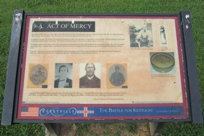
Woodward’s canteen was empty, and for more than ten hours he lay near here, thirsty and bleeding from his multiple wounds. Late that night, a Confederate soldier from the 41st Georgia found Woodward and gave the wounded Pennsylvanian a drink of water.
When the Confederate discovered that Woodward’s canteen was empty, the Southerner gave Woodward his full canteen and took Woodward’s empty one. After this act of mercy, the Confederate departed. Woodward survived the battle and the war.
“I myself was unfortunate enough to be shot through the left leg…hauled five miles this morning to Antioch Church…and thrown out in a pile like wood…I lay for six days out under a white oak tree, with my wound dressed once.”
Adam
this page online
The U.S. Small Business Administration (SBA) Grant No. SBAHQ-01-I-0036 is funded by the SBA. SBA’s funding is not an endorsement of any products, opinions or services. All SBA funded programs are extended to the public on a nondiscriminatory basis.
The Southern and Eastern Kentucky Tourism Development Association (SEKTDA) is the sole owner of this panel. To receive more information on SEKTDA and its programs call toll free (877-TOURSEKY) or visit our website at www.tourseky.com.
(captions)
William Woodward in a postwar photograph. Photograph courtesy of Jeffers Vaughan
A .69 caliber buck and ball load.
An unknown Confederate soldier left William Woodward a canteen similar to the one pictured above.
Erected by Southern and Eastern Kentucky Tourism Development Association (SEKTDA). (Marker Number 9.)
Topics. This historical marker is listed in this topic list: War, US Civil.
Location. This marker has been replaced by another marker nearby. It was located near 37° 40.425′ N, 84° 58.493′ W. Marker was in Perryville, Kentucky, in Boyle
Photographed by Bernard Fisher, August 18, 2011
2. Act of Mercy Marker

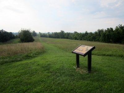
Regionally, this marker was in Kentucky’s Bluegrass Region. It was also in the American South and specifically in the Upper South. Globally, it was in North America, the Western Hemisphere, the Western World, and the Anglosphere. Historically, it found itself in what was once the territory of the Mississippian Culture and also the Antebellum South.
Other nearby markers. At least 8 other markers are within walking distance of this location: A different marker also named Act of Mercy (here, next to this marker); a different marker also named Starkweather’s Hill (within shouting distance of this marker); a different marker also named Starkweather’s Hill (about 400 feet away); Sanctuary (approx. 0.2 miles away); The Cornfield (approx. 0.2 miles away); Starkweather's Wall: Highwatermark of the West (approx. 0.2 miles away); The Bloodbath At The Crib (approx. 0.2 miles away); Perryville and the Emancipation Proclamation (approx. ¼ mile away). Touch for a list and map of all markers in Perryville.
Other markers no longer nearby. Starkweather's Hill (was within shouting distance of this marker but has been replaced with another marker now near it); a different marker also named Starkweather's Hill (was about 300 feet away, measured in a direct line but has been reported to have been replaced with another marker now near it); a different marker also named Starkweather’s Hill (was about 400 feet away but has been reported to have been replaced with another marker now near it); Stewart's Attack (was about 700 feet away but has been confirmed missing); a different marker also named The Cornfield (was approx. 0.2 miles away but has been replaced with another marker now near it); Donelson Persists (was approx. 0.2 miles away but has been reported to have been replaced with another marker now near it); The Bloodbath at the Crib (was approx. 0.2 miles away but has been replaced with another marker now near it).
Related marker. Click here for another marker that is related to this marker. This marker has been replaced by another at this location.
Also see . . . Southern and Eastern Kentucky Tourism Development Association (SEKTDA). (Submitted on August 25, 2011, by Bernard Fisher of Richmond, Virginia.)
Credits. This page was last revised on November 22, 2025. It was originally submitted on August 25, 2011, by Bernard Fisher of Richmond, Virginia. This page has been viewed 1,307 times since then and 66 times this year. Last updated on March 6, 2021, by Bradley Owen of Morgantown, West Virginia. Photos: 1, 2. submitted on August 25, 2011, by Bernard Fisher of Richmond, Virginia.
