Point of Rocks in Frederick County, Maryland — The American Northeast (Mid-Atlantic)
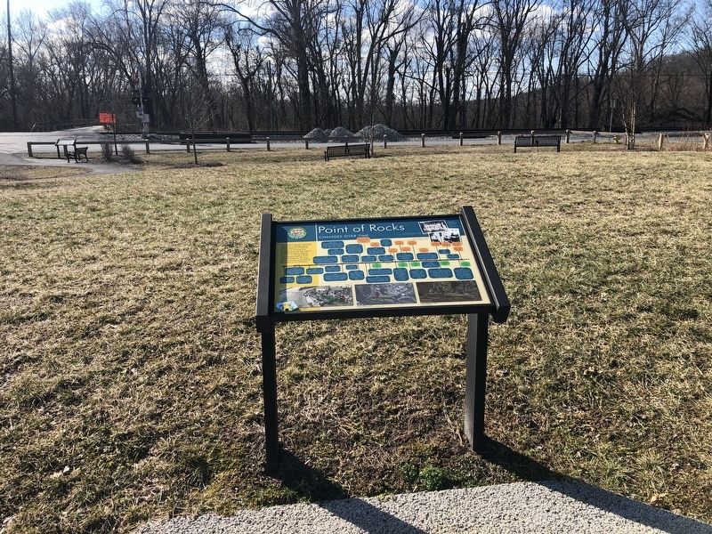
Point of Rocks
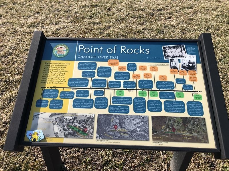
Changes Over Time
— Canal Towns • Point of Rocks —
The "Point of Rocks" has long served as a distinguishing natural feature for Native Americans residing and traveling through the region. Until the Treaty of Albany in 1722, including English state representatives and Iroquois Nations, the area was nominally controlled by the Iroquois Confederacy.
10,000 BC Paleo-Indians first arrive in this area
1632 Colony of Maryland founded by Second Lord Baltimore as granted by King Charles I
1707 First known map of the area created by Swiss explorer Louis Michel
1720's Many settlers arrive, moving south and west along the Potomac
1735 Potomac ferry service established; operates under various owners until bridge completion in 1852 renders service obsolete
1825 Greg Snouffer builds the first tavern in Point of Rocks
1828-1832 Legal dispute between C&O Canal Co. and B&O Railroad over right of way through narrow pass at Point of Rocks
1832 B&O Railroad reaches Point of Rocks from Baltimore
1833 Compromise between C&O Canal Co. and B&O Railroad; notable rock spur is blasted to provide access for both
1834 C&O Canal opens service from Washington, DC through Point of Rocks
1848 Point of Rocks incorporated
1852 First (wood) bridge crosses Potomac at Point of Rocks; accommodates rail, carriages, and horses
1861-1865: Civil War Point of Rocks is a hub of conflict due to its bridge, railroad, canal, and proximity to Virginia - bridge destroyed in 1861
1868 B&O Railroad blasts tunnel through Point of Rocks
1873 B&O Railroad connect Point of Rocks to Washington, DC via the Metropolitan Branch
Numerous major floods pre-date modern record keeping
1876 B&O Railroad builds Point of Rocks train station, which stands today at the railroad junction
1887 population 150
1889 Major flood 40.20 ft
1889 Major flood washes away new bridge on day of opening and severely damages C&O Canal
1892 New Pratt Truss steel bridge opens across Potomac
1920-1921 Electricity service arrives in Point of Rocks
1924 Major flood 32.20 ft
1924 C&O Canal ends commercial use due to major flood damage, lack of investment, and railroad competition
1934 population 500
1936 Major flood 41.03 ft
1937 Major flood 33.86 ft
1937 Bridge over the Potomac is rebuilt to its current Camelback Trussform, using WPA funds
1939 US 15 completed from Point of Rocks to Frederick and beyond
1940 population 369
1942 Major flood 40.43 ft
1941-1945 Substantial Point of Rocks expansion in war-related use of railroad, including troops and supplies
1955 Major flood 29.08 ft
c. 1968 First major subdivision opens: Point of Rocks Estates
1970 New US 15 alignment opens from bridge to new Route 340 interchange. 22 homes removed, including all those overlooking the town on Catoctin Ridge
1972 Major flood 37.43 ft
1972 population 300
1983 MARC established
1985 Major flood 36.28 ft
1987 B&O and CSX incorporated
Jan. 1996 Major flood 36.34 ft
Sept. 1996 Major flood 36.26 ft
1999 FEMA/MEMA buys out about 24 residential structures in the Potomac floodplain. All were demolished by 2007, including many on this site
2010 population 1,466
Topics and series. This historical marker is listed in these topic lists: Industry & Commerce • Settlements & Settlers • Waterways & Vessels
Location. 39° 16.466′ N, 77° 32.413′ W. Marker is in Point of Rocks, Maryland, in Frederick County. Marker is on Clay Street (Maryland Route 28) just east of Commerce Street, on the right when traveling east. Touch for map. Marker is at or near this postal address: 3707 Clay St, Point of Rocks MD 21777, United States of America. Touch for directions.
Other nearby markers. At least 8 other markers are within walking distance of this marker. A different marker also named Point of Rocks (within shouting distance of this marker); a different marker also named Point of Rocks (within shouting distance of this marker); a different marker also named Point of Rocks (within shouting distance of this marker); a different marker also named Point of Rocks (about 300 feet away, measured in a direct line); a different marker also named Point of Rocks (about 400 feet away); a different marker also named Point of Rocks (about 400 feet away); Battle at Point of Rocks (approx. 0.2 miles away); a different marker also named Point of Rocks (approx. 0.4 miles away). Touch for a list and map of all markers in Point of Rocks.
Credits. This page was last revised on March 6, 2021. It was originally submitted on March 6, 2021, by Devry Becker Jones of Washington, District of Columbia. This page has been viewed 382 times since then and 71 times this year. Photos: 1, 2, 3. submitted on March 6, 2021, by Devry Becker Jones of Washington, District of Columbia.


