Leesburg in Loudoun County, Virginia — The American South (Mid-Atlantic)
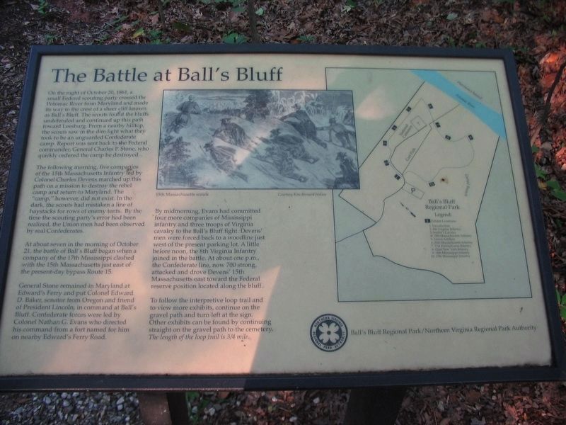
The Battle at Ball's Bluff
On the night of October 20, 1861, a small Federal scouting party crossed the Potomac River from Maryland and made its way to the crest of a sheer cliff known as Ball's Bluff. The scouts found the bluffs undefended and continued up this path toward Leesburg. From a nearby hilltop, the scouts saw in the dim light what they took to be an unguarded Confederate camp. Report was sent back to the Federal commander, General Charles P. Stone, who quickly ordered the camp be destroyed.
The following morning, five companies of the 15th Massachusetts Infantry led by Colonel Charles Devens marched up this path on a mission to destroy the rebel camp and return to Maryland. The "camp" however, did not exist. In the dark, the scouts had mistaken a line of haystacks for rows of enemy tents. By the time the scouting party's error had been realized, the Union men had been observed by real Confederates.
At about seven in the morning of October 21, the battle of Ball's Bluff began when a company of the 17th Mississippi clashed with the 15th Massachusetts just east of the present day bypass Route 15.
General Stone remained in Maryland at Edward's Ferry and put Colonel Edward D. Baker, senator from Oregon and friend of President Lincoln, in command at Ball's Bluff. Confederate forces were led by Colonel Nathan G. Evans who directed his command from a fort named for him on nearby Edward's Ferry Road.
By midmorning, Evans had committed four more companies of Mississippi infantry and three troops of Virginia cavalry to the Ball's Bluff fight. Devens' men were forced back to a woodline just west of the present parking lot. A little before noon, the 8th Virginia Infantry joined the battle. At about one p.m., the Confederate line, now 700 strong attacked and drove Devens' 15th Massachusetts east toward the Federal reserve position located along the bluff.
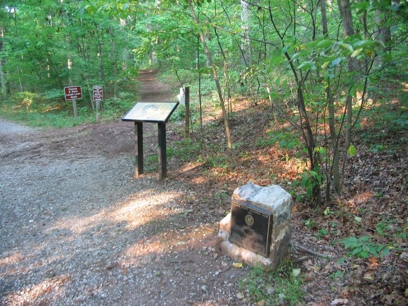
To follow the interpretive loop trail and to view more exhibits, continue on the gravel path and turn left at the sign. Other exhibits can be found by continuing straight on the gravel path to the cemetery. The length of the loop trail is 3/4 mile.
Erected by Ball's Bluff Regional Park/Northern Virginia Regional Park Authority.
Topics and series. This historical marker is listed in this topic list: War, US Civil. In addition, it is included in the NOVA Parks series list. A significant historical date for this entry is October 20, 1861.
Location. This marker has been replaced by another marker nearby. It was located near 39° 7.842′ N, 77° 31.844′ W. Marker was in Leesburg, Virginia, in Loudoun County. Marker could be reached from Balls Bluff Park, 0.2 miles east of Balls Bluff Road, on the right when traveling west. Touch for map. Marker was in this post office area: Leesburg VA 20176, United States of America. Touch for directions.
Other nearby markers. At least 8 other markers are within walking distance of this location. A different marker also named The Battle at Ball’s Bluff (here, next to this marker); A Divided America, A Divided Loudoun County (within shouting distance of this marker); Battle of Balls Bluff (within shouting distance of this marker); Additional Area Civil War Sites (within shouting distance of this marker); The Battle of Ball's Bluff in Perspective (within shouting distance of this marker); Aftermath of Ball’s Bluff (within shouting distance of this marker); Battle of Ball's Bluff - October 21, 1861 (within shouting distance of this marker); a different marker also named The Battle of Ball's Bluff (within shouting distance of this marker). Touch for a list and map of all markers in Leesburg.
Related marker. Click here for another marker that is related to this marker. This marker has been replaced with the linked marker.
Credits. This page was last revised on March 8, 2021. It was originally submitted on March 6, 2021, by Craig Swain of Leesburg, Virginia. This page has been viewed 127 times since then and 16 times this year. Last updated on March 6, 2021, by Bradley Owen of Morgantown, West Virginia. Photos: 1, 2. submitted on August 30, 2007, by Craig Swain of Leesburg, Virginia. • Bill Pfingsten was the editor who published this page.

