Leesburg in Loudoun County, Virginia — The American South (Mid-Atlantic)
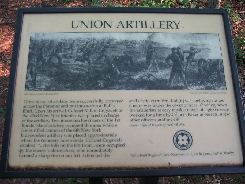
Union Artillery
Three pieces of artillery were successfully conveyed across the Patomac and put into action at Ball's Bluff. Upon his arrival, Colonel Milton Cogswell of the 42nd New York Infantry was placed in charge of the artillery. Two mountain howitzers of the 1st Rhode Island artillery occupied this area while a James rifled cannon of the 6th New York Independent artillery was placed approximately where the cemetery now stands. Colonel Cogswell recalled: "…the hills on the left front…were occupied by the enemy's skirmishers, who immediately opened a sharp fire on our left. I directed the artillery to open fire…but [it] was ineffectual as the enemy was under the cover of trees, shooting down the artillerists at easy musket range…the pieces were worked for a time by Colonel Baker in person…a few other officers, and myself."
Source: Official Records of the Civil War.
Erected by Ball's Bluff Regional Park/Northern Virginia Regional Park Authority.
Topics and series. This historical marker is listed in this topic list: War, US Civil. In addition, it is included in the NOVA Parks series list.
Location. This marker has been replaced by another marker nearby. It was located near 39° 7.971′ N, 77° 31.627′ W. Marker was in Leesburg, Virginia, in Loudoun County. Marker could be reached from Balls Bluff Park east of Balls Bluff Road, on the right when traveling west. Touch for map. Marker was in this post office area: Leesburg VA 20176, United States of America. Touch for directions.
Other nearby markers. At least 8 other markers are within walking distance of this location. A different marker also named Union Artillery (here, next to this marker); Ball’s Bluff Overlook (within shouting distance of this marker); M1841 12 Pound Mountain Howitzer (within shouting distance of this marker); 20th Massachusetts Infantry (within shouting distance of this marker); 13 Pounder "James Rifle" (about 400 feet away, measured in a direct line); A National Cemetery System (about 400 feet away); The North: Union Leaders at Ball's Bluff (about 400 feet away); United States National Military Cemetery (about 400 feet away). Touch for a list and map of all markers in Leesburg.
Related marker. Click here for another marker that is related to this marker. This marker has been replaced with the linked marker.
Credits. This page was last revised on March 6, 2021. It was originally submitted on March 6, 2021, by Craig Swain of Leesburg, Virginia. This page has been viewed 294 times since then and 38 times this year. Photos: 1, 2. submitted on August 31, 2007, by Craig Swain of Leesburg, Virginia. • Devry Becker Jones was the editor who published this page.

