Iowa City in Johnson County, Iowa — The American Midwest (Upper Plains)
View from the Overlook Plaza
Photographed by Connor Olson, July 25, 2020
1. View from the Overlook Plaza Marker
Inscription.
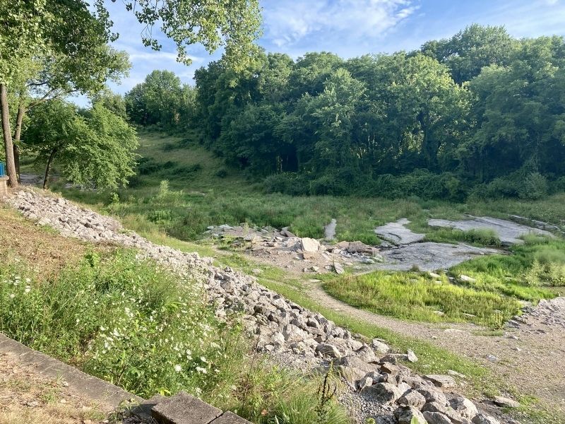
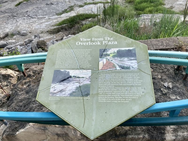
View from the Overlook Plaza. . The plaza area is located above the bend in the Devonian Fossil Gorge and affords views of both the limestone surfaces upstream and the developing wetland downstream. In the upstream direction, the 2008 flooding only slightly deepened of the gorge that was first cut into bedrock by the 1993 flooding. The more recent flooding widened the gorge, and it also removed the pile of unconsolidated ancient river sediments that appeared in the center of the gorge after the earlier flooding. The block of limestone that originally deflected the floodwater over this sediment mound was swept away in 2008. However, the newer flood exposed similar sediments further downstream.
The flooding of 2008 widened the downstream area of the gorge significantly, exposing old glacial till with an orange-red pΰleosol (ancient soil).. Unfortunately the area was dangerously steep and had to be landscaped. It lies beneath the grassy hill that forms the West Bank at the lower end of the gorge. In this area, the rock of the gorge shows broad folds with numerous faults and fractures in the area of markers 15 and 16.
A great deal of rock material was deposited by the 2008 flood in the area just below the plaza. This material includes blocks of limestone ripped from the gorge floor and a large "raft” of concrete slabs connected with steel re-bar that once formed the plaza around the lower biostrome (marker 3) prior to the flooding. This material was deposited in the inside of the curve in the gorge, an area where the water's energy was dissipated.
Photo captions: , Left: View of Devonian Fossil Gorge looking upstream from the plaza as seen in the summer of 2010. , Right: View of Devonian Fossil Gorge looking downstream from the plaza as seen in the summer of 2010.
The plaza area is located above the bend in the Devonian Fossil Gorge and affords views of both the limestone surfaces upstream and the developing wetland
downstream. In the upstream direction, the 2008
flooding only slightly deepened of the gorge that was
first cut into bedrock by the 1993 flooding. The more
recent flooding widened the gorge, and it also removed
the pile of unconsolidated ancient river sediments that
appeared in the center of the gorge after the earlier
flooding. The block of limestone that originally deflected the floodwater over this sediment mound was swept away in 2008. However, the newer flood exposed
similar sediments further downstream.
The flooding of 2008 widened the downstream area of the gorge significantly, exposing old glacial till with an orange-red pΰleosol (ancient soil).. Unfortunately the area was dangerously steep and had to be landscaped. It lies
beneath the grassy hill that forms the West Bank at the lower
end of the gorge. In this area, the rock of the gorge shows
broad folds with numerous faults and fractures in the area
of markers 15 and 16.
A great deal of rock material was deposited by the 2008
flood in the area just below the plaza. This material includes
blocks of limestone ripped from the gorge floor and a large
"raft” of concrete slabs connected with steel re-bar that once
formed the plaza around the lower biostrome (marker 3)
prior to the flooding. This material was deposited in
the inside of the curve in the gorge, an area
where the water's energy was dissipated.
Photo captions:
Left: View of Devonian Fossil Gorge looking upstream from the plaza as seen in
the summer of 2010.
Right: View of Devonian Fossil Gorge looking downstream from the plaza as seen
in the summer of 2010.
Topics.
Click or scan to see this page online
This historical marker is listed in these topic lists: Disasters • Waterways & Vessels. A significant historical year for this entry is 2008.
Location. 41° 43.307′ N, 91° 31.939′ W. Marker is in Iowa City, Iowa, in Johnson County. It is on Riverwalk Trail south of Prairie de Chien Road Northeast, on the right when traveling south. Touch for map. Marker is in this post office area: Iowa City IA 52240, United States of America. Touch for directions.

Regionally, this marker is in Eastern Iowa. It is also in the American Midwest and in the Corn Belt. Globally, it is in North America, the Western Hemisphere, the Western World, and the Anglosphere. Historically, it finds itself in what was once the territory of the Mississippian Culture and also the Louisiana Purchase.
Other nearby markers. At least 8 other markers are within 4 miles of this marker, measured as the crow flies: Site Geology (here, next to this marker); Devonian Fossils (a few steps from this marker); An Ancient Sea (a few steps from this marker); The Coralville Dam (a few steps from this marker); Samuel Jordan Kirkwood (approx. 3.8 miles away); Old Brick (approx.
Credits. This page was last revised on March 9, 2021. It was originally submitted on March 9, 2021, by Connor Olson of Menomonee Falls, Wisconsin. This page has been viewed 251 times since then and 9 times this year. Photos:1, 2, 3. submitted on March 9, 2021, by Connor Olson of Menomonee Falls, Wisconsin. • Mark Hilton was the editor who published this page.