North Murderkill Hundred in Camden in Kent County, Delaware — The American Northeast (Mid-Atlantic)
Camden
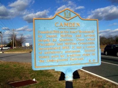
Photographed by Bill Pfingsten, December 15, 2010
1. Camden Marker
Erected 1971 by Division of Historical and Cultural Affairs. (Marker Number KC-41.)
Topics and series. This historical marker is listed in these topic lists: Abolition & Underground RR • Settlements & Settlers. In addition, it is included in the Delaware Public Archives, and the Quakerism series lists. A significant historical year for this entry is 1783.
Location. 39° 6.81′ N, 75° 32.251′ W. Marker is in Camden, Delaware, in Kent County. It is in North Murderkill Hundred. It is at the intersection of U.S. 13 and E. Camden-Wyoming Ave. (Delaware Route 10) on U.S. 13. Touch for map. Marker is in this post office area: Camden Wyoming DE 19934, United States of America. Touch for directions.

Regionally, this marker is in the American Mid-Atlantic, on the Delmarva Peninsula, and on the Eastern Seaboard. Globally, it is in the North Atlantic Region, North
this page online
Other nearby markers. At least 8 other markers are within walking distance of this marker: A different marker also named Camden (approx. ¼ mile away); Brinkley Hill (approx. ¼ mile away); Gov. George Truitt Home (approx. ¼ mile away); Morning Star Institutional Church of God in Christ, Inc. (approx. 0.3 miles away); Caesar Rodney (approx. 0.3 miles away); Operation Silent Witness (approx. 0.4 miles away); Site of Whatcoat Church (approx. 0.4 miles away); Camden Friends Meeting (approx. half a mile away). Touch for a list and map of all markers in Camden.
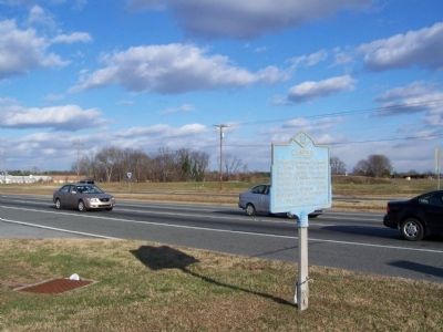
Photographed by Bill Pfingsten, December 15, 2010
2. Camden Marker
Credits. This page was last revised on May 15, 2026. It was originally submitted on January 6, 2011, by Bill Pfingsten of Bel Air, Maryland. This page has been viewed 1,418 times since then and 32 times this year. Last updated on March 10, 2021, by Carl Gordon Moore Jr. of North East, Maryland. Photos: 1, 2. submitted on January 6, 2011, by Bill Pfingsten of Bel Air, Maryland.
