Murfreesboro in Rutherford County, Tennessee — The American South (East South Central)
Battle of Stones River
Site of Breckinridge's Attack
— Battle of Stones River —
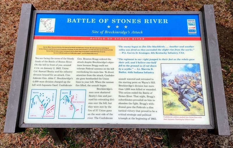
Union Gen. William S. Rosecrans led the Army of the Cumberland from Nashville towards Murfreesboro in December 1862, while Confederate Gen. Braxton Bragg and the Army of Tennessee occupied the town to protect the approaches to Chattanooga. The armies clashed on December 31, and a flank attack almost swept the Federals from the field. Rosecrans fended off attack on January 2 and prepared to take the offensive. Bragg, his army exhausted, evacuated Murfreesboro the next day. There were 23,000 total casualties out of 81,000 soldiers engaged—one of the bloodiest battles of the war.
(main text)
You are facing the scene of the bloody finale of the Battle of Stones River. On the hill in front of you, around 4 P.M. on January 2, 1863, Union Col. Samuel Beatty and his infantry division braced for an attack. Confederate Gen. John C. Breckinridge's 4,400-man division charged up the hill with bayonets fixed. Confederate Gen. Braxton Bragg ordered the attack despite Breckinridge's objections because Bragg could not tolerate Federal cannons on the hill overlooking his main line. To divert attention from the attack, Confederate guns bombarded the Union lines to your left. When the cannon fire lifted, the assault began.
Breckinridge's men soon shattered Beatty's line and pursued his retreating division over the hill, but they were met with the fire of 57 Union guns on the west side of the river. The Confederate assault wavered and retreated to the starting point on Wayne's Hill. Breckinridge's division lost more than 1,800 men killed or wounded. This action ended the battle of Stones River. That night, Bragg's subordinates prevailed on him to abandon the fight. Bragg's withdrawal gave the Federals a slim tactical victory that proved to be a critical strategic and political triumph at the beginning of 1863.
"The enemy began to flee like blackbirds. ...Another and another volley was fired as they ascended the slight rise from the works." —Pvt. Gervis D. Grainger, 6th Kentucky Infantry, CSA
"The regiment to our right jumped to their feet as the rebels gave their yell, and I believe one-half fell to the ground as if cut down by a scythe." —Lt. Marvin B. Butler, 44th Indiana Infantry
(caption):
Confederate soldiers pushed into Union lines with their bayonets. Painting by Gilbert Gaul.
Erected by Tennessee Civil War Trails.
Topics. This historical marker is listed in this topic list: War, US Civil. A significant historical date for this entry is January 2, 1863.
Location. 35° 53.236′ N, 86° 25.364′ W. Marker is in Murfreesboro, Tennessee

Photographed By Shane Oliver, January 30, 2021
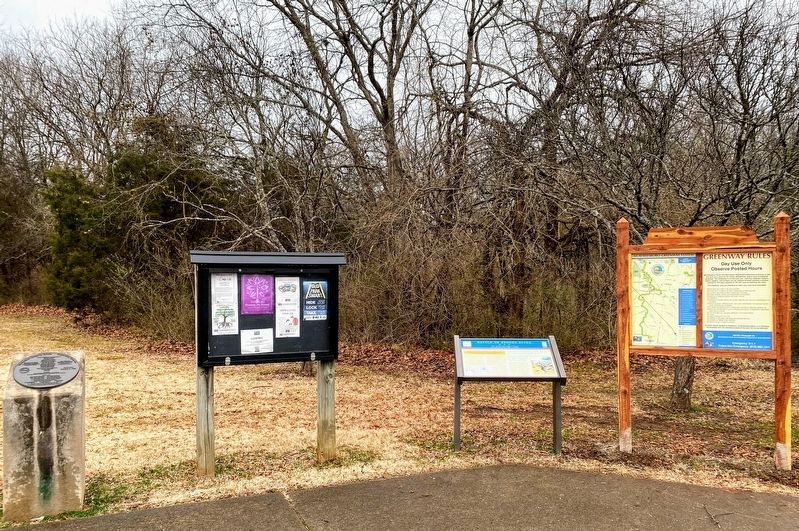
2. Battle of Stones River Marker at the Thompson Lane Trailhead
City of Murfreesboro website entry
Click for more information.
Click for more information.
Other nearby markers. At least 8 other markers are within walking distance of this marker. McFadden's Ford (about 500 feet away, measured in a direct line); My Poor Orphans! (about 600 feet away); Stones River Artillery Monument (approx. 0.2 miles away); Battle at Stones River (approx. 0.2 miles away); Remembering by Rail (approx. 0.2 miles away); McFadden Cemetery (approx. 0.2 miles away); The Very Forest Seemed to Fall (approx. ¼ mile away); Battle of Murfreesboro (approx. 0.6 miles away). Touch for a list and map of all markers in Murfreesboro.
Also see . . . Stones River National Battlefield. National Park Service website entry (Submitted on March 15, 2021.)
Credits. This page was last revised on February 27, 2022. It was originally submitted on March 14, 2021, by Shane Oliver of Richmond, Virginia. This page has been viewed 262 times since then and 14 times this year. Photos: 1, 2, 3, 4. submitted on March 14, 2021, by Shane Oliver of Richmond, Virginia. • Bernard Fisher was the editor who published this page.


