Floral City in Citrus County, Florida — The American South (South Atlantic)
Floral City's Travelers and Their Trails
Inscription.
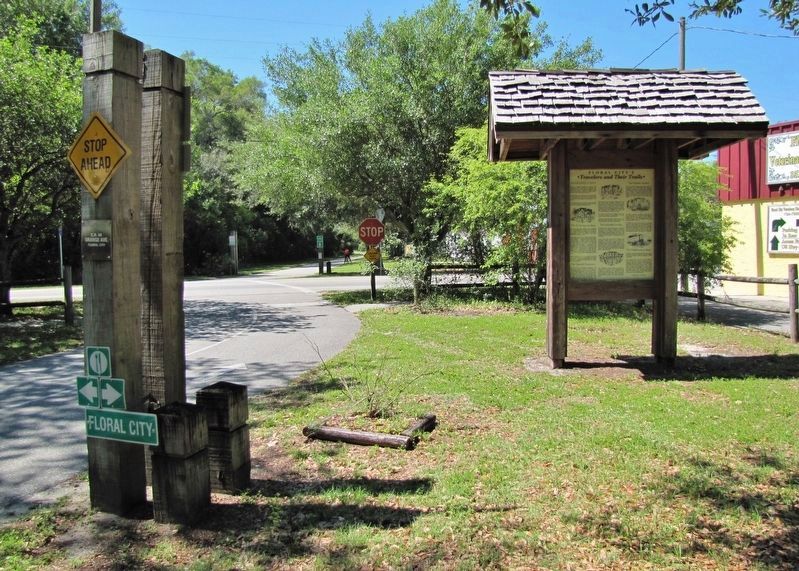
[north-facing kiosk panel]
Introduction
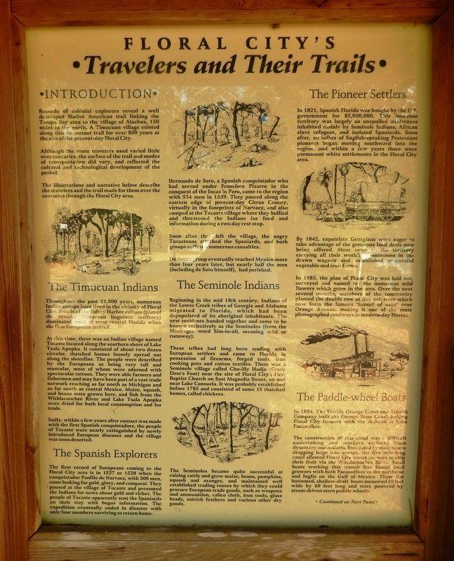
Records of colonial explorers reveal a well-developed Native American trail linking the Tampa Bay area to the village of Alachua, 150 miles to the north. A Timucuan village existed along this important trail for over 800 years at the site of the present-day Floral City.
Although the route travelers used varied little over centuries, the surface of the trail and modes of transportation did vary, and reflected the cultural and technological development of the period.
The illustrations and narrative below describe the travelers and the trail made for them over the centuries through the Floral City area.
The Timucuan Indians
Throughout the past 12,000 years, numerous Indian groups have lived in the vicinity of Floral City. People of the Safety Harbor culture (part of the broader Timucuan linguistic territory) dominated most of west central Florida when the first Europeans arrived.
At this time, there was an Indian village named Tocaste located along the southern shore of Lake Tsala Apopka. It consisted of about two dozen circular, thatched homes loosely spread out along the shoreline. The people were described by the Europeans as being very tall and muscular, most of whom were adorned with spectacular tattoos. They were able farmers and fishermen and may have been part of a vast trade network reaching as far north as Michigan and as far south as central Mexico. Maize, squash, and beans were grown here, and fish from the Withlacoochee River and Lake Tsala Apopka were dried for both local consumption and for trade.
Sadly, within a few years after contact was made with the first Spanish conquistadors, the people of Tocaste were nearly extinguished by newly introduced European diseases and the village was soon deserted.
The Spanish Explorers
The first record of Europeans coming to the Floral City area is in 1527 or 1528 when the conquistador Panfilo de Narvaez, with 300 men, came looking for gold, glory, and conquest. They paused at the village of Tocaste and pressured the Indians for news about gold and riches. The people of Tocaste apparently sent the Spaniards on their way with bogus information. The expedition eventually ended in disaster with only four members surviving to return home.
Hernando de Soto, a Spanish conquistador who had served under Francisco Pizarro in the conquest of the Incas in Peru, came to the region with 534 men in 1539. They passed along the eastern edge of present-day Citrus County, virtually in the footprints of Narvaez, and also camped at the Tocaste village where they bullied and threatened the Indians for food and information during a two day rest stop.
Soon
after they left the village, the angry Tocasteans attacked the Spaniards, and both groups suffered numerous casualties.
De Soto’s group eventually reached Mexico more than four years later, but nearly half the men (including de Soto himself), had perished.
The Seminole Indians
Beginning in the mid-18th century, Indians of the Lower Creek tribes of Georgia and Alabama migrated to Florida, which had been depopulated of its aboriginal inhabitants. The new residents banded together and came to be known collectively as the Seminoles (from the Muskogee word Sim-in-oli, meaning wild or runaway).
These tribes had long been trading with European settlers and came to Florida in possession of firearms, forged tools, iron cooking pots and cotton textiles. There was a Seminole village called Cho-illy Hadjo (Crazy Deer's Foot) near the site of Floral City’s First Baptist Church on East Magnolia Street, on and near Lake Consuela. It was probably established before 1785 and consisted of some 15 thatched homes, called chickees.
The Seminoles became quite successful at raising cattle and grew maize, beans, pumpkins, squash and oranges, and maintained well established trading routes by which they could procure European trade goods, such as weapons and ammunition, calico cloth, iron tools, glass beads, ostrich feathers and various other dry goods.
The
Pioneer Settlers
In 1821, Spanish Florida was bought by the U.S. government for $5,000,000. This immense territory was largely an unspoiled wilderness inhabited mainly by Seminole Indians, African slave refugees, and isolated Spaniards. Soon after, an influx of English-speaking Protestant pioneers began moving southward into the region, and within a few years there were permanent white settlements in the Floral City area.
By 1842, expatriate Georgians were eager to take advantage of the generous land deals now being offered. Most came to the territory carrying all their worldly possessions in ox-drawn wagons and established successful vegetable and fruit farms.
In 1883, the plan of Floral City was laid out, surveyed and named for the numerous wild flowers which grow in the area. Over the next several months, members of the community planted the double row of live oak trees which now form the famous "tunnel of oaks" over Orange Avenue, making it one of the most photographed roadways in modern-day Florida.
The Paddle-wheel Boats
In 1884, The Florida Orange Canal and Transit Company built the Orange State Canal, linking Floral City farmers with the railhead at Lake Panasoffkee.
The construction of this canal was a difficult undertaking and workers suffered from dysentery and malaria. Excavated by mule teams dragging large iron scoops, the
five mile-long canal allowed Floral City citrus growers to ship their fruit via the Withlacoochee River. Small boats working this transit line linked local growers with both Panasoffkee to the northeast and Inglis on the Gulf of Mexico. These flat-bottomed, shallow-draft boats measured 10 feet wide by 60 feet long and were powered by steam-driven stern paddle wheels.
[south-facing kiosk panel]
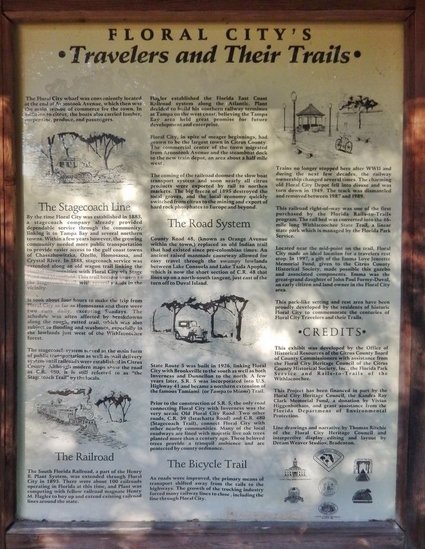
The Floral City wharf was conveniently located at the end of Aroostook Avenue, which then was the main avenue of commerce for the town. In addition to citrus, the boats also carried lumber, turpentine, produce, and passengers.
The Stagecoach Line
By the time Floral City was established in 1883, a stagecoach company already provided dependable service through the community, linking it to Tampa Bay and several northern towns. Within a few years however, the growing community needed more public transportation to provide easier access to the gulf coast towns of Chassahowitzka, Ozello, Homosassa, and Crystal River. In 1888, stagecoach service was extended along an old wagon trail linking the coastal communities with Floral City via Stage Pond and Mannfield. This trail became known as the Stagecoach Trail, with several stands in the vicinity.
It took about four hours to make the trip
from Floral City as far as Homosassa and there were two runs daily, excepting Sundays. The schedule was often affected by breakdowns along the rough, rutted trail, which was also subject to flooding and washouts, especially in the lowlands just west of the Withlacoochee forest.
The stagecoach system served as the main form of public transportation as well as mail delivery system until railroads were established in Citrus County. Although modern maps show the road as C.R. 480, it is still referred to as "the Stagecoach Trail" by the locals.
The Railroad
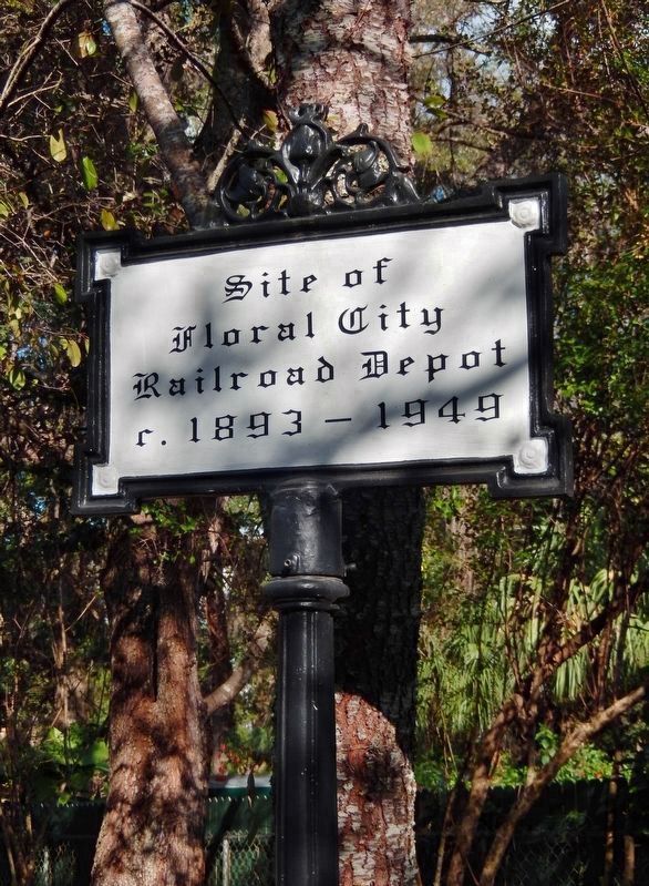
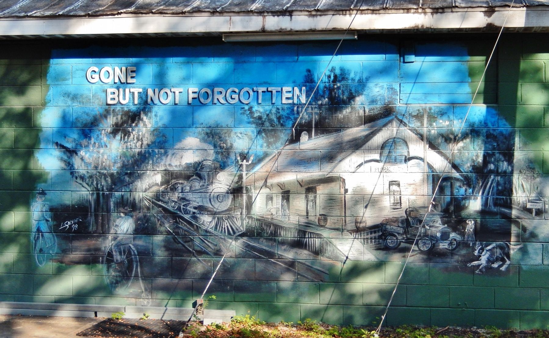
The South Florida Railroad, a part of the Henry B. Plant System, was extended through Floral City in 1893. There were about 100 railroads operating in Florida at this time, and Plant was competing with fellow railroad magnate Henry M. Flagler to buy up and extend existing railroad lines around the state.
Flagler established the Florida East Coast Railroad system along the Atlantic. Plant decided to build his southern railway terminus at Tampa on the west coast, believing the Tampa Bay area held great promise for future development and enterprise.
Floral City, in spite of meager beginnings, had grown to be the largest town in Citrus County. The commercial center of the town migrated from Aroostook Avenue and the steamboat dock to the new train depot, an area about a half mile west.
The
coming of the railroad doomed the slow boat transport system and soon nearly all citrus products were exported by rail to northern markets. The big freeze of 1895 destroyed the local groves, and the local economy quickly switched from citrus to the mining and export of hard rock phosphates to Europe and beyond.
The Road System
County Road 48, (known as Orange Avenue within the town,) replaced an old Indian trail that had existed since pre-Colombian times. An ancient raised manmade causeway allowed for easy travel through the swampy lowlands between Lake Consuela and Lake Tsala Apopka, which is now the short section of C.R. 48 that lines up on a north-south tangent, just east of the turn off to Duval Island.
State Route 5 was built in 1926, linking Floral City with Brooksville to the south as well as both Inverness and Dunnellon to the north. A few years later, S.R. 5 was incorporated into U.S. Highway 41 and became a northern extension of the famous Tamiami (or Tampa to Miami) Trail.
Prior to the construction of S.R. 5, the only road connecting Floral City with Inverness was the very scenic Old Floral City Road. Two other roads, C.R. 39 (Istachatta Road) and C.R. 480 (Stagecoach Trail), connect Floral City with other nearby communities. Many of the local roadways are lined with majestic live oak trees planted more than a century ago. These beloved trees provide a tranquil ambience and are protected by county ordinance.
The Bicycle Trail
As roads were improved, the primary means of transport shifted away from the rails to the highways. The growth of the trucking industry forced many railway lines to close, including the line through Floral city.
Trains no longer stopped here after WWII and during the next few decades, the railway ownership changed several times. The charming old Floral City Depot fell into disuse and was torn down in 1949. The track was dismantled and removed between 1987 and 1989.
This railroad right-of-way was one of the first purchased by the Florida Rails-to-Trails program. The rail bed was converted into the 46-mile long Withlacoochee State Trail, a linear state park which is managed by the Florida Park Service.
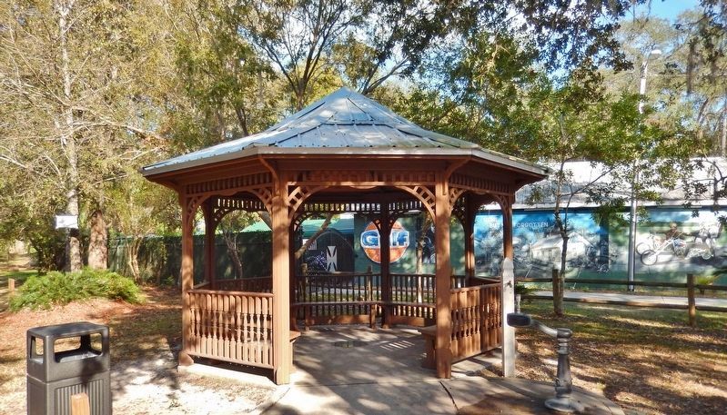
Located near the mid-point on the trail, Floral City made an ideal location for a travelers rest stop. In 1997, a gift of the Emma Love Jenrette Memorial Fund, given to the Citrus County Historical Society, made possible this gazebo and associated components. Emma was the great-grand daughter of John Paul Formy-Duval, an early citizen and land owner in the Floral City area.
This park-like setting and rest area have been proudly developed by the residents of historic Floral City to commemorate the centuries of Floral City Travelers and their Trails.
Credits
This exhibit was developed by the Office of Historical Resources of the Citrus County Board of County Commissioners with assistance from the Floral City Heritage Council of the Citrus County Historical Society, Inc., the Florida Park Service and Rails-to-Trails of the Withlacoochee.
This Project has been financed in part by the Floral City Heritage Council, the Kandra Ray Clark Memorial Fund, a donation by Vivian Higgenbotham, and grant assistance from the Florida Department of Environmental Protection.
Line drawings and narrative by Thomas Ritchie of the Floral City Heritage Council and interpretive display editing and layout by Dream Weaver Studios, Bradenton.
Erected by Office of Historical Resources of the Citrus County Board of County Commissioners.
Topics. This historical marker is listed in these topic lists: Native Americans • Railroads & Streetcars • Roads & Vehicles • Settlements & Settlers.
Location. 28° 45.023′ N, 82° 17.781′ W. Marker is in Floral City, Florida, in Citrus County. Marker can be reached from East Orange Avenue (County Road 48) just east of South Florida Avenue (U.S. 41), on the left when traveling east. Marker kiosk is located beside the Withlacoochee State Trail (rail trail) in Floral City Park, just north of East Orange Avenue. Touch for map. Marker is in this post office area: Floral City FL 34436, United States of America. Touch for directions.
Other nearby markers. At least 8 other markers are within 4 miles of this marker, measured as the crow flies. The Historic Duval House (about 600 feet away, measured in a direct line); a different marker also named The Historic Duval House (about 600 feet away); Historic Floral City (approx. half a mile away); What Lies Ahead (approx. 0.9 miles away); Mile Posts (approx. 1.3 miles away); Lonely Outpost in a Hostile Land (approx. 3.8 miles away); A Costly Florida War (approx. 3.8 miles away); War Comes to the Cove (approx. 3.9 miles away). Touch for a list and map of all markers in Floral City.
Credits. This page was last revised on March 15, 2021. It was originally submitted on November 27, 2020, by Cosmos Mariner of Cape Canaveral, Florida. This page has been viewed 616 times since then and 115 times this year. Last updated on March 14, 2021, by Carl Gordon Moore Jr. of North East, Maryland. Photos: 1, 2, 3, 4, 5, 6. submitted on November 30, 2020, by Cosmos Mariner of Cape Canaveral, Florida. • Bill Pfingsten was the editor who published this page.
